Šešula, Maslinica (Šolta) Beach, Croatia
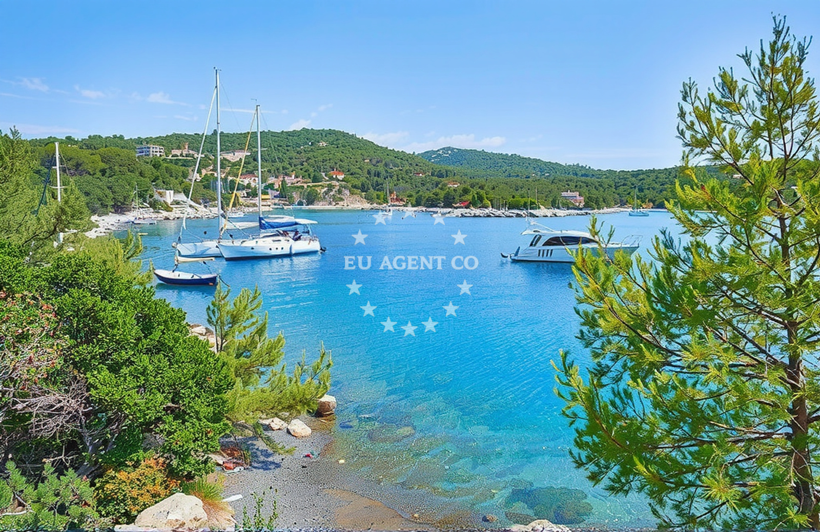
Šešula Beach, located in Maslinica on the island of Šolta, offers a unique coastal experience characterized by rocky outcrops, shaded areas, and nearby amenities. Nestled along the Adriatic Sea, this beach is part of a region renowned for its sailing opportunities and cultural heritage. Its natural features and accessible location make it a point of interest for both casual visitors and yacht charter guests exploring the Croatian coast.
About this beach
Šešula, Maslinica (Šolta)
Beach: Šešula
Location: Maslinica (Šolta)
Characteristics and facilities
Rocks
Restaurant / snack bar
Caffe bar / Drinks stand
Natural shade
Beach character
The beach is defined by its rocky terrain, which creates a distinctive shoreline and offers natural shade from surrounding cliffs and vegetation. This characteristic makes it a sheltered spot compared to more open beaches in the area. The presence of a restaurant, snack bar, and café bar provides visitors with on-site dining options, though these facilities are likely seasonal and should be confirmed in advance. The beach’s natural shade, combined with its proximity to the sea, creates a balanced environment for relaxation and light activity.
Swimming and shore
The rocky shoreline may present challenges for swimming in certain areas, with shallower waters near the shore and deeper sections further out. The natural topography suggests that the beach is more suited for leisurely exploration of the shoreline rather than extensive swimming. Visitors should be mindful of the rocky terrain when entering or exiting the water.
Facilities and activities
On-site facilities include a restaurant, snack bar, and café bar, which cater to visitors seeking refreshments. These amenities are positioned to serve both beachgoers and those arriving by boat. While no specific activities are listed in the catalog, the beach’s location within Šolta’s coastal landscape suggests potential for short excursions to nearby points of interest or participation in local cultural experiences.
Access and location
Šešula Beach is situated in Maslinica, a village on the island of Šolta, which lies in the Adriatic Sea near the town of Split. The island of Šolta is part of the Split-Dalmatia County and is known for its traditional fishing villages, olive groves, and scenic coastal routes. Access to the beach is likely via local roads or by boat, given the island’s character as a destination for both day-trippers and yacht charter guests. The beach’s coordinates (43.392878, 16.209112) place it within a region that is part of Croatia’s broader nautical network, connecting to other islands and coastal towns via ferry or private boat.
What to expect
Visitors to Šešula Beach can expect a rocky shoreline with natural shade, complemented by on-site dining options. The beach’s character is defined by its geological features and proximity to the Adriatic’s sailing routes. While the lack of detailed facilities information means expectations should be tempered with practical considerations, the beach offers a quiet alternative to more crowded coastal spots. Its location within Šolta’s landscape provides opportunities to explore the island’s traditional villages, olive groves, and nearby islands such as Brač and Hvar, which are accessible via short boat trips.
Practical tips
Given the beach’s rocky nature, visitors are advised to wear appropriate footwear for walking along the shoreline. The on-site dining options may have limited hours, so confirming availability in advance is recommended. Those arriving by boat should be mindful of anchoring regulations in the area, as Šolta’s waters are popular with charter yachts and recreational boaters.
Exploring the coast by yacht
The surrounding waters of Šolta are part of Croatia’s Adriatic sailing routes, offering access to nearby islands and coastal towns. Charter guests exploring this region may find Šešula Beach a convenient stop, particularly for those seeking a quieter alternative to more developed areas. The island’s position near Split and the broader Dalmatian coast means it is often included in yacht itineraries that combine cultural landmarks with natural beauty. Nearby anchorages and marinas, such as those in the village of Šipovo or the town of Supetar on nearby Brac, provide options for those arriving by boat.
Cultural and Historical Context of Šolta
The island of Šolta has a long history tied to maritime traditions, with evidence of ancient Roman settlements and medieval fortifications. Local villages like Maslinica retain traditional architecture and agricultural practices, including olive cultivation. This cultural heritage adds depth to the experience of visiting Šešula Beach, offering visitors a glimpse into the region’s historical and social fabric.
Anchorages in the surrounding area
Anchorages in the surrounding area include Maslinica and Solta, offering nearby mooring options.
- Anchorage — maslinica — solta — 0.1 NM from beach
- Anchorage — maslinica — solta — 0.2 NM from beach
- Anchorage — solta — 1.1 NM from beach
- Anchorage — solta — 1.6 NM from beach
- Anchorage — solta — 2.1 NM from beach
- Anchorage — solta — 2.8 NM from beach
- Krknjaši — krknjasi — drvenik veli — 3.2 NM from beach
- Anchorage — drvenik veli — 3.2 NM from beach
Distances are straight-line geographic distances, not sailing routes.
Mooring buoys in the surrounding area
Mooring buoys in the surrounding area include Konoba Sesula and Restaurant Sismis, located near Maslinica.
- Konoba Sesula mooring — maslinica — solta — 0.0 NM from beach
- Restaurant Sismis buoys — maslinica — solta — 0.2 NM from beach
- Krušica Donja — donja krusica — solta — 2.7 NM from beach
- Jetty — drvenik veli — 3.2 NM from beach
- Jetty — drvenik veli — 3.3 NM from beach
Distances are straight-line geographic distances, not sailing routes.
Marine fuel stations
- Fuel station — rogac — solta — 4.0 NM from beach
- Ina — trogir — 7.4 NM from beach
- B-Max — b max — trogir — 7.5 NM from beach
- Ina — milna brac — 10.9 NM from beach
Distances are straight-line geographic distances, not sailing routes.
Harbours in the surrounding area
- Rogač — rogac — solta — 3.9 NM from beach
- Drvenik Veli — 4.5 NM from beach
- Borak — drvenik mali — 6.2 NM from beach
- Stomorska — solta — 6.4 NM from beach
- Toče — okrug gornji — ciovo — 6.6 NM from beach
- Vranjica — trogir — 7.2 NM from beach
Distances are straight-line geographic distances, not sailing routes.
Marinas in the surrounding area
Marinas in the surrounding area include Marina Martinis Marchi and Marina Trogir, providing mooring options for yachts.
- Marina Martinis Marchi — maslinica — solta — 0.3 NM from beach
- Marina Trogir — 7.4 NM from beach
- Marina Baotić — marina baotic — trogir — 7.4 NM from beach
- ACI Marina Trogir — 7.5 NM from beach
- Marina Agana — 8.3 NM from beach
Distances are straight-line geographic distances, not sailing routes.
Restaurants near the beach
Restaurants near the beach include Restaurant Sesula, Šišmiš, and Martinis Marchi, located in Maslinica.
- Restaurant Sesula — maslinica — solta — 0.1 NM from beach
- Restaurant Šišmiš — maslinica — solta — 0.2 NM from beach
- Martinis Marchi — maslinica — solta — 0.3 NM from beach
- Restaurant Gajeta — maslinica — solta — 0.3 NM from beach
- Sakajet — maslinica — solta — 0.3 NM from beach
- Saskinja — maslinica — solta — 0.3 NM from beach
- Konoba Moni — maslinica — solta — 0.4 NM from beach
Distances are straight-line geographic distances, not sailing routes.
Navigation guides for the surrounding area
Navigation guides for the surrounding area include Maslinica and Uvala Sesula, assisting with local sailing routes.
- Maslinica — 0.2 NM from beach
- Uvala Sesula — 0.3 NM from beach
- Uvala Donja Krusica — 3.0 NM from beach
- Uvala Krknjas — 3.1 NM from beach
- Uvala Tatinja — 3.9 NM from beach
Distances are straight-line geographic distances, not sailing routes.
Yachts from nearby departure bases
Yachts from nearby departure bases, including Šolta Rogač, provide options for sailing in the area.
Sailing yachts
- Oceanis 41.1 (Goa) — Šolta Rogač — 3.9 NM from departure base to beach
- Sun Odyssey 449 (Port Royal) — Šolta Rogač — 3.9 NM from departure base to beach
- Oceanis 50 Family (Ganges) — Šolta Rogač — 3.9 NM from departure base to beach
- Cyclades 43.4 (Tigris) — Šolta Rogač — 3.9 NM from departure base to beach
- Sun Odyssey 349 (Siberia) — Šolta Rogač — 3.9 NM from departure base to beach
Catamarans
- Lagoon 450 Flybridge (Samogon) — Šolta Rogač — 3.9 NM from departure base to beach
- Lagoon 450 (Madagascar) — Šolta Rogač — 3.9 NM from departure base to beach
- Lagoon 400 (Greenland) — Šolta Rogač — 3.9 NM from departure base to beach
- Lagoon 42 (Galapagos) — Šolta Rogač — 3.9 NM from departure base to beach
- Lagoon 40 (Solentia) — Šolta Rogač — 3.9 NM from departure base to beach
Distances are straight-line geographic distances, not sailing routes.