Policija, Vis (Vis) Beach, Croatia
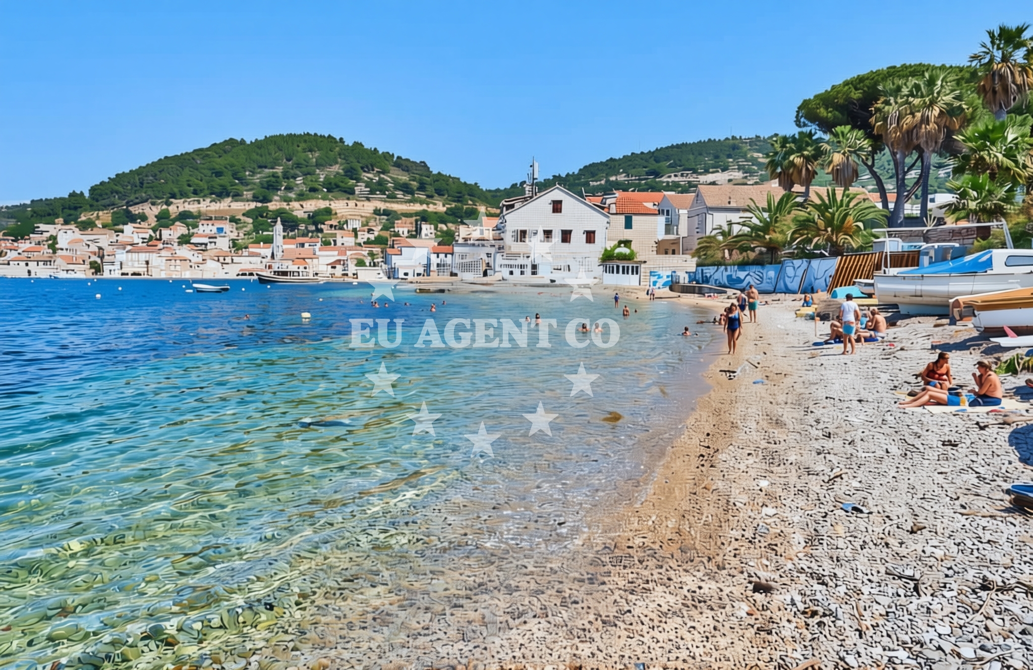
About this beach
Policija, Vis (Vis)
Beach: Policija
Location: Vis (Vis)
Beach character
Policija Beach lies on the southern coast of Vis, an island in the Adriatic Sea renowned for its pristine environment and historical significance. The beach's name, 'Policija,' is believed to reference a nearby police station or watchtower, reflecting the island's role as a strategic coastal outpost during historical periods. The shoreline is likely composed of pebbles and fine sand, typical of Vis's coastal profile, with the sea offering calm waters that are inviting for swimmers and snorkelers. The surrounding area is marked by low-lying hills and olive groves, creating a landscape that blends natural serenity with the island's agricultural traditions.Swimming and shore
The beach's waters, part of the broader Adriatic coastline, are generally clear and suitable for swimming. The shore may feature a mix of rocky outcrops and sandy patches, offering varied access points for visitors. While no specific facilities are documented, the beach's location on Vis suggests it is part of a coastline that remains relatively untouched by mass tourism, preserving its natural character. The nearby island of Vis is a protected area, which likely influences the beach's environmental conditions and visitor experience.Facilities and activities
Facilities at Policija Beach are not explicitly detailed in available records. However, given Vis's status as a protected island, it is reasonable to infer that the beach operates with minimal infrastructure, emphasizing preservation of its natural state. Activities associated with the beach may include swimming, snorkeling, and exploring the surrounding coastal trails. The island's historical sites, such as the medieval fortress of Fort Kamenjak, are within proximity, offering opportunities for cultural exploration. Visitors may also enjoy the island's network of hiking paths, which connect to other scenic spots on Vis.Access and location
Policija Beach is situated on the island of Vis, accessible via ferry services from the mainland and other nearby islands. The nearest major settlement is Vis town, located on the island's northern coast, which serves as a hub for local services and accommodations. The beach's coordinates (43.057601, 16.195244) place it within the central-southern portion of Vis, where the coastline transitions from rugged cliffs to more sheltered coves. The area's remoteness contributes to its appeal as a quiet, natural retreat.What to expect
Visitors to Policija Beach can expect a setting defined by natural simplicity and the island's protected status. The beach is likely to be less crowded than more commercialized coastal areas, offering a peaceful environment for those seeking solitude or a connection to nature. The surrounding landscape, with its hills, olive groves, and clear waters, creates a visually striking backdrop. While no specific amenities are documented, the beach's location on Vis suggests it is part of a coastline that prioritizes conservation over development. Those visiting should consider the island's seasonal weather patterns, which can influence sea conditions and accessibility.Practical tips
Given the lack of detailed facility information, visitors are advised to plan for self-sufficiency. Bringing personal items such as water, sunscreen, and snacks is recommended, as on-site services may be limited. The beach's connection to Vis's protected status means that environmental guidelines should be followed, including respect for local wildlife and adherence to any conservation rules. For those interested in exploring further, the island's hiking trails and historical sites provide additional opportunities.Exploring the coast by yacht
The waters around Vis, including the area near Policija Beach, are part of a broader sailing region in the Adriatic Sea. This area is popular among yacht charter guests due to its combination of sheltered bays, open sea routes, and proximity to other Dalmatian islands. The island of Vis itself is a common stop for sailors exploring the Adriatic, with its natural harbors and scenic anchorages. For those interested in yacht charter experiences, the surrounding coastline offers opportunities to explore nearby islands such as Hvar and Brac, as well as to enjoy the tranquil waters of the Vis Channel. Euro-Agent's yacht search platform can provide further details on available charters and sailing itineraries in the region.Historical and Cultural Context of Vis
The island of Vis has a rich history influenced by its strategic location in the Adriatic. During the Roman Empire, it was part of the region known as the 'Islands of the Adriatic,' and later, it played a role in medieval maritime trade. The island's fortress, Fort Kamenjak, dates back to the 16th century and offers insight into its historical significance as a defensive outpost. Today, Vis is a protected area, preserving its natural and cultural heritage, which includes traditional villages, stone churches, and agricultural landscapes.Anchorages in the surrounding area
Anchorages near Policija, Vis (Vis) Beach include Kut, Vis luka, and Stonca.
- Anchorage — kut — vis — 0.1 NM from beach
- Vis luka — 0.5 NM from beach
- Stonca — vis — 0.6 NM from beach
- Anchorage — vis — 0.7 NM from beach
- Anchorage — vis — 1.0 NM from beach
- Anchorage — vis — 1.2 NM from beach
- Parja — vis — 1.4 NM from beach
- Anchorage — vis — 2.0 NM from beach
Distances are straight-line geographic distances, not sailing routes.
Mooring buoys in the surrounding area
Mooring buoys in the vicinity include Buoy field — vis and Konoba Stončica jetty — vis.
- Buoy field — vis — 0.3 NM from beach
- Jetty — vis — 0.7 NM from beach
- Jetty — vis — 1.4 NM from beach
- Konoba Stončica jetty — vis — 2.1 NM from beach
- Stončica — stoncica — vis — 2.2 NM from beach
Distances are straight-line geographic distances, not sailing routes.
Marine fuel stations
Fuel stations nearby are Petrol station Ina — vis and Ina — milna brac.
- Petrol station Ina — vis — 0.5 NM from beach
- Fuel station — hvar — 12.7 NM from beach
- Ina — milna brac — 19.5 NM from beach
- Fuel station — rogac — solta — 20.8 NM from beach
Distances are straight-line geographic distances, not sailing routes.
Harbours in the surrounding area
Harbours close to the beach are Kut — vis and Luka — vis.
- Kut — vis — 0.2 NM from beach
- Luka — vis — 0.4 NM from beach
- Rogačić — vis — 1.3 NM from beach
- Komiža — komiza — vis — 4.8 NM from beach
- Hvar — 12.7 NM from beach
- Vira — hvar — 13.0 NM from beach
Distances are straight-line geographic distances, not sailing routes.
Marinas in the surrounding area
Marinas in the surrounding area include ACI Marina Palmižana and Marina Milna Kanarija — milna brac.
- ACI Marina Palmižana — aci marina palmizana — st klement — 10.8 NM from beach
- Marina Milna Kanarija — milna brac — 19.5 NM from beach
- Marina Vlaška — milna brac — 19.5 NM from beach
- ACI Marina Milna — milna brac — 19.6 NM from beach
- Marina Martinis Marchi — maslinica — solta — 20.4 NM from beach
Distances are straight-line geographic distances, not sailing routes.
Restaurants near the beach
Restaurants near the beach include Restaurant Villa Kaliopa — kut — vis and Val — vis.
- Restaurant Villa Kaliopa — kut — vis — 0.0 NM from beach
- Val — vis — 0.1 NM from beach
- Pojoda — kut — vis — 0.2 NM from beach
- Lambik — kut — vis — 0.2 NM from beach
- Vatrica — kut — vis — 0.2 NM from beach
- Tezok — kut — vis — 0.2 NM from beach
- Kod Paveta — vis — 0.3 NM from beach
Distances are straight-line geographic distances, not sailing routes.
Navigation guides for the surrounding area
Navigation guides for the area include Uvala Stoncica and Uvala Tarsce.
- Uvala Stoncica — 2.4 NM from beach
- Komiža — 4.6 NM from beach
- Luka Soline — 9.7 NM from beach
- Uvala Tarsce — 10.1 NM from beach
- Uvala Stari Stani — 10.2 NM from beach
Distances are straight-line geographic distances, not sailing routes.
Yachts from nearby departure bases
Yachts depart from bases such as Milna Marina Vlaška and Šolta Rogač.
Sailing yachts
- Hanse 388 (BANJO) — Milna Marina Vlaška — 19.5 NM from departure base to beach
- Bavaria 46 Cruiser (MO) — Milna Marina Vlaška — 19.5 NM from departure base to beach
- Hanse 455 (AURUM 1) — Milna Marina Vlaška — 19.5 NM from departure base to beach
- Hanse 505 (AVALON) — Milna Marina Vlaška — 19.5 NM from departure base to beach
- Oceanis 46.1 (Everest) — Šolta Rogač — 20.8 NM from departure base to beach
- Sun Odyssey 449 (Tortuga) — Šolta Rogač — 20.8 NM from departure base to beach
- Sun Odyssey 490 (Izzy) — Šolta Rogač — 20.8 NM from departure base to beach
Catamarans
- Lagoon 450 (Madagascar) — Šolta Rogač — 20.8 NM from departure base to beach
- Lagoon 450 Flybridge (Samogon) — Šolta Rogač — 20.8 NM from departure base to beach
- Lagoon 40 (Solentia) — Šolta Rogač — 20.8 NM from departure base to beach
Distances are straight-line geographic distances, not sailing routes.