Blaca Zapad Beach, Sućuraj (Hvar), Croatia
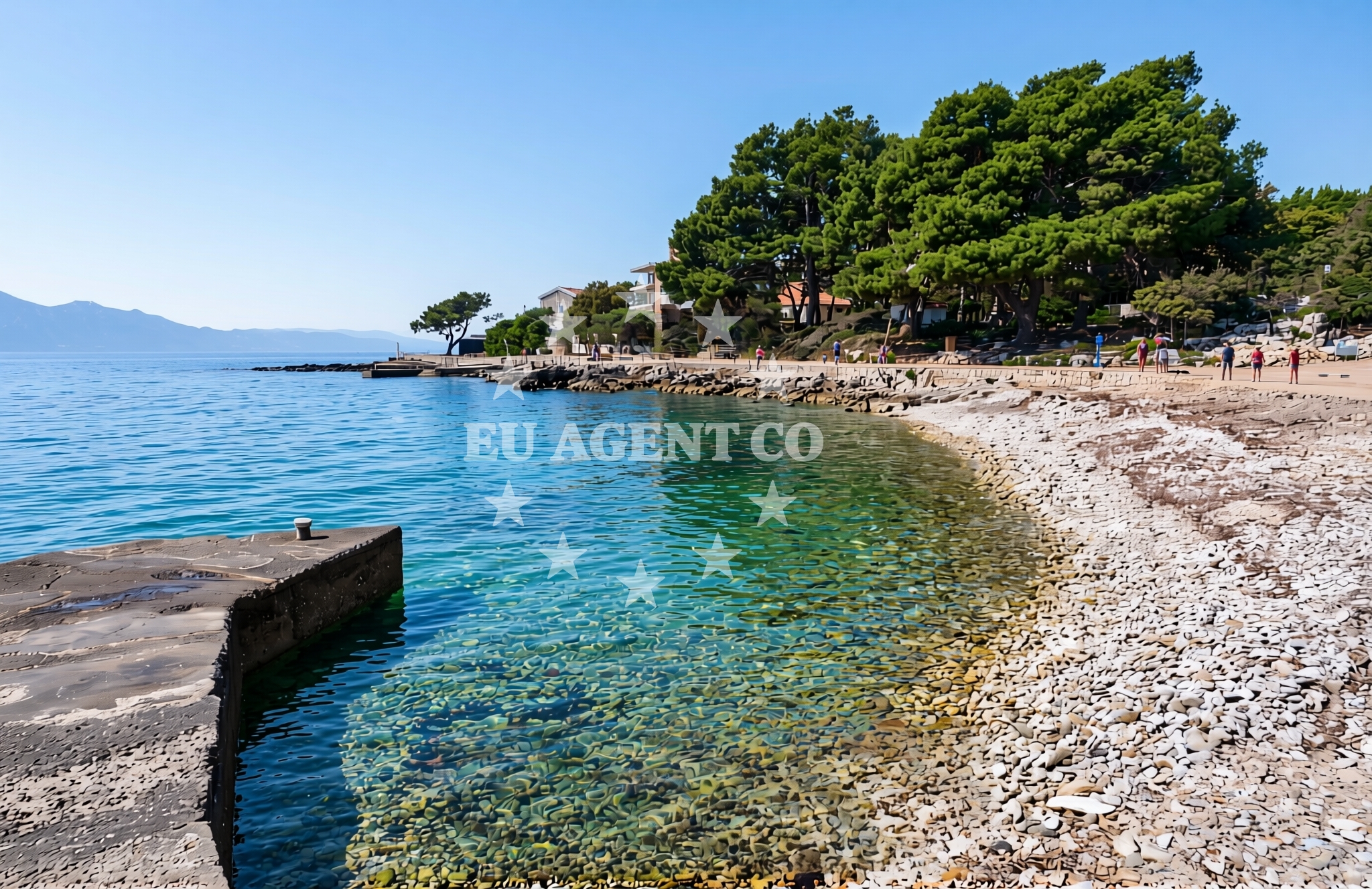
Blaca Zapad Beach, located in the coastal village of Sućuraj on the island of Hvar, offers a unique shoreline experience characterized by its gravel composition. This beach is part of the broader Hvar coastline, known for its historic settlements, vineyards, and proximity to the Adriatic Sea's sailing routes. The beach features a restaurant, snack bar, and caffe bar, making it a convenient spot for visitors seeking refreshments during their stay.
About this beach
Blaca zapad, Sućuraj (Hvar)
Beach: Blaca zapad
Location: Sućuraj (Hvar)
Characteristics and facilities
Gravel
Restaurant / snack bar
Caffe bar / Drinks stand
Beach character
The gravel shoreline of Blaca Zapad distinguishes it from the more common sandy beaches found along the Croatian coast. While this texture may affect the comfort of barefoot walking, it also contributes to the beach's distinct character. The area is relatively quiet compared to some of Hvar's more tourist-heavy shores, offering a more subdued atmosphere for those seeking a less crowded environment. The beach's proximity to Sućuraj, a village with a rich agricultural heritage, adds to its appeal for visitors interested in exploring the island's rural and coastal contrasts.
Swimming and shore
Swimming conditions at Blaca Zapad are influenced by the gravel shoreline, which may make the water feel cooler or more turbulent near the shore compared to sandy beaches. The beach does not have explicit facilities for swimmers, such as showers or changing rooms, but the nearby restaurant and caffe bar provide amenities for visitors. The gravel substrate may also create a more uneven surface for sunbathing, though the area's natural setting offers scenic views of the surrounding landscape.
Facilities and activities
The beach is equipped with a restaurant, snack bar, and caffe bar, catering to visitors looking for light meals, beverages, or snacks. These facilities are integrated into the beach's layout, allowing guests to enjoy food and drinks while taking in the coastal views. There are no explicitly listed recreational activities beyond the basic amenities, but the beach's location in Sućuraj provides opportunities for exploring nearby vineyards, historic sites, and the broader Hvar coastline.
Access and location
Blaca Zapad Beach is situated in Sućuraj, a village on the island of Hvar, which is part of the Split-Dalmatia County in Croatia. The beach is accessible via local roads connecting Sućuraj to the rest of the island. Hvar itself is a popular destination for yacht charter guests, with its sheltered bays, historic ports, and vibrant cultural scene. The beach's location places it within reach of other attractions on Hvar, including the town of Hvar, the Fort Hvar, and the island's renowned vineyards.
What to expect
Visitors to Blaca Zapad Beach can expect a gravel shoreline with limited formal facilities beyond the on-site restaurant, snack bar, and caffe bar. The beach's character is defined by its natural substrate and its integration into the Sućuraj village landscape. The area is best suited for those seeking a quieter alternative to Hvar's more crowded beaches, with the added convenience of nearby dining options. The beach does not have explicit amenities for swimmers, such as showers or changing rooms, but its location in Sućuraj provides access to the island's broader attractions.
Practical tips
Given the gravel shoreline, visitors may want to wear sturdy footwear for walking along the beach. The on-site dining options are a key feature, but it's advisable to check their operating hours in advance. The beach's location in Sućuraj makes it a good base for exploring Hvar's vineyards, historic sites, and other coastal areas, though transportation to these points may require local transit or private arrangements.
Exploring the coast by yacht
Blaca Zapad Beach is situated within the sailing region of the Adriatic Sea, an area renowned for its yacht charter opportunities. Hvar, in particular, is a favored destination for charter guests due to its sheltered bays, scenic coastline, and proximity to other Dalmatian islands. Euro-Agent offers yacht charters in this region, allowing visitors to explore the Adriatic's waters, including the nearby islands of Brac, Vis, and Korcula. The beach's location provides a convenient landing point for those navigating the Hvar coastline by boat, though it is not explicitly marked as an anchorage or marina in the catalog.
Cultural and Historical Context of Sućuraj
Sućuraj, the village hosting Blaca Zapad Beach, has a long history tied to agriculture and viticulture. The area is known for its production of local wines, which can be sampled in nearby vineyards. The village's traditional architecture and rural setting contrast with the more developed coastal towns of Hvar, offering visitors a glimpse into the island's historical and cultural heritage. This context enhances the appeal of Blaca Zapad as a destination that combines natural beauty with regional traditions.
Anchorages in the surrounding area
Anchorages near Sućuraj and Selca kod Bogomolja on Hvar.
- Anchorage — sucuraj — hvar — 0.4 NM from beach
- Anchorage — sucuraj — hvar — 0.5 NM from beach
- Anchorage — sucuraj — hvar — 1.1 NM from beach
- Anchorage — selca kod bogomolja — hvar — 1.4 NM from beach
- Anchorage — selca kod bogomolja — hvar — 1.5 NM from beach
- Anchorage — sucuraj — hvar — 1.8 NM from beach
- Anchorage — selca kod bogomolja — hvar — 2.9 NM from beach
- Anchorage — selca kod bogomolja — hvar — 3.1 NM from beach
Distances are straight-line geographic distances, not sailing routes.
Mooring buoys in the surrounding area
Mooring buoys and jetties in Sućuraj and Selca kod Bogomolja on Hvar.
- Jetty — sucuraj — hvar — 0.6 NM from beach
- Konoba Gambo buoys — selca kod bogomolja — hvar — 3.3 NM from beach
- Drvenik - Ferry dock — drvenik ferry dock — 3.8 NM from beach
- Kraj - Soline — kraj soline — drasnice — 6.4 NM from beach
- Brist — 6.4 NM from beach
Distances are straight-line geographic distances, not sailing routes.
Marine fuel stations
Fuel stations in Korcula, Ploce, Makarska, and Brac.
- Fuel station — korcula — 10.2 NM from beach
- Fuel station — ploce — 12.2 NM from beach
- Ina — makarska — 12.5 NM from beach
- Fuel station — sumartin — brac — 16.9 NM from beach
Distances are straight-line geographic distances, not sailing routes.
Harbours in the surrounding area
Harbours in Sućuraj, Drvenik, and other nearby coastal areas on Hvar.
- Sućuraj — sucuraj — hvar — 0.6 NM from beach
- Drvenik — 3.7 NM from beach
- Živogošće — zivogosce — 4.0 NM from beach
- Igrane — 4.6 NM from beach
- Zaostrog — 4.7 NM from beach
- Duba — duba peljeska — 5.9 NM from beach
Distances are straight-line geographic distances, not sailing routes.
Marinas in the surrounding area
- Marina Tučepi — marina tucepi — 9.9 NM from beach
- ACI Marina Korčula — korcula — 10.0 NM from beach
- Marina Lumbarda — korcula — 11.9 NM from beach
- Marina Ramova — krvavica — 14.7 NM from beach
- Marina Baška Voda — marina baska voda — 17.3 NM from beach
Distances are straight-line geographic distances, not sailing routes.
Restaurants near the beach
Restaurants in Sućuraj and Selca kod Bogomolja on Hvar.
- Restaurant — sucuraj — hvar — 0.6 NM from beach
- Riblji Restoran — sucuraj — hvar — 0.6 NM from beach
- Mlaska — sucuraj — hvar — 1.7 NM from beach
- u.Mrtinovic — selca kod bogomolja — hvar — 3.2 NM from beach
Distances are straight-line geographic distances, not sailing routes.
Navigation guides for the surrounding area
Navigation guides for Hvar and surrounding coastal areas.
- OTOK HVAR — 1.3 NM from beach
- Uvala Drvenik (Donja Vala) — 3.9 NM from beach
- Uvala Kozja — 5.4 NM from beach
- Uvala Duboka — 5.6 NM from beach
- Uvala Divna — 6.4 NM from beach
Distances are straight-line geographic distances, not sailing routes.
Yachts from nearby departure bases
Yachts departing from Tučepi Port and Ploče City Port.
Sailing yachts
- Bavaria 40 Cruiser (LADY BUTTERFLY) — Tučepi Port — 9.9 NM from departure base to beach
- Elan 40 Impression (Karleta) — Ploče City Port — 12.1 NM from departure base to beach
- Salona 44 (SAMOA) — Ploče City Port — 12.1 NM from departure base to beach
- Sun Odyssey 349 (Visnjica) — Ploče City Port — 12.1 NM from departure base to beach
- Elan 514 Impression (Cesarica III) — Ploče City Port — 12.1 NM from departure base to beach
- Sun Odyssey 419 (Luka Ploce) — Ploče City Port — 12.1 NM from departure base to beach
- More 55 (MRS. ROBINSON) — Ploče City Port — 12.1 NM from departure base to beach
- Sun Odyssey 349 (Porto Tolero) — Ploče City Port — 12.1 NM from departure base to beach
Catamarans
- Lagoon 450 Fly (Alba Mouse) — Ploče City Port — 12.1 NM from departure base to beach
Motor yachts
- Princess V53 (Chablis) — Makarska Port — 12.2 NM from departure base to beach
Distances are straight-line geographic distances, not sailing routes.