Bilina, Sućuraj (Hvar) Beach, Croatia
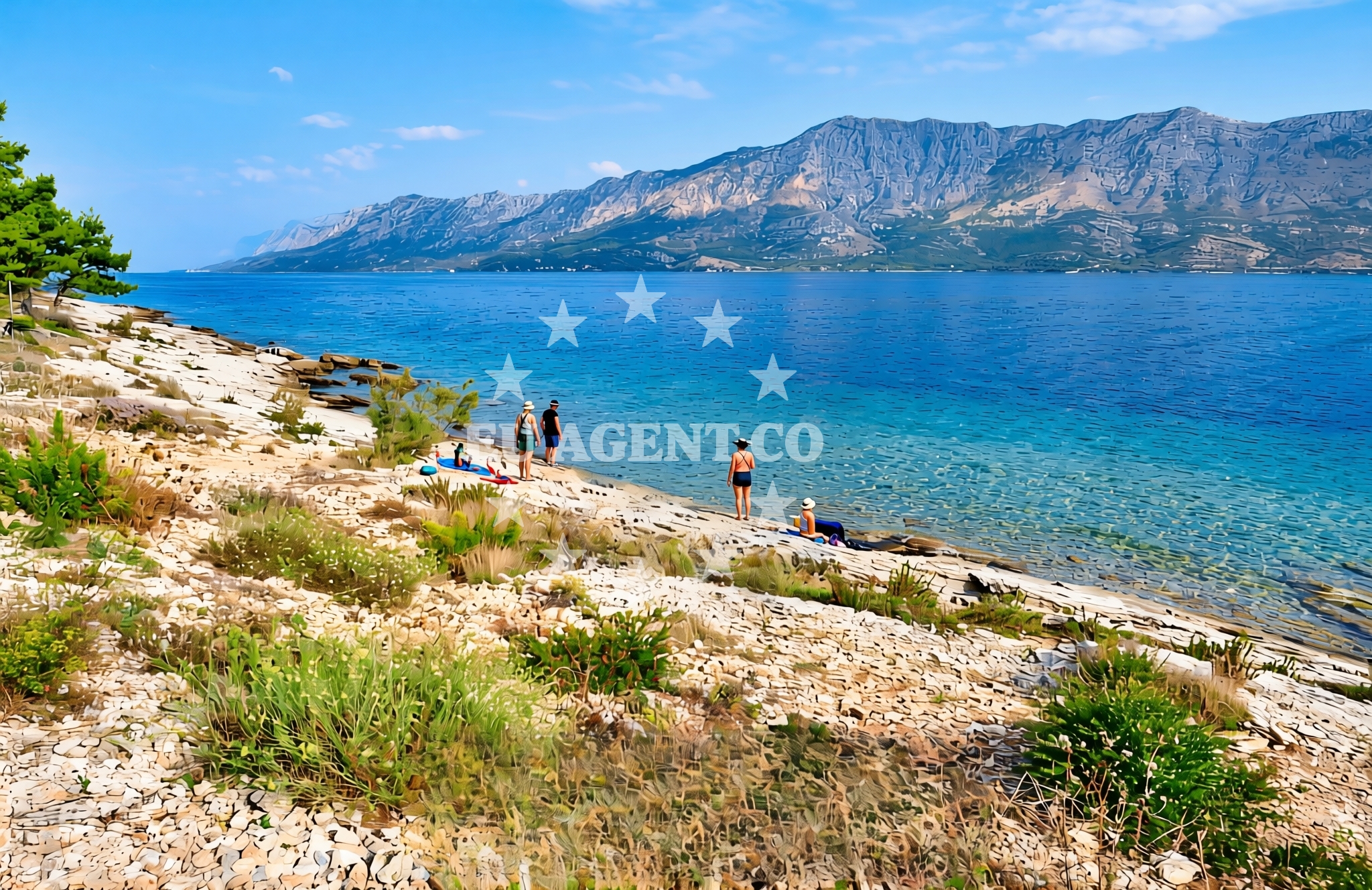
Bilina Beach is located in the village of Sućuraj on the island of Hvar, part of the Dalmatian Coast in Croatia. Nestled along the southern shore of Hvar, this beach offers a tranquil escape for visitors seeking unspoiled natural scenery. The area is characterized by rugged coastlines, olive groves, and vineyards, reflecting the island’s rich agricultural heritage. Sućuraj itself is a historic settlement known for its traditional architecture and proximity to the Pakleni Islands, a popular sailing destination in the Adriatic.
About this beach
Bilina, Sućuraj (Hvar)
Beach: Bilina
Location: Sućuraj (Hvar)
Beach character
Bilina Beach is part of the Sućuraj coastline, which features a mix of rocky shores and shallow, pebbled areas. The beach is not heavily developed, preserving its natural character. The surrounding landscape includes terraced vineyards and pine forests, typical of the Hvar region. While specific details about the beach’s width or sand quality are not documented, the area is known for its clear waters and gentle waves, making it suitable for swimming and water activities.
Swimming and shore
The waters around Bilina Beach are part of the Adriatic Sea, known for their clarity and moderate temperatures during the summer months. Swimming conditions are generally favorable, though the shore may consist of pebbles or rocky sections, as is common along the Hvar coast. The absence of significant depth changes or strong currents makes it a safe option for swimmers, particularly in calmer weather. Nearby, the Sućuraj Bay offers additional sheltered areas for water-based recreation.
Facilities and activities
Facilities at Bilina Beach are minimal, as the area remains largely undeveloped. No specific amenities such as showers, restrooms, or parking are documented for the beach itself. However, the village of Sućuraj provides basic services, including local shops and dining options. Activities centered around the beach include sunbathing, snorkeling, and exploring the surrounding coastline by foot or boat. The nearby Pakleni Islands, accessible by yacht or ferry, offer opportunities for sailing, kayaking, and visiting historic sites like the Church of St. Nicholas.
Access and location
Bilina Beach is located in the village of Sućuraj, accessible by road from Hvar Town or via ferry services connecting the island of Hvar to the mainland and other nearby islands. The beach is part of a broader network of coastal trails and maritime routes, making it a convenient stop for yacht charter guests exploring the Adriatic. The proximity to the Pakleni Islands and the town of Hvar enhances its appeal for those combining land and sea activities during their visit.
What to expect
Visitors to Bilina Beach can expect a peaceful, natural setting with minimal modern infrastructure. The beach’s character is defined by its integration with the surrounding landscape, offering views of olive groves, vineyards, and the open sea. While no specific facilities are available on-site, the area’s proximity to Sućuraj ensures access to essential services. The beach is ideal for those seeking solitude, with opportunities to enjoy the coastline’s natural beauty and the island’s cultural heritage.
Practical tips
Given the beach’s undeveloped nature, visitors may want to bring water, sunscreen, and comfortable footwear for walking on pebbled areas. Parking in Sućuraj is limited, so arriving early is advisable. For those arriving by yacht, anchoring in nearby bays or using marinas in Hvar Town provides convenient access to the area.
Exploring the coast by yacht
The waters around Bilina Beach are part of the Hvar sailing region, a popular destination for yacht charter guests. The area offers a mix of sheltered anchorages, scenic routes, and opportunities to explore the Pakleni Islands. Yacht charter companies often include Hvar in itineraries due to its proximity to historic sites, vibrant towns, and diverse marine life. Charter guests can easily access Bilina Beach from marinas in Hvar Town or nearby anchorages, making it a convenient stop for those exploring the southern Dalmatian Coast.
Historical and Cultural Context
Sućuraj, the village near Bilina Beach, has a long history tied to viticulture and traditional craftsmanship. The area is home to the Sućuraj Fortress, a 16th-century structure offering panoramic views of the island and sea. This cultural heritage adds depth to the visit, allowing guests to explore the region’s past while enjoying its natural landscapes.
Anchorages in the surrounding area
- Anchorage — sucuraj — hvar — 0.5 NM from beach
- Anchorage — sucuraj — hvar — 1.4 NM from beach
- Anchorage — sucuraj — hvar — 1.9 NM from beach
- Anchorage — selca kod bogomolja — hvar — 2.3 NM from beach
- Anchorage — selca kod bogomolja — hvar — 2.3 NM from beach
- Anchorage — sucuraj — hvar — 2.3 NM from beach
- Anchorage — drvenik — 2.9 NM from beach
- Anchorage — selca kod bogomolja — hvar — 3.7 NM from beach
Distances are straight-line geographic distances, not sailing routes.
Mooring buoys in the surrounding area
Mooring buoys in Sućuraj and nearby areas provide access points near Bilina, Sućuraj (Hvar) Beach.
- Jetty — sucuraj — hvar — 0.3 NM from beach
- Drvenik - Ferry dock — drvenik ferry dock — 3.0 NM from beach
- Konoba Gambo buoys — selca kod bogomolja — hvar — 4.1 NM from beach
- Brist — 5.7 NM from beach
- Kraj - Soline — kraj soline — drasnice — 6.5 NM from beach
Distances are straight-line geographic distances, not sailing routes.
Marine fuel stations
Marine fuel stations in Korcula, Ploce, Makarska, and Brac serve the broader Central and South Dalmatia regions.
- Fuel station — korcula — 10.6 NM from beach
- Fuel station — ploce — 11.6 NM from beach
- Ina — makarska — 12.6 NM from beach
- Fuel station — sumartin — brac — 17.3 NM from beach
Distances are straight-line geographic distances, not sailing routes.
Harbours in the surrounding area
Harbors in Sućuraj, Drvenik, and surrounding areas are situated near Bilina, Sućuraj (Hvar) Beach.
- Sućuraj — sucuraj — hvar — 0.3 NM from beach
- Drvenik — 2.8 NM from beach
- Zaostrog — 3.8 NM from beach
- Živogošće — zivogosce — 3.9 NM from beach
- Igrane — 4.6 NM from beach
- Duba — duba peljeska — 6.3 NM from beach
Distances are straight-line geographic distances, not sailing routes.
Marinas in the surrounding area
Marinas in Tučepi, Korcula, and Lumbarda cater to vessels approaching the Hvar and Korcula regions.
- Marina Tučepi — marina tucepi — 10.0 NM from beach
- ACI Marina Korčula — korcula — 10.5 NM from beach
- Marina Lumbarda — korcula — 12.3 NM from beach
- Marina Ramova — krvavica — 14.9 NM from beach
- Marina Baška Voda — marina baska voda — 17.5 NM from beach
Distances are straight-line geographic distances, not sailing routes.
Restaurants near the beach
Restaurants in Sućuraj and Selca kod Bogomolja are located near Bilina, Sućuraj (Hvar) Beach.
- Restaurant — sucuraj — hvar — 0.3 NM from beach
- Riblji Restoran — sucuraj — hvar — 0.3 NM from beach
- Mlaska — sucuraj — hvar — 2.3 NM from beach
- u.Mrtinovic — selca kod bogomolja — hvar — 4.0 NM from beach
Distances are straight-line geographic distances, not sailing routes.
Navigation guides for the surrounding area
Navigation guides for Otok Hvar and Uvala Drvenik detail routes near Bilina, Sućuraj (Hvar) Beach.
- OTOK HVAR — 0.5 NM from beach
- Uvala Drvenik (Donja Vala) — 3.1 NM from beach
- Uvala Kozja — 6.2 NM from beach
- Uvala Duboka — 6.4 NM from beach
- Uvala Divna — 6.6 NM from beach
Distances are straight-line geographic distances, not sailing routes.
Yachts from nearby departure bases
Yachts departing from Tučepi Port and Ploče City Port are positioned near Bilina, Sućuraj (Hvar) Beach.
Sailing yachts
- Bavaria 40 Cruiser (LADY BUTTERFLY) — Tučepi Port — 10.0 NM from departure base to beach
- Elan 40 Impression (Karleta) — Ploče City Port — 11.5 NM from departure base to beach
- Salona 44 (SAMOA) — Ploče City Port — 11.5 NM from departure base to beach
- Elan 514 Impression (Cesarica III) — Ploče City Port — 11.5 NM from departure base to beach
- Sun Odyssey 349 (Porto Tolero) — Ploče City Port — 11.5 NM from departure base to beach
- Sun Odyssey 419 (Luka Ploce) — Ploče City Port — 11.5 NM from departure base to beach
- More 55 (MRS. ROBINSON) — Ploče City Port — 11.5 NM from departure base to beach
- Sun Odyssey 349 (Visnjica) — Ploče City Port — 11.5 NM from departure base to beach
Catamarans
- Lagoon 450 Fly (Alba Mouse) — Ploče City Port — 11.5 NM from departure base to beach
Motor yachts
- Princess V53 (Chablis) — Makarska Port — 12.4 NM from departure base to beach
Distances are straight-line geographic distances, not sailing routes.