Mali Zal Beach, Croatia
Beach character
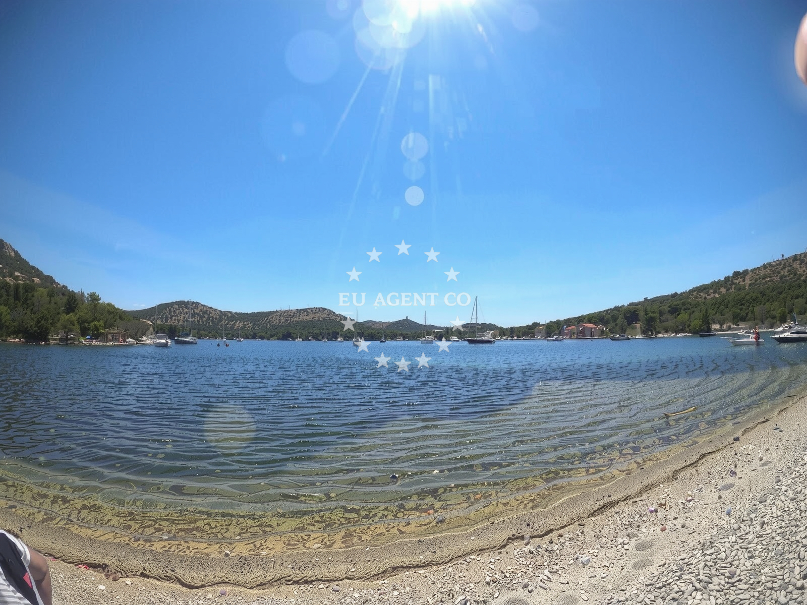
The beach's defining characteristic is its multi-cove structure, with the main shoreline flanked by smaller inlets. The pebble surface dominates, though some sections have finer grains. The surrounding landscape consists of low, grassy hills that provide limited natural shade. The seabed transitions from shallow, sandy areas near the shore to deeper zones with larger boulders further out. This topography creates a gentle slope that allows for safe wading, though the pebbles may make barefoot walking uncomfortable for some visitors.Swimming and shore
The beach's depth increases gradually, making it suitable for families with young children. However, the pebble substrate means entering the water is easier with sandals or water shoes. Snorkeling is possible in the shallows, where the sand and boulders create varied underwater terrain. SUP and surfing are popular activities, with the beach's sheltered position offering calmer conditions compared to more exposed Adriatic shores. The absence of artificial structures means the experience remains untamed, with waves influenced by the bay's natural contours.Facilities and activities
There are no permanent facilities at Mali Zal, reflecting its status as a more natural, less developed shoreline. Parking is limited to a few spaces on the main road and a small overflow area on the road leading to the beach. The lack of amenities means visitors should bring their own supplies. The beach's primary appeal lies in its activities: SUP, surfing, and snorkeling are explicitly noted in the catalog, with the latter benefiting from the clear waters and underwater topography.Access and location
The beach is accessible via a road that descends from Ul. Portorus 68, with parking limited to a few vehicles. This road access is a notable feature, as many Adriatic beaches require hiking or boat access. The beach's location within Skrivena Luka places it near the Pelješac Peninsula's western end, close to the mouth of the Neretva River. This positioning makes it a potential stop for sailors exploring the southern Dalmatian coast, though no specific marinas or anchorages are mentioned in the catalog.What visitors say
Visitors have highlighted both the beach's natural beauty and its logistical challenges. One reviewer noted the 'beautiful sky during night,' suggesting the area's unspoiled character. Others mentioned the ease of entering the water with sandals and the 'rare car accessible sea access.' However, limited parking and the pebble surface were recurring concerns. A 2023 visitor described the beach as 'one of the few on the island,' emphasizing its uniqueness despite its modest amenities.Practical tips
Bring sandals or water shoes for easier access to the sea. Arrive early to secure parking, as spaces are limited. The pebble surface may be uncomfortable for those unaccustomed to it. Sun protection is recommended, as shade is minimal. The beach's natural character means no lifeguards or amenities are present.Exploring the coast by yacht
For yacht charter guests, the proximity to Skrivena Luka offers opportunities to explore the Pelješac Peninsula's western coast. The area is part of a broader sailing region that includes the Bay of Kotor and the Elafonisos islands. While no specific marinas are mentioned in the catalog, the beach's location near the Neretva River mouth suggests it could serve as a reference point for sailors navigating the southern Adriatic. The smooth depth gradient makes it a potentially safe anchorage for small vessels, though this is not explicitly confirmed in the catalog.Regional Context
Mali Zal's location on the Pelješac Peninsula places it near several cultural and historical sites, including the medieval fortress of Sveti Nikola. The peninsula itself is a popular sailing destination, with its sheltered waters and proximity to the island of Mljet. The surrounding area is known for its vineyards and olive groves, reflecting the region's agricultural heritage.Anchorages in the surrounding area
Anchorages near Skrivena Luka include Skrivena Luka — lastovo and several other nearby options on Lastovo.
- Skrivena Luka — lastovo — 0.1 NM from beach
- Anchorage — lastovo — 0.4 NM from beach
- Anchorage — lastovo — 2.1 NM from beach
- Anchorage — lastovo — 2.1 NM from beach
- Zaklopatica — lastovo — 2.3 NM from beach
- Korito — lastovo — 2.3 NM from beach
- Prehodišće — prehodisce — lastovo — 3.2 NM from beach
- Anchorage — lastovo — 3.3 NM from beach
Distances are straight-line geographic distances, not sailing routes.
Mooring buoys in the surrounding area
Mooring buoys in the area include Porto Rosso jetty — lastovo and jetty — lastovo near the beach.
- Porto Rosso jetty — lastovo — 0.2 NM from beach
- Jetty — lastovo — 0.3 NM from beach
- Augusta Insula restaurant jetty — lastovo — 2.2 NM from beach
- Restaurant Triton dock — lastovo — 2.2 NM from beach
- Konoba Santor Jetty — lastovo — 2.2 NM from beach
Distances are straight-line geographic distances, not sailing routes.
Marine fuel stations
Fuel stations in the vicinity include Ina — ubli — lastovo and other marine stations on Lastovo.
- Ina — ubli — lastovo — 2.8 NM from beach
- Ina — vela luka — korcula — 15.5 NM from beach
- Fuel station — korcula — 17.4 NM from beach
- Ina — vrboska — hvar — 28.2 NM from beach
Distances are straight-line geographic distances, not sailing routes.
Harbours in the surrounding area
Harbours in the surrounding area include Ubli — lastovo and other ports on Lastovo.
- Ubli — lastovo — 2.9 NM from beach
- Brna — korcula — 10.2 NM from beach
- Zavalatica — korcula — 10.8 NM from beach
- Prigradica — korcula — 14.2 NM from beach
Distances are straight-line geographic distances, not sailing routes.
Marinas in the surrounding area
Marinas near Skrivena Luka include Marina Solitudo — lastovo and other facilities on Lastovo.
- Marina Solitudo — lastovo — 3.3 NM from beach
- Marina Korkyra — vela luka — korcula — 15.5 NM from beach
- Marina Lumbarda — korcula — 16.8 NM from beach
- ACI Marina Korčula — korcula — 17.2 NM from beach
- ACI Marina Vrboska — hvar — 28.1 NM from beach
Distances are straight-line geographic distances, not sailing routes.
Restaurants near the beach
Restaurants near the beach include Restaurant Porto Rosso — lastovo and Konoba Nautica — lastovo.
- Restaurant Porto Rosso — lastovo — 0.2 NM from beach
- Konoba Nautica — lastovo — 0.3 NM from beach
- Fumari — lastovo — 1.8 NM from beach
- Bacvara — lastovo — 1.8 NM from beach
- Amfora — lastovo — 1.9 NM from beach
- OPG Podanje — lastovo — 2.0 NM from beach
- Augusta Insula — lastovo — 2.2 NM from beach
Distances are straight-line geographic distances, not sailing routes.
Navigation guides for the surrounding area
Navigation guides cover Skrivena Luka and nearby points such as Zaklopatica and Luka Velji Lago.
- Skrivena Luka — 0.4 NM from beach
- Zaklopatica — 2.2 NM from beach
- Luka Velji Lago — 2.9 NM from beach
- Luka Mali Lago — 2.9 NM from beach
- Brna — 10.0 NM from beach
Distances are straight-line geographic distances, not sailing routes.
Yachts from nearby departure bases
Yachts depart from bases like Ploče City Port and Tučepi Port, offering access to Skrivena Luka.
Sailing yachts
- Elan 40 Impression (Karleta) — Ploče City Port — 30.5 NM from departure base to beach
- Sun Odyssey 349 (Porto Tolero) — Ploče City Port — 30.5 NM from departure base to beach
- Salona 44 (SAMOA) — Ploče City Port — 30.5 NM from departure base to beach
- More 55 (MRS. ROBINSON) — Ploče City Port — 30.5 NM from departure base to beach
- Elan 514 Impression (Cesarica III) — Ploče City Port — 30.5 NM from departure base to beach
- Sun Odyssey 419 (Luka Ploce) — Ploče City Port — 30.5 NM from departure base to beach
- Sun Odyssey 349 (Visnjica) — Ploče City Port — 30.5 NM from departure base to beach
- Bavaria 40 Cruiser (LADY BUTTERFLY) — Tučepi Port — 32.5 NM from departure base to beach
Catamarans
- Lagoon 450 Fly (Alba Mouse) — Ploče City Port — 30.5 NM from departure base to beach
Motor yachts
- Princess V53 (Chablis) — Makarska Port — 33.8 NM from departure base to beach
Distances are straight-line geographic distances, not sailing routes.
Frequently asked questions
Is there parking available at Mali Zal?
Parking is limited to a few spaces on the main road and a small overflow area on the road leading to the beach.What activities are available at the beach?
SUP, surfing, and snorkeling are explicitly noted as available activities.Nearby beaches
Reviews
Nice beach. One of the few on the Island. Friends went even more around the bay. They spend all they there and said there are good restaurants and its cozy place overall. Beautiful sky during night.
Entering the sea is definitely easier with sandals, and the shallows last quite a long time. There is little parking, a few places on the main road, and on the road that goes down to the beach on the left there is an extension for some 3 maybe 4 cars. A typical pebble beach with not too much shade.
Amazing place, wonderful bay with crystal clear water without any splendor. Just me and my thoughts
Rare car accessible sea access
bellisimo Dubrovnik-Neretva