Kurila Beach - Artatore 170A, Mali Lošinj, Croatia
Kurila Beach stretches along the northern coast of Mali Lošinj, a car-free island in the Adriatic Sea. This 2.1km-long shore is characterized by its straight alignment and boulder-strewn terrain, offering a unique contrast to the island's more typical pebble or sandy beaches. The beach's moderate depth increase and boulder-strewn seabed create a distinctive underwater topography that supports local marine life.
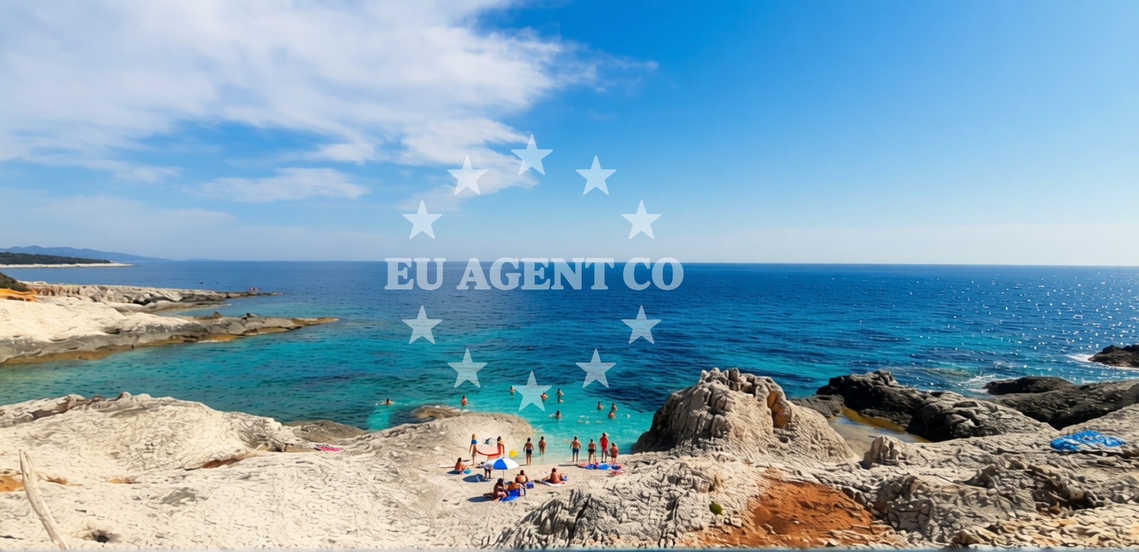
Beach character
The beach's 50-meter width is defined by rocky outcrops that extend into the sea, forming natural shelters along parts of the shore. These boulders contribute to the beach's 'moderate' depth increase profile, with the seabed remaining predominantly rocky even at greater depths. The straight shoreline orientation creates a uniform experience along its length, though the boulder cover means the beach is not suitable for sunbathing on the sand. Visitors should note the 'Good' cleanliness index reported in official assessments, though no specific facilities are listed in the beach's authoritative features.
Swimming and shore
Snorkeling is the primary water-based activity associated with Kurila Beach, facilitated by the rocky seabed that creates diverse microhabitats for marine species. The beach's boulder-strewn character means swimming conditions are generally safe for competent swimmers, though the lack of designated swimming zones should be noted. The absence of artificial structures or beach amenities means visitors must bring their own equipment for water activities.
Facilities and activities
No permanent facilities are listed in the beach's authoritative records. The lack of structured amenities means visitors should plan for self-sufficiency in terms of refreshments, shade, and changing facilities. The beach's 'Leisure seekers' recommendation suggests it is best suited for those seeking solitude rather than commercial beach services.
Access and location
Located at Artatore 170A on Mali Lošinj, the beach is accessible by road from the island's main settlements. As Mali Lošinj is car-free, visitors must arrive by boat or use the island's limited shuttle services. The beach's position on the northern coast places it within sailing distance of the Istrian Peninsula and the broader Adriatic cruising routes. The island's lack of motor vehicles creates a quiet coastal environment that contrasts with more developed Adriatic destinations.
What to expect
Expect a beach experience defined by its natural rocky formations and absence of commercial infrastructure. The 'Moderate' crowd index during high season suggests it is less crowded than Mali Lošinj's more famous beaches like Škrip or Veli Rat. The beach's primary appeal lies in its snorkeling opportunities and the unique geological features that shape its shoreline. Visitors should be prepared for a beach without umbrellas, sunbeds, or refreshment stands.
Practical tips
Given the beach's boulder-strewn terrain, wear sturdy footwear for beach access. The lack of facilities means bringing water, snacks, and sun protection is essential. Early arrival is recommended to secure parking in nearby settlements, as Mali Lošinj's car-free policy relies on limited visitor parking areas.
Exploring the coast by yacht
For yacht charter guests, Kurila Beach offers a secluded anchorage point along Mali Lošinj's northern coast. The island's protected status as a nature reserve makes it a popular stop for sailors seeking calm waters and unspoiled scenery. Charter yachts can anchor in the nearby Bay of Mali Lošinj, with the beach serving as a convenient landing point for shore excursions. The absence of marinas on the beach itself means visitors should use the island's designated mooring areas.
Geological Context
The beach's boulder-strewn character is part of Mali Lošinj's broader geological profile, shaped by glacial deposits and Adriatic wave action. The rocky seabed creates a unique habitat for marine species, contributing to the area's biodiversity. This geological character is consistent with other northern Adriatic beaches that feature similar formations.
Anchorages in the surrounding area
Anchorages in the surrounding area near Mali Lošinj, including Cunski and Koludarc.
- Anchorage — mali losinj — 0.9 NM from beach
- Anchorage — mali losinj — 1.4 NM from beach
- Anchorage — cunski — losinj — 1.9 NM from beach
- Anchorage — koludarc — 2.3 NM from beach
- Anchorage — cunski — losinj — 2.4 NM from beach
- Anchorage — losinj — 2.8 NM from beach
- Buoy field — susak — 3.9 NM from beach
- Porat — susak — 4.6 NM from beach
Distances are straight-line geographic distances, not sailing routes.
Mooring buoys in the surrounding area
Mooring buoys and jetties in nearby areas such as Cunski, Vele Srakane, and Koludarc.
- Jetty — cunski — losinj — 2.4 NM from beach
- Quay — vele srakane — 2.6 NM from beach
- Jetty — koludarc — 2.6 NM from beach
- Jetty — mali losinj — 3.6 NM from beach
- Marina Cikat — mali losinj — 3.7 NM from beach
Distances are straight-line geographic distances, not sailing routes.
Marine fuel stations
Marine fuel stations located in Mali Lošinj and the nearby town of Rab.
- Adria Oil — mali losinj — 3.5 NM from beach
- Ina — mali losinj — 4.0 NM from beach
- Tifon — nerezine — losinj — 6.8 NM from beach
- Ina — rab — 20.3 NM from beach
Distances are straight-line geographic distances, not sailing routes.
Harbours in the surrounding area
Harbours in the surrounding area, including Cunski, Vele Srakane, and Susak.
- Za Osirom — cunski — losinj — 2.4 NM from beach
- Gornja Trata — vele srakane — 2.6 NM from beach
- Susak — 4.0 NM from beach
- Mali Lošinj — mali losinj — 4.1 NM from beach
- Sveti Martin — mali losinj — 4.6 NM from beach
- Nerezine — losinj — 6.0 NM from beach
Distances are straight-line geographic distances, not sailing routes.
Marinas in the surrounding area
Marinas in nearby locations such as Mali Lošinj, Nerezine, and Rab.
- Marina Lošinj — mali losinj — 3.5 NM from beach
- Y/C Marina Mali Lošinj — mali losinj — 3.8 NM from beach
- Marina Nerezine — losinj — 5.9 NM from beach
- ACI Marina Rab — 20.3 NM from beach
- ACI Marina Supetarska Draga — rab — 20.8 NM from beach
Distances are straight-line geographic distances, not sailing routes.
Restaurants near the beach
Restaurants located in Mali Lošinj, offering dining options near the beach.
- Oaza — mali losinj — 1.4 NM from beach
- Artatore — losinj — 1.6 NM from beach
- Ana — losinj — 1.6 NM from beach
- Ristorante Eki — mali losinj — 1.6 NM from beach
- Klub Kapetana — mali losinj — 3.5 NM from beach
- Konoba Cigale — mali losinj — 3.6 NM from beach
- Diana — mali losinj — 3.7 NM from beach
Distances are straight-line geographic distances, not sailing routes.
Navigation guides for the surrounding area
Navigation guides for nearby areas including Uvala Artaturi and Susak Harbour.
- Uvala Artaturi — 1.6 NM from beach
- Uvala Liski — 1.9 NM from beach
- Susak Harbour — 3.8 NM from beach
- Mali Losinj — 4.1 NM from beach
- Uvala Porat — 4.4 NM from beach
Distances are straight-line geographic distances, not sailing routes.
Yachts from nearby departure bases
Yachts departing from the nearby base of Mali Lošinj, offering various sail and motor boat options.
Sailing yachts
- Dufour 360 Grand (Vanila) — Mali Lošinj — 3.7 NM from departure base to beach
- Elan 344 Impression (Helios) — Mali Lošinj — 3.7 NM from departure base to beach
- Bavaria 37 Cruiser (Alani) — Mali Lošinj — 3.7 NM from departure base to beach
- Elan 40 Impression (Laali) — Mali Lošinj — 3.7 NM from departure base to beach
- Sun Odyssey 32i (Cikat) — Mali Lošinj — 3.7 NM from departure base to beach
Motor boats
- Galeon Galia 700 — Mali Lošinj — 3.7 NM from departure base to beach
- Barracuda 530 RIB (Hvar) — Mali Lošinj — 3.7 NM from departure base to beach
- Atlantic Marine Sun Cruiser 690 — Mali Lošinj — 3.7 NM from departure base to beach
- Merry Fisher 895 (Zablace) — Mali Lošinj — 3.7 NM from departure base to beach
- Antares 36 (JOIA) — Mali Lošinj — 3.7 NM from departure base to beach
Distances are straight-line geographic distances, not sailing routes.