Jarsan sredina, Igrane Beach, Croatia
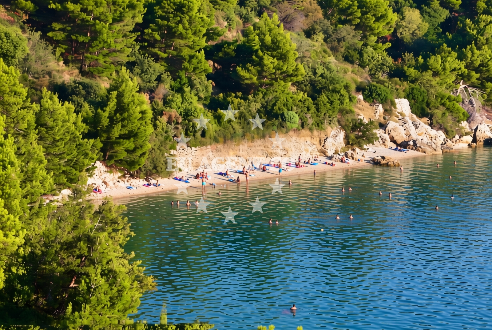
Jarsan sredina, Igrane Beach lies along the eastern coast of Croatia, nestled within a landscape shaped by the Adriatic Sea's influence. This 100-meter stretch of shore is defined by its gravel and rocky terrain, offering a stark contrast to the sandy beaches more commonly found in the region. Its location places it within a coastal area that has historically been a passage for maritime activity, though the beach itself remains a quiet, undeveloped shoreline.
About this beach
Jarsan sredina, Igrane
Beach: Jarsan sredina
Location: Igrane
Characteristics and facilities
Gravel, rocks
100 m
Beach character
The beach's composition of gravel and rocks suggests it is not suited for swimming, but rather for walking or exploring the natural contours of the coastline. The short length of the beach means it is unlikely to accommodate large groups, though it may serve as a scenic spot for those seeking solitude. The rocky terrain could present challenges for visitors unaccustomed to uneven surfaces, making sturdy footwear advisable for those planning to traverse the shore.
Swimming and shore
Swimming conditions at Jarsan sredina, Igrane Beach are not explicitly documented in available records. The presence of gravel and rocks along the shore implies that the water's edge may be uneven or shallow, which could affect swimming safety. Visitors should exercise caution when entering the water, as the rocky nature of the beach may make it unsuitable for those seeking a smooth, sandy entry point.
Facilities and activities
No specific facilities or activities are listed for Jarsan sredina, Igrane Beach. The absence of structured amenities suggests it is not a destination for organized tourism, but rather a natural feature of the coastline. Those interested in exploring the area may find value in the beach's proximity to the broader Adriatic landscape, though no recreational activities are explicitly associated with the site.
Access and location
Jarsan sredina, Igrane Beach is located in the municipality of Igrane, a coastal settlement in Croatia. Its exact coordinates (43.196418° N, 17.135903° E) place it within a region known for its rugged coastline and historical maritime connections. Access to the beach likely requires local knowledge of the area, as no specific roads or pathways are mentioned in the available data. Visitors should consider local guidance when planning their visit.
What to expect
Jarsan sredina, Igrane Beach is a short, gravelly shoreline that offers a glimpse into the natural character of Croatia's eastern coast. Visitors should expect a rugged, undeveloped environment with no formal amenities or services. The beach's rocky composition makes it more suitable for walking or observation than for swimming or sunbathing. Those planning to visit should prepare for uneven terrain and consider the site's limited scale when arranging travel.
Practical tips
Visitors to Jarsan sredina, Igrane Beach should wear sturdy footwear to navigate the gravel and rocky shoreline. Sun protection is recommended, as the beach's exposure to the Adriatic Sea may increase UV exposure. Due to the absence of formal facilities, visitors should bring their own supplies for any extended stay on the beach.
Exploring the coast by yacht
The beach lies within a region of Croatia that is part of the broader Adriatic sailing network, though no specific marinas or anchorages are documented in proximity to Jarsan sredina. The area's coastal geography, characterized by rocky inlets and open waters, may appeal to sailors exploring the Croatian coast. Yacht charter operators in the region often highlight the Adriatic's diverse landscapes, which include both sheltered bays and exposed shores like this one.
Regional Context and Coastal Character
The area around Jarsan sredina is part of a coastline that transitions between rocky headlands and more sheltered bays. This stretch of the Adriatic is known for its natural beauty and limited tourism infrastructure, making it a destination for those seeking a more secluded experience. The nearby waters are part of a sailing route that connects to other coastal settlements in the region, though specific details about maritime access are not available in the catalog.
Anchorages in the surrounding area
Anchorages in Hvar and Selca kod Bogomolja lie nearby, offering options in the same region as the beach.
- Anchorage — sucuraj — hvar — 3.5 NM from beach
- Anchorage — selca kod bogomolja — hvar — 3.9 NM from beach
- Anchorage — selca kod bogomolja — hvar — 4.7 NM from beach
- Anchorage — selca kod bogomolja — hvar — 4.7 NM from beach
- Anchorage — sucuraj — hvar — 4.7 NM from beach
- Anchorage — sucuraj — hvar — 4.7 NM from beach
- Anchorage — sucuraj — hvar — 4.8 NM from beach
- Anchorage — selca kod bogomolja — hvar — 4.9 NM from beach
Distances are straight-line geographic distances, not sailing routes.
Mooring buoys in the surrounding area
Mooring buoys at Kraj Soline, Sucuraj, and Selca kod Bogomolja are situated in proximity to the beach.
- Kraj - Soline — kraj soline — drasnice — 1.8 NM from beach
- Jetty — sucuraj — hvar — 4.8 NM from beach
- Konoba Gambo buoys — selca kod bogomolja — hvar — 5.0 NM from beach
- Drvenik - Ferry dock — drvenik ferry dock — 5.5 NM from beach
- Quay — bogomolje — hvar — 6.3 NM from beach
Distances are straight-line geographic distances, not sailing routes.
Marine fuel stations
Marine fuel stations in Makarska, Brac, Korcula, and Ploce serve the broader central and southern Dalmatia areas.
- Ina — makarska — 7.9 NM from beach
- Fuel station — sumartin — brac — 13.2 NM from beach
- Fuel station — korcula — 14.5 NM from beach
- Fuel station — ploce — 15.7 NM from beach
Distances are straight-line geographic distances, not sailing routes.
Harbours in the surrounding area
- Igrane — 0.2 NM from beach
- Živogošće — zivogosce — 1.1 NM from beach
- Drašnice — drasnice — 1.6 NM from beach
- Čaklje — caklje — podgora — 3.0 NM from beach
- Podgora — 4.0 NM from beach
- Sućuraj — sucuraj — hvar — 4.8 NM from beach
Distances are straight-line geographic distances, not sailing routes.
Marinas in the surrounding area
- Marina Tučepi — marina tucepi — 5.3 NM from beach
- Marina Ramova — krvavica — 10.2 NM from beach
- Marina Baška Voda — marina baska voda — 12.7 NM from beach
- ACI Marina Korčula — korcula — 14.3 NM from beach
- Marina Lumbarda — korcula — 16.4 NM from beach
Distances are straight-line geographic distances, not sailing routes.
Restaurants near the beach
Restaurants in Sucuraj and Selca kod Bogomolja offer dining options near the beach.
- Mlaska — sucuraj — hvar — 3.6 NM from beach
- Restaurant — sucuraj — hvar — 4.8 NM from beach
- Riblji Restoran — sucuraj — hvar — 4.8 NM from beach
- u.Mrtinovic — selca kod bogomolja — hvar — 4.9 NM from beach
Distances are straight-line geographic distances, not sailing routes.
Navigation guides for the surrounding area
Navigation guides for Podgora, Hvar, and surrounding bays support route planning in the region.
- Podgora — 3.6 NM from beach
- OTOK HVAR — 5.2 NM from beach
- Uvala Drvenik (Donja Vala) — 5.8 NM from beach
- Uvala Kozja — 6.0 NM from beach
- Uvala Duboka — 6.2 NM from beach
Distances are straight-line geographic distances, not sailing routes.
Yachts from nearby departure bases
Sailing yachts
- Bavaria 40 Cruiser (LADY BUTTERFLY) — Tučepi Port — 5.3 NM from departure base to beach
- Oceanis 43 (BLACK SHEEP) — Baška Voda — 12.7 NM from departure base to beach
- Elan 50 Impression (FINES DE CLAIRES) — Baška Voda — 12.7 NM from departure base to beach
Catamarans
- Lagoon 450 (LAMANTIN) — Baška Voda — 12.7 NM from departure base to beach
Motor yachts
- Princess V53 (Chablis) — Makarska Port — 7.7 NM from departure base to beach
- Canados 86 (Karisma) — Baška Voda — 12.7 NM from departure base to beach
Motor boats
- Jeanneau NC 37 (Black Pearl) — Makarska Port — 7.7 NM from departure base to beach
- Galeon 430 Skydeck (Bellagio) — Makarska Port — 7.7 NM from departure base to beach
- Jeanneau NC 37 (Black Pearl) — Makarska Port — 7.7 NM from departure base to beach
- Galeon 430 Skydeck (BELLAGIO) — Makarska Port — 7.7 NM from departure base to beach
Distances are straight-line geographic distances, not sailing routes.