Jarsan istok, Igrane Beach, Croatia
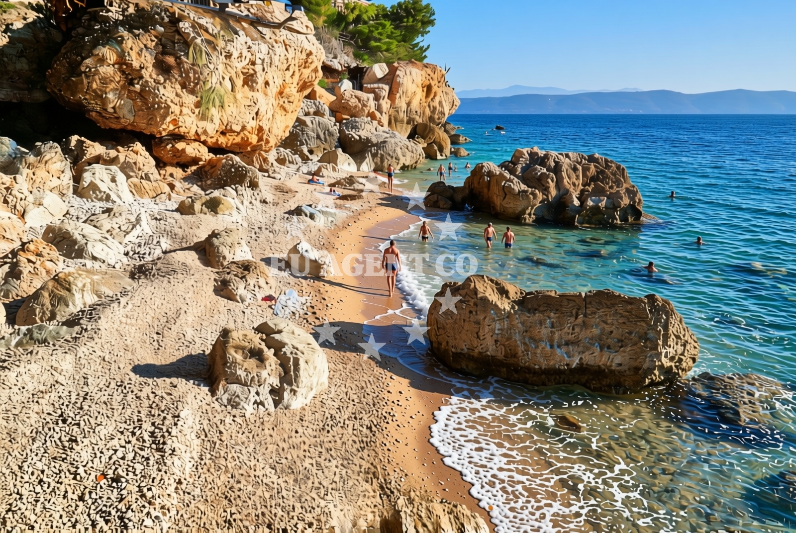
About this beach
Jarsan istok, Igrane
Beach: Jarsan istok
Location: Igrane
Characteristics and facilities
Gravel, rocks
50 m
Natural shade
Beach character
The beach's defining feature is its gravel and rock composition, which creates a stark contrast to the soft sands of more tourist-oriented shores. The shoreline is uneven, with larger stones and boulders forming natural steps leading to the water. Natural shade is available in limited pockets where rock formations cast shadows during midday, though sun exposure remains significant across much of the beach. The 50-meter length makes it a modest stretch, ideal for solitary exploration rather than large gatherings.Swimming and shore
Swimming conditions here are dictated by the rocky terrain. The water is accessible in shallow, uneven areas between the stones, but the lack of sandy beaches means the experience differs from conventional swimming spots. The shore's ruggedness makes it unsuitable for young children or those seeking easy water access. The sea itself is typical of the Adriatic, with clear waters and moderate wave action depending on wind conditions.Facilities and activities
There are no facilities or services directly associated with Jarsan istok, Igrane Beach. No lifeguard posts, changing rooms, or restrooms are present. The absence of infrastructure aligns with its status as a natural, undeveloped shore. Activities are limited to walking along the beach and exploring the rocky coastline, though the area's proximity to Igrane and the surrounding Dalmatian coast offers opportunities for hiking, cycling, or visiting nearby villages.Access and location
The beach is located in Igrane, a small village on the island of Brač, part of the Split-Dalmatia County. Access requires navigating the narrow coastal road that runs along the island's eastern shore. The nearest major settlement is Supetar, Brač's main town, which is approximately 12 kilometers west. The beach's remote position means it is not served by public transport, requiring visitors to arrange private transfers or use local taxi services.What to expect
Visitors should expect a beach that prioritizes natural authenticity over comfort. The gravel and rock surface requires sturdy footwear, and the lack of facilities means provisions must be brought from elsewhere. The beach's short length and exposed position make it more suitable for those seeking solitude or a brief stop during a coastal drive. The surrounding area of Igrane and Brač offers broader opportunities for exploration, including the island's famous Zlatni Rat beach and the historic village of Bol.Practical tips
Bring sturdy shoes for walking on the gravel and rocks. Sun protection is essential due to limited shade. Consider visiting during early morning or late afternoon to avoid the harshest sunlight. The beach's remoteness means it is often quiet, but this also means no on-site services for food or drinks.Exploring the coast by yacht
For yacht charter guests, the proximity to Brač's marinas, including those in Supetar and Bol, makes this beach a potential stop for those exploring the island's eastern coast. The rocky shoreline may pose challenges for anchoring, but nearby anchorages in the Supetar Bay area offer safer alternatives. Sailors should note that the beach itself is not a designated anchorage, but the surrounding waters are part of the popular sailing routes along the Dalmatian coast.Regional Context and Nearby Attractions
Igrane is part of Brač, an island renowned for its limestone cliffs, vineyards, and connection to the Adriatic's sailing scene. The village itself is small but sits near the island's only airport, making it a gateway for visitors. Beyond the beach, Brač offers hiking trails through the Paklenica National Park, the famous Blue Cave, and the scenic road to the island's northern tip. The nearby town of Bol, home to the iconic Zlatni Rat beach, is a short drive away and provides access to more developed coastal amenities.Anchorages in the surrounding area
Anchorages in the surrounding area include Sucuraj and Selca kod Bogomolja on Hvar, offering nearby options for mooring.
- Anchorage — sucuraj — hvar — 3.4 NM from beach
- Anchorage — selca kod bogomolja — hvar — 3.8 NM from beach
- Anchorage — selca kod bogomolja — hvar — 4.6 NM from beach
- Anchorage — selca kod bogomolja — hvar — 4.6 NM from beach
- Anchorage — sucuraj — hvar — 4.6 NM from beach
- Anchorage — sucuraj — hvar — 4.7 NM from beach
- Anchorage — sucuraj — hvar — 4.7 NM from beach
- Anchorage — selca kod bogomolja — hvar — 4.9 NM from beach
Distances are straight-line geographic distances, not sailing routes.
Mooring buoys in the surrounding area
- Kraj - Soline — kraj soline — drasnice — 1.9 NM from beach
- Jetty — sucuraj — hvar — 4.8 NM from beach
- Konoba Gambo buoys — selca kod bogomolja — hvar — 4.9 NM from beach
- Drvenik - Ferry dock — drvenik ferry dock — 5.5 NM from beach
- Quay — bogomolje — hvar — 6.3 NM from beach
Distances are straight-line geographic distances, not sailing routes.
Marine fuel stations
- Ina — makarska — 8.0 NM from beach
- Fuel station — sumartin — brac — 13.2 NM from beach
- Fuel station — korcula — 14.5 NM from beach
- Fuel station — ploce — 15.6 NM from beach
Distances are straight-line geographic distances, not sailing routes.
Harbours in the surrounding area
- Igrane — 0.2 NM from beach
- Živogošće — zivogosce — 1.0 NM from beach
- Drašnice — drasnice — 1.7 NM from beach
- Čaklje — caklje — podgora — 3.1 NM from beach
- Podgora — 4.1 NM from beach
- Sućuraj — sucuraj — hvar — 4.7 NM from beach
Distances are straight-line geographic distances, not sailing routes.
Marinas in the surrounding area
- Marina Tučepi — marina tucepi — 5.4 NM from beach
- Marina Ramova — krvavica — 10.3 NM from beach
- Marina Baška Voda — marina baska voda — 12.8 NM from beach
- ACI Marina Korčula — korcula — 14.2 NM from beach
- Marina Lumbarda — korcula — 16.3 NM from beach
Distances are straight-line geographic distances, not sailing routes.
Restaurants near the beach
Restaurants near the beach include Mlaska and other dining options in Sucuraj, offering meals within a short distance.
- Mlaska — sucuraj — hvar — 3.5 NM from beach
- Restaurant — sucuraj — hvar — 4.7 NM from beach
- Riblji Restoran — sucuraj — hvar — 4.8 NM from beach
- u.Mrtinovic — selca kod bogomolja — hvar — 4.9 NM from beach
Distances are straight-line geographic distances, not sailing routes.
Navigation guides for the surrounding area
Navigation guides for the surrounding area cover locations such as Podgora, Hvar, and Uvala Drvenik, assisting in route planning near the beach.
- Podgora — 3.7 NM from beach
- OTOK HVAR — 5.1 NM from beach
- Uvala Drvenik (Donja Vala) — 5.7 NM from beach
- Uvala Kozja — 6.0 NM from beach
- Uvala Duboka — 6.2 NM from beach
Distances are straight-line geographic distances, not sailing routes.
Yachts from nearby departure bases
Sailing yachts
- Bavaria 40 Cruiser (LADY BUTTERFLY) — Tučepi Port — 5.4 NM from departure base to beach
- D&D Kufner 54 (Komiza) — Baška Voda — 12.8 NM from departure base to beach
- Elan 45 Impression (" MONACO ") — Baška Voda — 12.8 NM from departure base to beach
Catamarans
- Lagoon 450 (LAMANTIN) — Baška Voda — 12.8 NM from departure base to beach
Motor yachts
- Princess V53 (Chablis) — Makarska Port — 7.8 NM from departure base to beach
- Canados 86 (Karisma) — Baška Voda — 12.8 NM from departure base to beach
Motor boats
- Jeanneau NC 37 (Black Pearl) — Makarska Port — 7.8 NM from departure base to beach
- Galeon 430 Skydeck (Bellagio) — Makarska Port — 7.8 NM from departure base to beach
- Jeanneau NC 37 (Black Pearl) — Makarska Port — 7.8 NM from departure base to beach
- Galeon 430 Skydeck (BELLAGIO) — Makarska Port — 7.8 NM from departure base to beach
Distances are straight-line geographic distances, not sailing routes.