Igrane Zapad Beach, Croatia
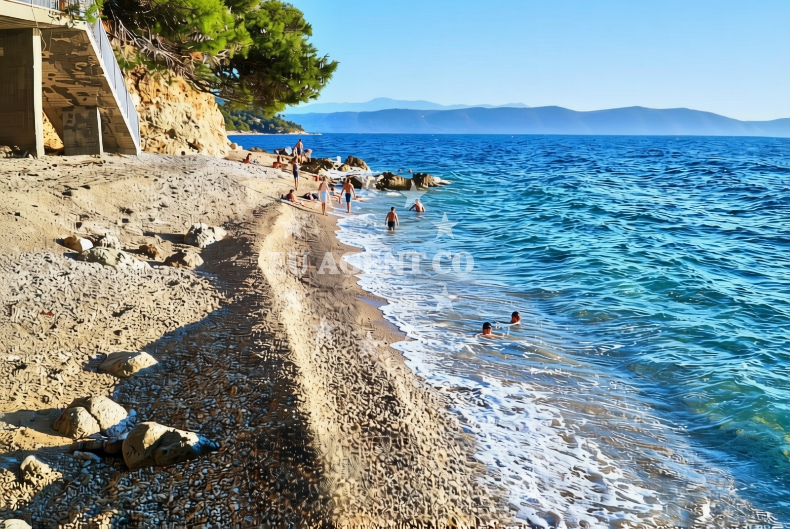
Igrane Zapad Beach lies along the rugged coastline of Igrane, a small settlement on Croatia’s Adriatic coast. This 40-meter stretch of gravel and rock offers a raw, unspoiled shoreline that contrasts with the region’s more developed beaches. Its natural shade and proximity to the sea make it a unique spot for those seeking a less conventional coastal experience.
About this beach
Igrane zapad, Igrane
Beach: Igrane zapad
Location: Igrane
Characteristics and facilities
Gravel, rocks
40 m
Natural shade
Beach character
The beach’s composition of gravel and rock defines its character, creating a terrain that is more suited to walking than sunbathing. Natural shade from overhanging landforms provides limited relief from the sun, though visitors should expect exposed conditions during peak daylight hours. The beach’s short length and lack of formal amenities emphasize its role as a natural coastal feature rather than a tourist destination.
Swimming and shore
Swimming conditions at Igrane Zapad are dictated by the rocky shoreline and fluctuating wave action. The beach’s gravelly bottom makes it unsuitable for prolonged swimming, though the area may appeal to those interested in coastal exploration or snorkeling in shallower waters. The shore’s uneven terrain requires caution when entering or exiting the water.
Facilities and activities
No formal facilities are present at Igrane Zapad Beach. The absence of infrastructure aligns with its status as a natural coastal site. Activities are limited to passive enjoyment of the landscape, though the beach’s proximity to Igrane may offer opportunities for hiking or exploring nearby settlements. The gravel surface could accommodate light recreational use, such as walking or photography.
Access and location
Access to Igrane Zapad Beach is via the settlement of Igrane, located on the island of Brač. The beach’s position along the island’s western coast places it within reach of other Adriatic landmarks, including the popular resorts of Bol and Supetar. Its location makes it a potential stop for sailors navigating the Brač coastline, though the lack of docking facilities means visitors must rely on nearby marinas for boat access.
What to expect
Visitors to Igrane Zapad should expect a rugged, undeveloped shoreline with limited amenities. The beach’s gravel and rock composition creates a terrain that is more suited to exploration than relaxation. Natural shade is available in limited areas, but sun protection is essential. The beach’s proximity to Igrane offers potential for cultural or recreational activities beyond the shoreline, though no formal services are present at the beach itself.
Practical tips
Wear sturdy footwear for navigating the gravel and rocky terrain. Sunscreen and a hat are recommended due to limited shade. Check local conditions for safety before entering the water, as the beach’s structure may create unpredictable currents.
Exploring the coast by yacht
The area around Igrane Zapad is part of the Brač coastline, a popular sailing route in the Adriatic. Yacht charter guests exploring the region may find the beach’s location useful as a reference point for navigating between Brač’s western settlements and the broader Dalmatian coast. Nearby marinas in Igrane and Supetar provide docking options for those seeking to anchor in the vicinity.
Regional Context
Igrane is a small village on Brač, an island known for its limestone cliffs and traditional Dalmatian architecture. The settlement’s proximity to the beach reflects the island’s rugged coastal geography, which contrasts with the more tourist-focused areas of Brač. Visitors to the region may also consider exploring the nearby village of Šipovo, home to the Šipovo Lake, a freshwater reservoir offering alternative recreational opportunities.
Anchorages in the surrounding area
Anchorages near the beach, including Sucuraj and Selca kod Bogomolja on Hvar.
- Anchorage — sucuraj — hvar — 3.4 NM from beach
- Anchorage — selca kod bogomolja — hvar — 3.8 NM from beach
- Anchorage — selca kod bogomolja — hvar — 4.5 NM from beach
- Anchorage — selca kod bogomolja — hvar — 4.6 NM from beach
- Anchorage — sucuraj — hvar — 4.6 NM from beach
- Anchorage — sucuraj — hvar — 4.6 NM from beach
- Anchorage — sucuraj — hvar — 4.6 NM from beach
- Anchorage — selca kod bogomolja — hvar — 4.9 NM from beach
Distances are straight-line geographic distances, not sailing routes.
Mooring buoys in the surrounding area
Mooring buoys such as Kraj Soline in Drasnice and Jetty in Sucuraj, Hvar.
- Kraj - Soline — kraj soline — drasnice — 1.9 NM from beach
- Jetty — sucuraj — hvar — 4.7 NM from beach
- Konoba Gambo buoys — selca kod bogomolja — hvar — 4.9 NM from beach
- Drvenik - Ferry dock — drvenik ferry dock — 5.4 NM from beach
- Quay — bogomolje — hvar — 6.3 NM from beach
Distances are straight-line geographic distances, not sailing routes.
Marine fuel stations
Marine fuel stations in Makarska, Brac, Korcula, and Ploce, spanning central and south Dalmatia.
- Ina — makarska — 8.0 NM from beach
- Fuel station — sumartin — brac — 13.3 NM from beach
- Fuel station — korcula — 14.4 NM from beach
- Fuel station — ploce — 15.6 NM from beach
Distances are straight-line geographic distances, not sailing routes.
Harbours in the surrounding area
Harbors such as Igrane, Zivogošće, and Drašnice, with Igrane being the closest.
- Igrane — 0.1 NM from beach
- Živogošće — zivogosce — 1.0 NM from beach
- Drašnice — drasnice — 1.8 NM from beach
- Čaklje — caklje — podgora — 3.1 NM from beach
- Podgora — 4.1 NM from beach
- Sućuraj — sucuraj — hvar — 4.7 NM from beach
Distances are straight-line geographic distances, not sailing routes.
Marinas in the surrounding area
Marinas like Tučepi, Ramova in Krvavica, and Baška Voda, located in central and south Dalmatia.
- Marina Tučepi — marina tucepi — 5.4 NM from beach
- Marina Ramova — krvavica — 10.3 NM from beach
- Marina Baška Voda — marina baska voda — 12.9 NM from beach
- ACI Marina Korčula — korcula — 14.2 NM from beach
- Marina Lumbarda — korcula — 16.3 NM from beach
Distances are straight-line geographic distances, not sailing routes.
Restaurants near the beach
Restaurants such as Mlaska and u.Mrtinovic in Sucuraj and Selca kod Bogomolja, Hvar.
- Mlaska — sucuraj — hvar — 3.4 NM from beach
- Restaurant — sucuraj — hvar — 4.7 NM from beach
- Riblji Restoran — sucuraj — hvar — 4.7 NM from beach
- u.Mrtinovic — selca kod bogomolja — hvar — 4.8 NM from beach
Distances are straight-line geographic distances, not sailing routes.
Navigation guides for the surrounding area
Navigation guides for areas like Podgora, Hvar, and bays such as Drvenik and Kozja.
- Podgora — 3.7 NM from beach
- OTOK HVAR — 5.1 NM from beach
- Uvala Drvenik (Donja Vala) — 5.7 NM from beach
- Uvala Kozja — 6.0 NM from beach
- Uvala Duboka — 6.1 NM from beach
Distances are straight-line geographic distances, not sailing routes.
Yachts from nearby departure bases
Yachts departing from Tučepi Port and Makarska Port, including sail boats, motoryachts, and motor boats.
Sailing yachts
- Bavaria 40 Cruiser (LADY BUTTERFLY) — Tučepi Port — 5.4 NM from departure base to beach
- Elan 50 Impression (FINES DE CLAIRES) — Baška Voda — 12.8 NM from departure base to beach
- Oceanis 38.1 (Baby Dory) — Baška Voda — 12.8 NM from departure base to beach
Catamarans
- Lagoon 450 (LAMANTIN) — Baška Voda — 12.8 NM from departure base to beach
Motor yachts
- Princess V53 (Chablis) — Makarska Port — 7.8 NM from departure base to beach
- Canados 86 (Karisma) — Baška Voda — 12.8 NM from departure base to beach
Motor boats
- Jeanneau NC 37 (Black Pearl) — Makarska Port — 7.8 NM from departure base to beach
- Galeon 430 Skydeck (Bellagio) — Makarska Port — 7.8 NM from departure base to beach
- Galeon 430 Skydeck (BELLAGIO) — Makarska Port — 7.8 NM from departure base to beach
- Jeanneau NC 37 (Black Pearl) — Makarska Port — 7.8 NM from departure base to beach
Distances are straight-line geographic distances, not sailing routes.