Donja Krušica sjever, Srednje Selo (Šolta) Beach, Croatia
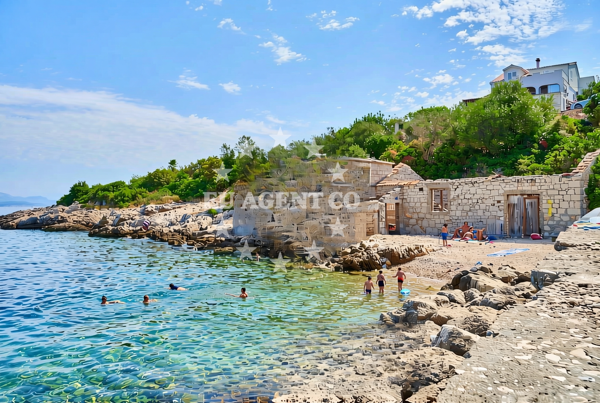
Donja Krušica sjever lies on the northern coast of Šolta Island, a quiet outpost in the Adriatic Sea’s Split-Dalmatia County. This shoreline is defined by its rugged terrain, featuring gravel, concrete slabs, and exposed rock formations. While not a traditional sandy beach, its raw coastal character offers a unique vantage point for visitors exploring Šolta’s lesser-known northern reaches.
About this beach
Donja Krušica sjever, Srednje Selo (Šolta)
Beach: Donja Krušica sjever
Location: Srednje Selo (Šolta)
Characteristics and facilities
Gravel, concrete / stone slabs, rocks
Beach character
The beach’s surface is dominated by gravel and rocky outcrops, with sections of concrete slabs likely repurposed from nearby infrastructure. The lack of soft sand makes it unsuitable for sunbathing but ideal for those seeking a more rugged coastal experience. The shoreline’s orientation faces the open sea, offering unobstructed views of the Adriatic’s horizon. Neighboring Srednje Selo, a small village on Šolta, provides a glimpse into the island’s traditional rural life, with stone houses and olive groves dotting the landscape.
Swimming and shore
Swimming conditions here are dictated by the rocky terrain. The shoreline’s steep drops into the sea make entry challenging, though the waters are typically clear and sheltered from strong currents. The beach’s northern exposure means it receives direct sunlight during midday, with cooler temperatures in the early morning and late afternoon. The surrounding area is sparsely developed, preserving the natural contours of the coastline.
Facilities and activities
No formal facilities are listed for Donja Krušica sjever itself. However, the nearby village of Srednje Selo offers basic amenities, including small shops and taverns serving local cuisine. The beach’s rocky nature limits recreational activities to walking along the shoreline or exploring the adjacent cliffs. The area is popular with hikers and nature enthusiasts due to its proximity to Šolta’s interior trails, which wind through pine forests and historic farms.
Access and location
Access to the beach is via a narrow road leading from Srednje Selo, a village on Šolta’s northern coast. The route passes through rural landscapes of olive trees and vineyards before reaching the shoreline. Šolta itself is accessible by ferry from Split or the nearby island of Brač, with connections operated by Jadrolinija. The beach’s remoteness makes it a destination for those seeking solitude, though its location within the Šolta archipelago ensures proximity to other islands like Hvar and Vis.
What to expect
Expect a rugged, undeveloped shoreline with gravel and rock surfaces. The beach is best suited for visitors seeking a raw coastal experience rather than sunbathing or swimming. The area’s appeal lies in its natural setting and proximity to Srednje Selo’s traditional village life. No lifeguards, umbrellas, or changing rooms are present, and the lack of soft sand means it is not ideal for families with young children. The beach is part of Šolta’s northern coastline, which remains less frequented than the island’s southern shores.
Practical tips
Wear sturdy footwear to navigate the rocky terrain. The beach’s exposure to the open sea means wind can be strong during the day. Bring water for hiking along the shoreline, as there are no shaded areas for rest. The nearest amenities are in Srednje Selo, a short walk inland.
Exploring the coast by yacht
For yacht charter guests, the Šolta archipelago offers a network of sheltered bays and anchorages, including the nearby harbor of Srednje Selo. The area is part of the Central Dalmatian coast, a popular sailing route known for its calm waters and scenic islands. Charter yachts can explore Šolta’s northern coastline, with Donja Krušica sjever serving as a potential stop for those seeking a remote anchorage. Nearby marinas on Brač and Hvar provide docking options for extended stays.
Šolta’s Cultural Landscape
Šolta is one of the largest islands in the Šolta archipelago, with a history dating back to ancient times. The island’s rural character is preserved through its traditional villages, including Srednje Selo, which retains stone houses and agricultural land. Local culture emphasizes fishing and viticulture, with wineries producing Plavac Mali, a robust red wine. The island’s isolation has helped maintain its rustic charm, making it a destination for cultural immersion.
Anchorages in the surrounding area
Anchorages in Rogac and Solta are within 2 nautical miles of Donja Krušica sjever, Srednje Selo (Šolta) Beach.
- Anchorage — rogac — solta — 1.3 NM from beach
- Anchorage — rogac — solta — 1.7 NM from beach
- Anchorage — solta — 2.0 NM from beach
- Anchorage — solta — 2.1 NM from beach
- Anchorage — solta — 2.2 NM from beach
- Anchorage — solta — 2.2 NM from beach
- Anchorage — necujam — solta — 2.3 NM from beach
- Anchorage — solta — 2.3 NM from beach
Distances are straight-line geographic distances, not sailing routes.
Mooring buoys in the surrounding area
- Krušica Donja — donja krusica — solta — 0.0 NM from beach
- Pasarela restaurant jetty — rogac — solta — 1.7 NM from beach
- Lonely Paradise restaurant buoys — solta — 2.5 NM from beach
- Restaurant Sismis buoys — maslinica — solta — 2.6 NM from beach
- Konoba Sesula mooring — maslinica — solta — 2.7 NM from beach
Distances are straight-line geographic distances, not sailing routes.
Marine fuel stations
- Fuel station — rogac — solta — 1.6 NM from beach
- Ina — trogir — 6.3 NM from beach
- B-Max — b max — trogir — 6.5 NM from beach
- Ina — milna brac — 9.1 NM from beach
Distances are straight-line geographic distances, not sailing routes.
Harbours in the surrounding area
Harbours in Rogač and Stomorska, both in Solta, are situated within 5 nautical miles of the beach.
- Rogač — rogac — solta — 1.6 NM from beach
- Stomorska — solta — 4.3 NM from beach
- Toče — okrug gornji — ciovo — 5.2 NM from beach
- Drvenik Veli — 6.0 NM from beach
- Slatine — ciovo — 6.2 NM from beach
- Trogir Harbour — 6.4 NM from beach
Distances are straight-line geographic distances, not sailing routes.
Marinas in the surrounding area
Marinas in Maslinica and Trogir are located within 8.9 nautical miles of Donja Krušica sjever, Srednje Selo (Šolta) Beach.
- Marina Martinis Marchi — maslinica — solta — 2.8 NM from beach
- Marina Trogir — 6.3 NM from beach
- ACI Marina Trogir — 6.3 NM from beach
- Marina Baotić — marina baotic — trogir — 6.5 NM from beach
- Marina Vlaška — milna brac — 8.9 NM from beach
Distances are straight-line geographic distances, not sailing routes.
Restaurants near the beach
Restaurants in Rogac and Maslinica, within 2.7 nautical miles, offer dining options near Donja Krušica sjever.
- Villa Solta — rogac — 1.5 NM from beach
- Pasarela — rogac — solta — 1.7 NM from beach
- Stara Kuća — rogac — solta — 1.7 NM from beach
- Lonely Paradise — solta — 2.5 NM from beach
- Restaurant Šišmiš — maslinica — solta — 2.6 NM from beach
- Konoba Mareta — necujam — solta — 2.6 NM from beach
- Restaurant Gajeta — maslinica — solta — 2.7 NM from beach
Distances are straight-line geographic distances, not sailing routes.
Navigation guides for the surrounding area
- Uvala Donja Krusica — 0.2 NM from beach
- Rogac — 1.9 NM from beach
- Uvala Sesula — 2.4 NM from beach
- Maslinica — 2.6 NM from beach
- Uvala Necujam — 2.7 NM from beach
Distances are straight-line geographic distances, not sailing routes.
Yachts from nearby departure bases
Sailing yachts
- Cyclades 43.4 (Himalaya) — Šolta Rogač — 1.6 NM from departure base to beach
- Sun Odyssey 449 (Port Royal) — Šolta Rogač — 1.6 NM from departure base to beach
- Sun Odyssey 349 (Siberia) — Šolta Rogač — 1.6 NM from departure base to beach
- Oceanis 50 Family (Mississippi) — Šolta Rogač — 1.6 NM from departure base to beach
- Cyclades 39.3 (Alaska) — Šolta Rogač — 1.6 NM from departure base to beach
Catamarans
- Lagoon 42 (Galapagos) — Šolta Rogač — 1.6 NM from departure base to beach
- Lagoon 450 Flybridge (Samogon) — Šolta Rogač — 1.6 NM from departure base to beach
- Lagoon 40 (Solentia) — Šolta Rogač — 1.6 NM from departure base to beach
- Lagoon 400 (Greenland) — Šolta Rogač — 1.6 NM from departure base to beach
- Lagoon 450 (Madagascar) — Šolta Rogač — 1.6 NM from departure base to beach
Distances are straight-line geographic distances, not sailing routes.