Donja Krušica jug, Donje Selo (Šolta) Beach, Croatia
8 photos
About this beach
Donja Krušica jug, Donje Selo (Šolta)
Beach: Donja Krušica jug
Location: Donje Selo (Šolta)
Characteristics and facilities
Gravel, concrete / stone slabs
Beach character
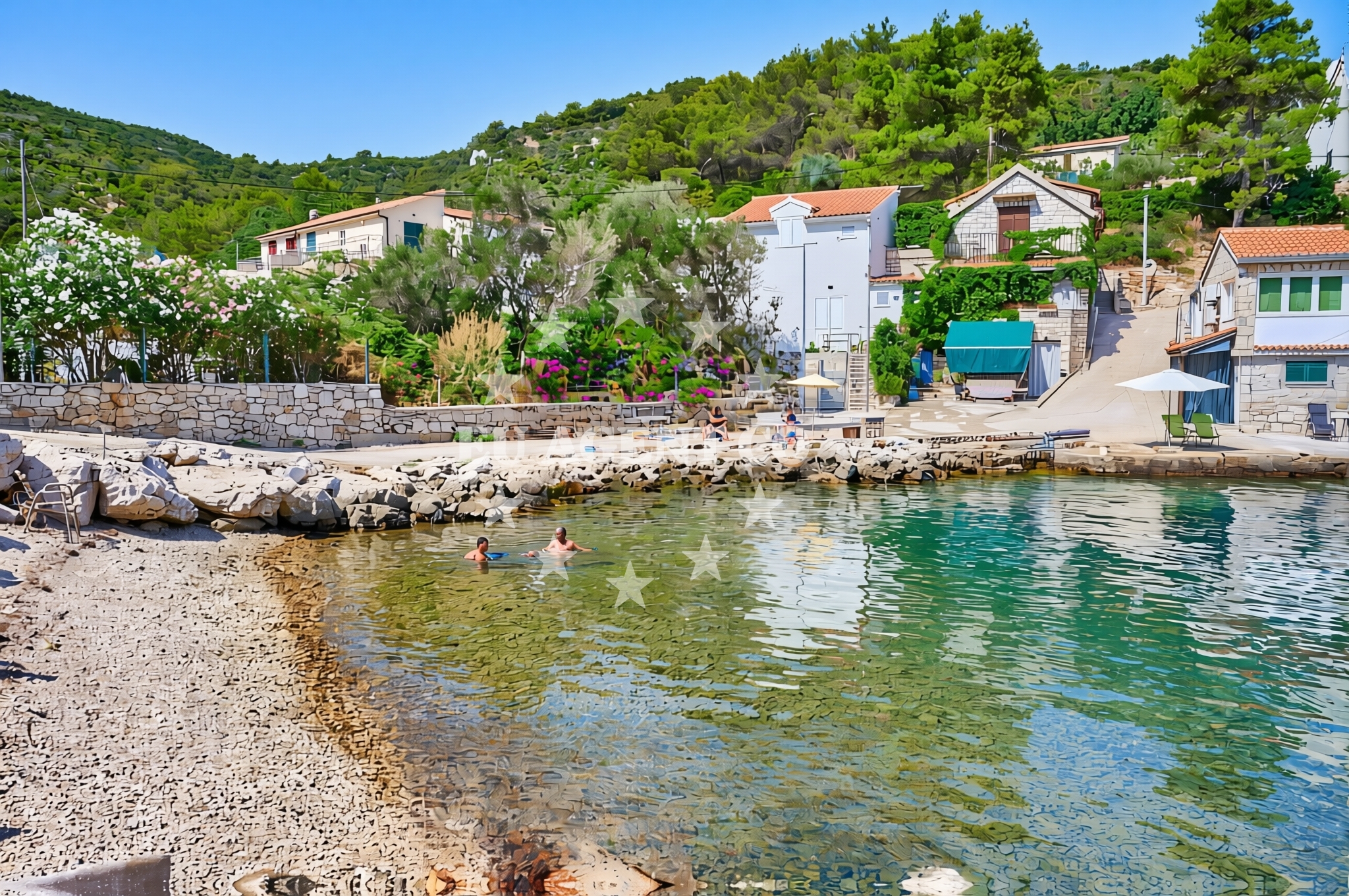
Donja Krušica jug’s defining feature is its surface composition: a mix of gravel and concrete/stone slabs. This creates a firm, uneven terrain that contrasts with the soft sands of many Adriatic beaches. The gravel likely results from natural erosion and coastal processes, while the concrete slabs may indicate localized construction or stabilization efforts. The beach’s character is less about relaxation on a sunbathing deck and more about engaging with the landscape’s natural texture. It’s a place where visitors might walk barefoot along the shore, feel the coolness of the stones underfoot, or observe how the surface interacts with tidal movements. The absence of traditional amenities like sunbeds or umbrellas underscores its informal, almost utilitarian nature.Swimming and shore
Swimming conditions at Donja Krušica jug are not explicitly detailed in the beach’s catalog, but the surrounding Šolta coastline is generally known for its clear, temperate waters. The Adriatic Sea here is influenced by the island’s geography, with currents and wave action varying by season. The gravelly shoreline may offer some shelter from waves, though this is not guaranteed. For swimmers, the beach’s surface could present a challenge—wading into the sea from the slabs may require careful footing. The area’s appeal likely lies more in its visual and tactile qualities than in recreational swimming, though it remains a viable option for those comfortable with the terrain.Facilities and activities
The beach lacks official amenities such as restrooms, showers, or food services, as noted in the catalog. This aligns with its character as a more natural, low-impact site. Activities here are limited to what the landscape permits: walking along the shore, exploring the gravel and stone formations, or simply observing the interplay of land and sea. The absence of marked recreational facilities means visitors should approach with expectations of minimal infrastructure. However, the nearby settlement of Donje Selo may offer access to local services, such as restaurants or shops, though these are not directly associated with the beach itself.Access and location
Donja Krušica jug is located in Donje Selo, a small village on Šolta Island, Croatia. Šolta is part of the Split-Dalmatia County and lies within the broader Adriatic region, renowned for its yacht-friendly waters and historic coastal towns. Access to the beach likely requires a combination of road and foot travel, as Šolta’s settlements are typically reached by ferry or boat from mainland Croatia or neighboring islands like Brač and Hvar. The island’s lack of major roads means visitors may need to navigate via local paths or arrange private transport. For yacht charter guests, the proximity to Split’s marinas and the island’s sheltered bays make it a convenient stop for exploring the area’s coastline.What to expect
Visitors to Donja Krušica jug should anticipate a beach experience that prioritizes natural textures over traditional comforts. The gravel and stone slabs create a firm, uneven surface ideal for walking but less so for sunbathing. The shoreline’s character is best appreciated during low tide, when the gravel becomes more exposed and the sea retreats to reveal the beach’s full extent. The area’s appeal is likely to those seeking a raw, unfiltered coastal encounter, though it may not suit families with young children or those preferring sandy beaches. The lack of amenities means visitors should come prepared with their own supplies, though the nearby village of Donje Selo may provide access to local services.Practical tips
Wear sturdy footwear to navigate the gravel and stone slabs safely. Bring water and snacks, as facilities are limited. Check tide times to plan visits around low tide for better access to the beach’s full length. Consider combining a visit with exploration of Šolta’s vineyards or nearby historic sites.Exploring the coast by yacht
For yacht charter guests, Šolta’s coastline—including Donja Krušica jug—offers a gateway to the Adriatic’s sailing routes. The island’s sheltered bays and proximity to Split make it a popular base for exploring the region. Motor yachts and sailboats can anchor near Donje Selo or use nearby marinas for refueling and provisioning. Euro-Agent specializes in yacht charters for this area, providing access to boats ranging from motor yachts to sailboats. The surrounding waters are ideal for day trips to nearby islands like Brač or Hvar, with opportunities to anchor in secluded coves or enjoy the island’s vineyard-lined shores.Šolta Island: A Yacht Charter Destination
Šolta, where Donja Krušica jug is located, is a favored spot for yacht charters due to its combination of natural beauty and accessibility. The island’s vineyards, olive groves, and historic sites such as the Šolta Monastery provide cultural interest, while its coastline offers sheltered anchorages and scenic sailing routes. Yacht charter guests can explore the island’s lesser-known bays, enjoy the clear waters of the Adriatic, and connect with local traditions. Euro-Agent can assist in arranging charters that include stops at Šolta’s beaches, vineyards, and nearby islands.Anchorages in the surrounding area
- Anchorage — rogac — solta — 1.3 NM from beach
- Anchorage — rogac — solta — 1.7 NM from beach
- Anchorage — solta — 1.9 NM from beach
- Anchorage — solta — 2.0 NM from beach
- Anchorage — solta — 2.1 NM from beach
- Anchorage — solta — 2.2 NM from beach
- Anchorage — necujam — solta — 2.3 NM from beach
- Anchorage — solta — 2.3 NM from beach
Distances are straight-line geographic distances, not sailing routes.
Mooring buoys in the surrounding area
- Krušica Donja — donja krusica — solta — 0.0 NM from beach
- Pasarela restaurant jetty — rogac — solta — 1.7 NM from beach
- Lonely Paradise restaurant buoys — solta — 2.5 NM from beach
- Restaurant Sismis buoys — maslinica — solta — 2.6 NM from beach
- Konoba Sesula mooring — maslinica — solta — 2.7 NM from beach
Distances are straight-line geographic distances, not sailing routes.
Marine fuel stations
- Fuel station — rogac — solta — 1.6 NM from beach
- Ina — trogir — 6.3 NM from beach
- B-Max — b max — trogir — 6.5 NM from beach
- Ina — milna brac — 9.1 NM from beach
Distances are straight-line geographic distances, not sailing routes.
Harbours in the surrounding area
- Rogač — rogac — solta — 1.6 NM from beach
- Stomorska — solta — 4.3 NM from beach
- Toče — okrug gornji — ciovo — 5.2 NM from beach
- Drvenik Veli — 6.0 NM from beach
- Slatine — ciovo — 6.3 NM from beach
- Trogir Harbour — 6.4 NM from beach
Distances are straight-line geographic distances, not sailing routes.
Marinas in the surrounding area
- Marina Martinis Marchi — maslinica — solta — 2.8 NM from beach
- Marina Trogir — 6.3 NM from beach
- ACI Marina Trogir — 6.4 NM from beach
- Marina Baotić — marina baotic — trogir — 6.6 NM from beach
- Marina Vlaška — milna brac — 8.9 NM from beach
Distances are straight-line geographic distances, not sailing routes.
Restaurants near the beach
- Villa Solta — rogac — 1.4 NM from beach
- Pasarela — rogac — solta — 1.7 NM from beach
- Stara Kuća — rogac — solta — 1.7 NM from beach
- Lonely Paradise — solta — 2.5 NM from beach
- Restaurant Šišmiš — maslinica — solta — 2.6 NM from beach
- Konoba Mareta — necujam — solta — 2.6 NM from beach
- Restaurant Gajeta — maslinica — solta — 2.7 NM from beach
Distances are straight-line geographic distances, not sailing routes.
Navigation guides for the surrounding area
- Uvala Donja Krusica — 0.3 NM from beach
- Rogac — 1.9 NM from beach
- Uvala Sesula — 2.4 NM from beach
- Maslinica — 2.6 NM from beach
- Uvala Necujam — 2.7 NM from beach
Distances are straight-line geographic distances, not sailing routes.
Yachts from nearby departure bases
Sailing yachts
- Cyclades 43.4 (Tigris) — Šolta Rogač — 1.6 NM from departure base to beach
- Sun Odyssey 490 (Izzy) — Šolta Rogač — 1.6 NM from departure base to beach
- Sun Odyssey 449 (Tortuga) — Šolta Rogač — 1.6 NM from departure base to beach
- Cyclades 39.3 (Alaska) — Šolta Rogač — 1.6 NM from departure base to beach
- Sun Odyssey 349 (Siberia) — Šolta Rogač — 1.6 NM from departure base to beach
Catamarans
- Lagoon 450 Flybridge (Samogon) — Šolta Rogač — 1.6 NM from departure base to beach
- Lagoon 450 (Madagascar) — Šolta Rogač — 1.6 NM from departure base to beach
- Lagoon 400 (Greenland) — Šolta Rogač — 1.6 NM from departure base to beach
- Lagoon 40 (Solentia) — Šolta Rogač — 1.6 NM from departure base to beach
- Lagoon 42 (Galapagos) — Šolta Rogač — 1.6 NM from departure base to beach
Distances are straight-line geographic distances, not sailing routes.
Frequently asked questions
Is Donja Krušica jug suitable for swimming?
The beach’s gravel and stone slabs may make wading into the sea challenging, but the surrounding Šolta coastline is generally known for clear, temperate waters. Swimming is possible, though visitors should be mindful of the terrain.Are there facilities at the beach?
The beach lacks official amenities such as restrooms or food services. Nearby Donje Selo may offer local services, but these are not directly associated with the beach.Nearby beaches
Donja Krušica sjever, Srednje Selo (Šolta) Beach
Donja Krušica sjever
0.1 km
Grčki rat, Donje Selo (Šolta) Beach
Grčki rat
0.2 km
Krusica beach
Stari put 46, Rogač
0.2 km
Donje Selo (Šolta): beaches and coves (3)
Donje Selo (Šolta)
1.2 km
Srednje Selo (Šolta): beaches and coves (3)
Srednje Selo (Šolta)
1.3 km
Kasjun beach
Stari put 46, Rogač
2.3 km
Grohote (Šolta): beaches and coves (3)
Grohote (Šolta)
2.5 km
Rogač (Šolta): beaches and coves (6)
Rogač (Šolta)
2.8 km