Didina Beach - Sućuraj, Croatia
Didina Beach, located at Trajektna 28 in Sućuraj on the island of Korčula, offers a unique coastal experience shaped by its cove formation and surrounding landscape. This 70-meter-long beach, flanked by 20-meter-wide pebble-covered shores, presents a striking contrast between the beige pebbles and the verdant mountain backdrop. The beach's moderate depth increase and proximity to Sućuraj's historic town center make it a notable spot along the Dalmatian coast.
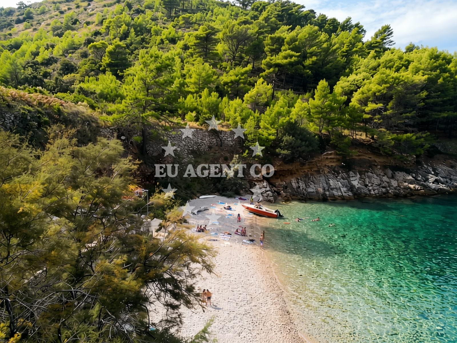
Beach character
The beach's defining characteristic is its cove structure, which creates a sheltered environment ideal for snorkeling. The pebbles, typical of the region's coastal geology, cover the shoreline and extend into the sea floor. The landscape offers panoramic views of the mountains that frame Sućuraj, adding to the beach's visual appeal. While the beach lacks artificial amenities, its natural setting and moderate crowd levels during high season contribute to a tranquil atmosphere.
Swimming and shore
Snorkeling is the primary water activity associated with Didina Beach, facilitated by the pebble-strewn sea floor and moderate depth progression. The beach's sheltered cove provides relatively calm conditions for swimmers, though the pebbles may require caution when entering or exiting the water. The absence of structured facilities means visitors should bring personal items such as towels and refreshments.
Facilities and activities
Didina Beach does not feature permanent amenities such as showers, restrooms, or umbrellas. However, its natural assets include the opportunity for snorkeling, which is supported by the clear waters and varied sea floor topography. The beach's cleanliness, rated as good, aligns with broader standards along the Korčula coast, where environmental management practices are emphasized.
Access and location
Access to Didina Beach is via Trajektna 28 in Sućuraj, a town on the island of Korčula in Croatia's Dalmatian region. Sućuraj itself is a historic settlement with a medieval fortress and a network of stone-paved streets, offering cultural context to the beach's location. The beach is within walking distance of the town center, and road access is available via the Korčula–Pelješac Peninsula route, connecting to broader Adriatic sailing routes.
What to expect
Visitors to Didina Beach should anticipate a naturalistic setting with minimal infrastructure. The beach's pebble-covered shoreline and mountainous backdrop create a visually distinct environment, suitable for those seeking a quiet alternative to busier coastal spots. Snorkeling enthusiasts will find the cove's conditions favorable, though the lack of designated facilities means self-sufficiency is required. The beach's moderate crowd levels during peak season ensure a balance between accessibility and seclusion.
Practical tips
Given the pebble-covered shoreline, sturdy footwear is recommended for walking on the beach. Sunscreen and hydration are essential due to the exposed coastal position. Visitors should note that parking options in Sućuraj are limited, with nearby lots requiring prior planning. The beach's proximity to Sućuraj's historic sites allows for combined cultural and natural exploration.
Exploring the coast by yacht
Didina Beach lies within the sailing area of the Korčula archipelago, a region popular among charter yachts for its clear waters and scenic anchorages. While the beach itself is not a formal marina, the surrounding waters are accessible to yachts navigating the Dalmatian coast. The proximity to Sućuraj's harbor and the broader Adriatic sailing routes make it a potential stop for those exploring the Croatian coastline.
Cultural and Historical Context of Sućuraj
Sućuraj, the town near Didina Beach, is renowned for its well-preserved medieval architecture, including the Sućuraj Fortress and the 15th-century St. Nicholas Church. The town's stone streets and traditional houses reflect its Venetian heritage, offering visitors a glimpse into the region's historical significance. Local cuisine features seafood and traditional Dalmatian dishes, with restaurants in Sućuraj serving freshly caught fish and homemade pastries.
Anchorages in the surrounding area
- Anchorage — selca kod bogomolja — hvar — 0.4 NM from beach
- Anchorage — selca kod bogomolja — hvar — 1.1 NM from beach
- Anchorage — selca kod bogomolja — hvar — 1.1 NM from beach
- Anchorage — selca kod bogomolja — hvar — 1.3 NM from beach
- Anchorage — selca kod bogomolja — hvar — 1.4 NM from beach
- Anchorage — selca kod bogomolja — hvar — 1.7 NM from beach
- Anchorage — selca kod bogomolja — hvar — 1.8 NM from beach
- Anchorage — sucuraj — hvar — 1.9 NM from beach
Distances are straight-line geographic distances, not sailing routes.
Mooring buoys in the surrounding area
- Konoba Gambo buoys — selca kod bogomolja — hvar — 1.1 NM from beach
- Quay — bogomolje — hvar — 3.6 NM from beach
- Jetty — sucuraj — hvar — 4.1 NM from beach
- Kraj - Soline — kraj soline — drasnice — 5.0 NM from beach
- Quay — hvar — 6.6 NM from beach
Distances are straight-line geographic distances, not sailing routes.
Marine fuel stations
- Ina — makarska — 10.2 NM from beach
- Fuel station — korcula — 11.1 NM from beach
- Fuel station — sumartin — brac — 13.7 NM from beach
- Fuel station — ploce — 15.7 NM from beach
Distances are straight-line geographic distances, not sailing routes.
Harbours in the surrounding area
- Igrane — 4.0 NM from beach
- Sućuraj — sucuraj — hvar — 4.1 NM from beach
- Živogošće — zivogosce — 4.2 NM from beach
- Drašnice — drasnice — 4.9 NM from beach
- Čaklje — caklje — podgora — 5.8 NM from beach
- Podgora — 6.6 NM from beach
Distances are straight-line geographic distances, not sailing routes.
Marinas in the surrounding area
- Marina Tučepi — marina tucepi — 7.9 NM from beach
- ACI Marina Korčula — korcula — 10.8 NM from beach
- Marina Ramova — krvavica — 12.4 NM from beach
- Marina Lumbarda — korcula — 13.1 NM from beach
- Marina Baška Voda — marina baska voda — 14.8 NM from beach
Distances are straight-line geographic distances, not sailing routes.
Restaurants near the beach
- u.Mrtinovic — selca kod bogomolja — hvar — 1.1 NM from beach
- Mlaska — sucuraj — hvar — 2.0 NM from beach
- Restaurant — sucuraj — hvar — 4.0 NM from beach
- Riblji Restoran — sucuraj — hvar — 4.0 NM from beach
Distances are straight-line geographic distances, not sailing routes.
Navigation guides for the surrounding area
- Uvala Kozja — 2.3 NM from beach
- Uvala Duboka — 2.5 NM from beach
- OTOK HVAR — 4.7 NM from beach
- Podgora — 6.4 NM from beach
- Uvala Drvenik (Donja Vala) — 7.0 NM from beach
Distances are straight-line geographic distances, not sailing routes.
Yachts from nearby departure bases
Sailing yachts
- Bavaria 40 Cruiser (LADY BUTTERFLY) — Tučepi Port — 7.9 NM from departure base to beach
- D&D Kufner 54 (Komiza) — Baška Voda — 14.8 NM from departure base to beach
- Bavaria 46 Cruiser (Silvanac) — Baška Voda — 14.8 NM from departure base to beach
Catamarans
- Lagoon 450 (LAMANTIN) — Baška Voda — 14.8 NM from departure base to beach
Motor yachts
- Princess V53 (Chablis) — Makarska Port — 10.0 NM from departure base to beach
- Canados 86 (Karisma) — Baška Voda — 14.8 NM from departure base to beach
Motor boats
- Galeon 430 Skydeck (BELLAGIO) — Makarska Port — 10.0 NM from departure base to beach
- Jeanneau NC 37 (Black Pearl) — Makarska Port — 10.0 NM from departure base to beach
- Galeon 430 Skydeck (Bellagio) — Makarska Port — 10.0 NM from departure base to beach
- Jeanneau NC 37 (Black Pearl) — Makarska Port — 10.0 NM from departure base to beach
Distances are straight-line geographic distances, not sailing routes.