Blaca istok, Sućuraj (Hvar) Beach, Croatia
Blaca istok beach lies along the eastern shore of Sućuraj, a coastal village on the island of Hvar. The beach's surface consists of gravel and concrete/stone slabs, creating a distinct contrast to the typical sandy shores of the Dalmatian coast. While not a traditional swimming beach, its proximity to Sućuraj's village center makes it a convenient spot for visitors seeking informal access to the sea. The beach is flanked by local amenities including a restaurant, snack bar and caffe bar, reflecting the village's role as a service hub for the broader Hvar region.
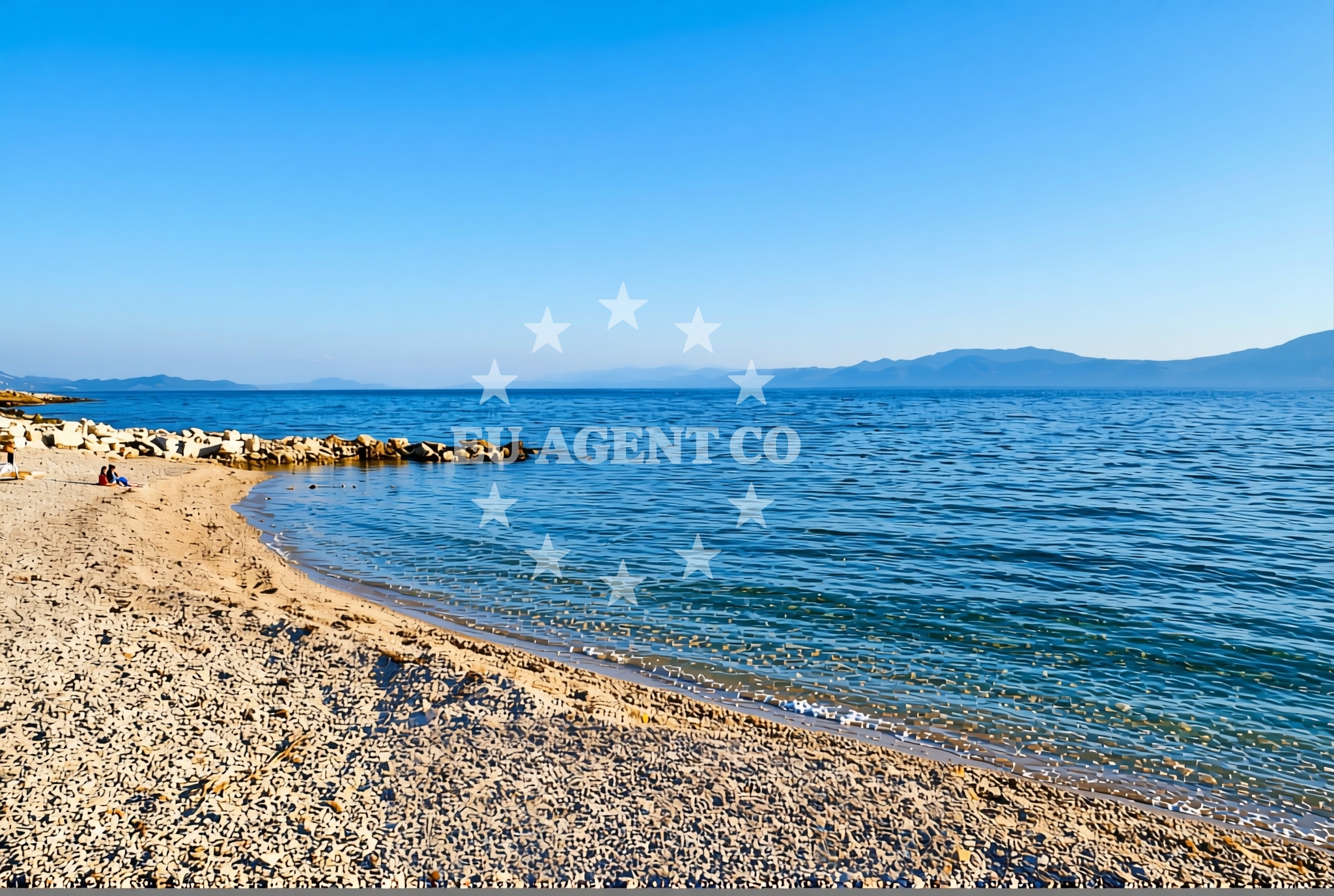
About this beach
Blaca istok, Sućuraj (Hvar)
Beach: Blaca istok
Location: Sućuraj (Hvar)
Characteristics and facilities
Gravel, concrete / stone slabs
Restaurant / snack bar
Caffe bar / Drinks stand
Beach character
The beach's gravel and stone slab composition suggests it is more suited for brief water access rather than extended sunbathing. The surface texture may pose challenges for barefoot walking, though the presence of nearby dining options indicates the area is maintained for visitor use. No specific swimming facilities or water depth information is recorded in the beach's authoritative features, implying the site functions more as a transitional shore than a primary bathing area.
Swimming and shore
While no explicit swimming conditions are documented, the beach's location on Hvar's southern coast suggests typical Adriatic sea temperatures during summer months. The shore's gravel composition may create uneven footing, making it less ideal for children or those seeking a relaxed beach experience. The absence of structured amenities like showers or changing rooms aligns with the site's informal character.
Facilities and activities
Direct beach facilities are limited to the natural surface features. However, the adjacent restaurant, snack bar and caffe bar provide immediate access to food and beverages. These establishments likely cater to both locals and visitors, offering a range of options from casual snacks to full meals. No structured activities or rental services are mentioned in the beach's authoritative records.
Access and location
Sućuraj's position on Hvar's southern coast places it within reach of major Adriatic sailing routes. The village is connected to the mainland via regular ferry services from Split, with travel times of approximately 2.5 hours. For yacht charter guests, the nearest major marinas include Hvar Town's marina (about 12 nautical miles west) and Stari Grad's marina (8 nautical miles northeast). The beach's proximity to Sućuraj's village center suggests road access via the island's main coastal road, which connects to all major settlements on Hvar.
What to expect
Visitors should anticipate a beach experience centered around its gravel and stone slab surface rather than traditional sand. The site's primary value lies in its proximity to Sućuraj's dining options and its role as a transitional shore along Hvar's coast. Those seeking swimming may need to look to other beaches in the area, while those interested in yacht charter access will find the village's location advantageous for exploring the broader Hvar sailing region.
Practical tips
Comfortable footwear is recommended due to the beach's gravel and stone surface. Visitors should note that the site lacks traditional beach amenities like showers or changing rooms. The adjacent dining options provide convenient access to food and beverages, though specific operating hours are not documented in the beach's records.
Exploring the coast by yacht
For yacht charter guests, Sućuraj's location offers strategic access to Hvar's sailing routes. The village sits along the southern coast, providing convenient access to both the island's western and eastern shores. Charter yachts can easily reach Hvar Town (12 nm west) and Stari Grad (8 nm northeast), with Sućuraj serving as a potential stopover point. The nearby marinas and anchorages support both short-term stays and longer cruising itineraries along the Dalmatian coast.
Regional Context
Sućuraj is one of Hvar's smaller coastal villages, known for its traditional architecture and role as a service hub for the surrounding area. The village maintains a quiet, residential character compared to the more touristic centers of Hvar Town or Stari Grad. Its location on the island's southern coast places it within easy reach of the famous Pakleni Islands, a popular anchorage area for yachts seeking sheltered waters and scenic views.
Anchorages in the surrounding area
Anchorages near Sućuraj and Selca kod Bogomolja on Hvar offer nearby mooring options.
- Anchorage — sucuraj — hvar — 0.3 NM from beach
- Anchorage — sucuraj — hvar — 0.6 NM from beach
- Anchorage — sucuraj — hvar — 1.2 NM from beach
- Anchorage — selca kod bogomolja — hvar — 1.5 NM from beach
- Anchorage — selca kod bogomolja — hvar — 1.6 NM from beach
- Anchorage — sucuraj — hvar — 1.8 NM from beach
- Anchorage — selca kod bogomolja — hvar — 3.0 NM from beach
- Anchorage — selca kod bogomolja — hvar — 3.2 NM from beach
Distances are straight-line geographic distances, not sailing routes.
Mooring buoys in the surrounding area
- Jetty — sucuraj — hvar — 0.5 NM from beach
- Konoba Gambo buoys — selca kod bogomolja — hvar — 3.4 NM from beach
- Drvenik - Ferry dock — drvenik ferry dock — 3.7 NM from beach
- Brist — 6.4 NM from beach
- Kraj - Soline — kraj soline — drasnice — 6.5 NM from beach
Distances are straight-line geographic distances, not sailing routes.
Marine fuel stations
- Fuel station — korcula — 10.2 NM from beach
- Fuel station — ploce — 12.1 NM from beach
- Ina — makarska — 12.5 NM from beach
- Fuel station — sumartin — brac — 16.9 NM from beach
Distances are straight-line geographic distances, not sailing routes.
Harbours in the surrounding area
Harbours in Sućuraj, Drvenik, Živogošće, Zaostrog, and Igrane are situated in the vicinity.
- Sućuraj — sucuraj — hvar — 0.5 NM from beach
- Drvenik — 3.6 NM from beach
- Živogošće — zivogosce — 4.0 NM from beach
- Zaostrog — 4.6 NM from beach
- Igrane — 4.6 NM from beach
- Duba — duba peljeska — 5.9 NM from beach
Distances are straight-line geographic distances, not sailing routes.
Marinas in the surrounding area
Marinas in Tučepi, Korcula, Lumbarda, Ramova, and Baška Voda are located nearby.
- Marina Tučepi — marina tucepi — 9.9 NM from beach
- ACI Marina Korčula — korcula — 10.0 NM from beach
- Marina Lumbarda — korcula — 11.9 NM from beach
- Marina Ramova — krvavica — 14.8 NM from beach
- Marina Baška Voda — marina baska voda — 17.3 NM from beach
Distances are straight-line geographic distances, not sailing routes.
Restaurants near the beach
Restaurants in Sućuraj and Selca kod Bogomolja are close to the beach.
- Restaurant — sucuraj — hvar — 0.5 NM from beach
- Riblji Restoran — sucuraj — hvar — 0.5 NM from beach
- Mlaska — sucuraj — hvar — 1.7 NM from beach
- u.Mrtinovic — selca kod bogomolja — hvar — 3.3 NM from beach
Distances are straight-line geographic distances, not sailing routes.
Navigation guides for the surrounding area
Navigation guides for Otok Hvar, Uvala Drvenik, and surrounding areas assist with route planning.
- OTOK HVAR — 1.2 NM from beach
- Uvala Drvenik (Donja Vala) — 3.9 NM from beach
- Uvala Kozja — 5.5 NM from beach
- Uvala Duboka — 5.7 NM from beach
- Uvala Divna — 6.4 NM from beach
Distances are straight-line geographic distances, not sailing routes.
Yachts from nearby departure bases
Sailing yachts
- Bavaria 40 Cruiser (LADY BUTTERFLY) — Tučepi Port — 9.9 NM from departure base to beach
- Elan 40 Impression (Karleta) — Ploče City Port — 12.0 NM from departure base to beach
- Elan 514 Impression (Cesarica III) — Ploče City Port — 12.0 NM from departure base to beach
- Sun Odyssey 349 (Visnjica) — Ploče City Port — 12.0 NM from departure base to beach
- Sun Odyssey 419 (Luka Ploce) — Ploče City Port — 12.0 NM from departure base to beach
- More 55 (MRS. ROBINSON) — Ploče City Port — 12.0 NM from departure base to beach
- Salona 44 (SAMOA) — Ploče City Port — 12.0 NM from departure base to beach
- Sun Odyssey 349 (Porto Tolero) — Ploče City Port — 12.0 NM from departure base to beach
Catamarans
- Lagoon 450 Fly (Alba Mouse) — Ploče City Port — 12.0 NM from departure base to beach
Motor yachts
- Princess V53 (Chablis) — Makarska Port — 12.3 NM from departure base to beach
Distances are straight-line geographic distances, not sailing routes.
Frequently asked questions
Is there parking available near the beach?
No specific parking information is documented for Blaca istok beach. Given Sućuraj's village size and the beach's proximity to the village center, visitors may find limited roadside parking options along the coastal road.
Can I swim at this beach?
The beach's gravel and stone slab composition suggests it is not primarily suited for swimming. However, the general Adriatic conditions along Hvar's coast during summer months would allow for water activities from this shore.