Zelenika
Region: South Adriatic
| Position: 42.448333, 18.576667 | Adriatic Sea / Jadransko more
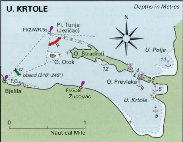
42°26'.9N 18°34'.6E Charts BA 1582, MK27, lmray M27 The harbour at Zelenika was badly damaged by the 1979 earthquake, and now all that is here is a clearance quay for customs. This is listed as an official port of entry. The quay has large rubber ship's fenders. Uvala Krtole
General
42°26'.9N 18°34'.6E Charts BA 1582, MK27, lmray M27 The harbour at Zelenika was badly damaged by the 1979 earthquake, and now all that is here is a clearance quay for customs. This is listed as an official port of entry. The quay has large rubber ship's fenders. Uvala Krtole
Adriatic Navigation Guide Images for Zelenika
Adriatic Navigation Guide images and captions provide additional visual reference for this navigation location.