Zavala (Pitavska Plaza)
Region: South Adriatic
| Position: 43.121667, 16.7 | Adriatic Sea / Jadransko more
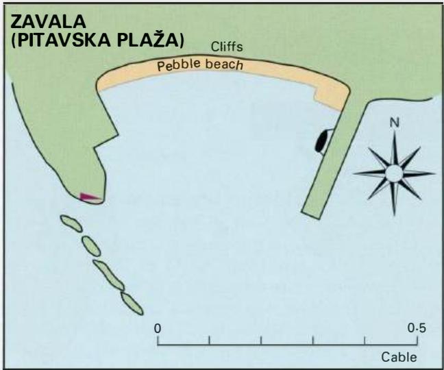
43°07'-3N 16°42'E Charts BA 2772, SC 5767, MK 79, 21, lmray M26 Pitavska Plafa, which is the 'harbour' for Zavala, lies on the S coast of Otok Hvar, N of Otok Scedro. There is a beach here with a short pier and a slipway. It is a popular place with holidaymakers. The pier is obvious in the closer approach. The high land to the N, the pier to the E
General
43°07'-3N 16°42'E Charts BA 2772, SC 5767, MK 79, 21, lmray M26 Pitavska Plafa, which is the 'harbour' for Zavala, lies on the S coast of Otok Hvar, N of Otok Scedro. There is a beach here with a short pier and a slipway. It is a popular place with holidaymakers. The pier is obvious in the closer approach. The high land to the N, the pier to the E and the rocks to the W protect Pitavska Plafa from N winds, and to some extent from W and E winds. Tie up alongside the pier. There is a cafe nearby, otherwise no facilities. Dubovica
Adriatic Navigation Guide Images for Zavala (Pitavska Plaza)
Adriatic Navigation Guide images and captions provide additional visual reference for this navigation location.