Vrboska
Region: South Adriatic
| Position: 43.18, 16.681667 | Adriatic Sea / Jadransko more
43°10'.8N 16°40'.9E Charts BA 2712, SC 5767, MK 79, lmray M26 Vrboska is situated at the end of a long narrow inlet, which is well sheltered from all directions except SE. An ACI marina has been established in Vrboska. There are no off-lying dangers in the approach, which is well lit. If approaching from N the island, OtoCic Zecevo, with its light
General
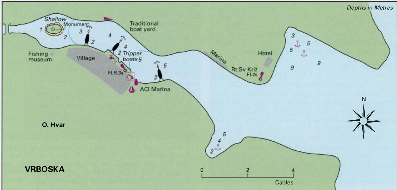
43°10'.8N 16°40'.9E Charts BA 2712, SC 5767, MK 79, lmray M26 Vrboska is situated at the end of a long narrow inlet, which is well sheltered from all directions except SE. An ACI marina has been established in Vrboska.
Approach
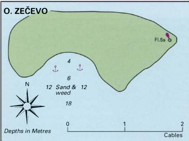
There are no off-lying dangers in the approach, which is well lit. If approaching from N the island, OtoCic Zecevo, with its light and light structure is a good guide.
Lights
OtoCic Zecevo Fl.5sllm5M Jelsa (outer breakwater) Fl.R.3s6m5M Rt Sv. Kriz Fl.2s5m5M Vrboska quay Fl.R.3s5m3M
Berth
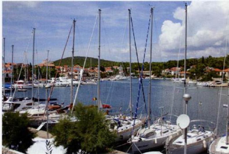
Berth at the ACI marina as directed, or at the town quay NW of the marina (on the same side as the marina). It is also possible to berth at the quay on the N side of the inlet, NE of the ACI marina. Pickup lines have been laid at all three quays. Anchor Anchor in one of the coves, either N or S of the entrance. The bottom is sand with patches of weed. If anchoring N of the entrance in a bora, take lines ashore. The ACI Marina at Vrboska, and the village quay towards the head of the harbour
Shelter
Good shelter from all directions except SE gales. Vrboska can be dangerous in the sirocco, when the sea level can rise by 2m, flooding the village and potentially damaging boats moored in the harbour. The hara is also felt strongly in the harbour.
Facilities
Water, electricity, toilets, showers, restaurant, laundry facilities and currency exchange facilities at the marina, which is open throughout the year. Water and electricity have been laid onto the town quay. Fuel from the fuel berth (depths of 2m alongside), just beyond the marina berths. Opening hours are from 0800 to 1500. Several grocery shops, baker, butcher, daily fruit and vegetable market. Post Office. Telephones. Internet cafe. Hotels, restaurants, cafe/bars. Medical centre. Bus service. Car, scooter, and bicycle hire. The boatyard can carry out limited repairs, and the marina has a workshop and a 5-ton crane. The marina address is: ACI Marina Vrboska, 21463 Vrboska, Croatia "Ir' (021) 774 018 Fax (021) 774 144 Email [email protected]
History
The village of Vrboska was founded in the 15th century as a landing place for the inland village of Vrbanj, and there are still many houses in Vrboska dating from this time. The harbour itself was developed in the 15th century, largely as the result of the efforts of one man, Matija lvanic, a local shipowner. lvanic was involved in the rebellion of the common people against the Hvar nobility. Unfortunately, the rebellion led to the village being burnt down in 1512. The village was particularly vulnerable to attacks by Turks and pirates, as was shown by the disastrous raid on the village in 1571. After this raid the church dedicated to St Mary was fortified in 1575 and can still be visited today. At the far end of the inlet, near the bridge, is an islet, which is a war memorial. There is also a small fishing museum on the quayside, which is worth a visit. Jelsa