Vrbnik
Region: North Adriatic
| Position: 45.078333, 14.676667 | Adriatic Sea / Jadransko more
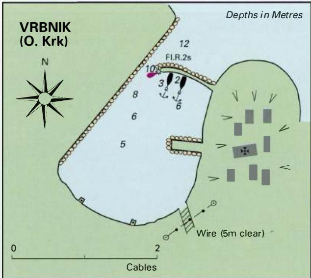
45°04'-7N 14°40'-6E Charts BA 2719, MK 5, 7, lmray M24 The harbour of Vrbnik is within a bay, protected from NE by a wall built out from the E shore which leaves only a narrow entrance channel. The town, built on a hill to the E of the harbour, has a prominent church belfry and is conspicuous from seaward. rock, Hrid Kamenjak, which has rocks exten
General
45°04'-7N 14°40'-6E Charts BA 2719, MK 5, 7, lmray M24 The harbour of Vrbnik is within a bay, protected from NE by a wall built out from the E shore which leaves only a narrow entrance channel. The town, built on a hill to the E of the harbour, has a prominent church belfry and is conspicuous from seaward. rock, Hrid Kamenjak, which has rocks extending off its SE side. Hrid Kamenjak lies rn cables offshore. Anchor at the head of Luka Sr5Cica in 5 to Sm (sand and mud) and take a line ashore if necessary. Uvala Mala Luka
Adriatic Navigation Guide Images for Vrbnik
Adriatic Navigation Guide images and captions provide additional visual reference for this navigation location.