Uvala Zmanscica
Region: Central Adriatic
| Position: 43.971667, 15.123333 | Adriatic Sea / Jadransko more
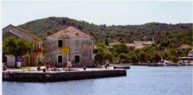
43°58'.3N 15°07'-4E Charts BA 2711, SC 5767, MK 13, 14, lmray M25 The small harbour of ZmansCica used to be mainly used by fishing boats, but now has 20 berths for yachts operated by the Sali concessionaire. The light on the harbour wall is a street light, not a navigation light. Uval<'l, Triluke's prime function is to serve the car ferries, which
General
43°58'.3N 15°07'-4E Charts BA 2711, SC 5767, MK 13, 14, lmray M25 The small harbour of ZmansCica used to be mainly used by fishing boats, but now has 20 berths for yachts operated by the Sali concessionaire. The light on the harbour wall is a street light, not a navigation light. Uval<'l, Triluke's prime function is to serve the car ferries, which ply back and forth between Dugi Otok and Zadar. Conveniently for yachts, there is a fuel berth here. As it is the only one on Dugi Otok queues of boats waiting to refuel start forming early in the morning. Boats milling around create a difficult and potentially dangerous situation.
Approach
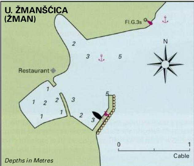
Uvala ZmansCica is situated 3M northwest of Sali. The light structure on the NE side of the harbour helps locate the harbour, and ZMAN painted on the harbour wall confirms its identification. There are no dangers in the immediate approach. Uvala Triluke lies 1.2M northwest of Sali. Hrid Pohlib, a low rock situated approximately 2 cables E of the headland on the N side of the entrance, has been joined to Dugi Otok by a low causeway, and a light structure erected on it. The causeway runs in a SW direction from the rock. The light structure on Hrid Pohlib shows up well from all directions, but the causeway does not, particularly when approaching from S. Entry into the bay is made by passing to the N of Hrid Pohlib. A signpost on the headland on the N side of the entrance confirms that this is Zaglav. The main dangers in the approach to Uvala Triluke lie nearly lM to the NE of Uvala Triluke. These dangers consist of rocks and shoals between the small islands of 0. Tukoscak and 0. Mrtonjak, and a shoal with 2.2m 4 cables SE of 0. Mrtonjak. The shoal is marked by an unlit beacon.
Lights
NE side of harbour Fl.G.3s6m4M Uvala Triluke entrance -Hrid Pohlib Fl.R.3s10m4M Ferry quay Fl.G.3s7m3M Rt Bluda Fl.G.3s7m3M 0. Lavdara Fl.3s7m5M
Berth
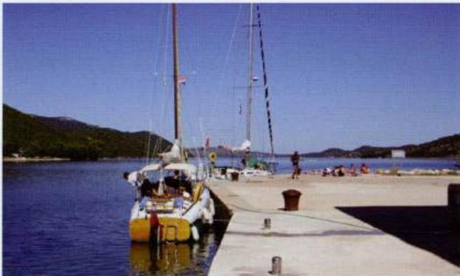
Moor bow/stern to the outer wall or the inner pier, using the pick-up lines provided. Anchor Anchor NE of the harbour in depths of 3-Sm. The bottom is sand with patches of weed. It may be possible to tie up alongside or go stern-to the quay in the N part of the bay, beyond the fuel berth. There are pick-up lines and stainless steel mooring bollards. Anchor Anchor in the SW cove in depths of 8-15m. Good holding on sand. The fuel berth at Uva la Triluke (Zaglav) on Dugi Otok has a number of berths for visitors nearby
Shelter
The anchorage is only sheltered from N through W to SW. The berth in the harbour is sheltered from N through W to S. Charges Harbour dues are levied. The quay is protected from NE through N to SE. The anchorage in the SW cove is sheltered from all directions except NE.
Facilities
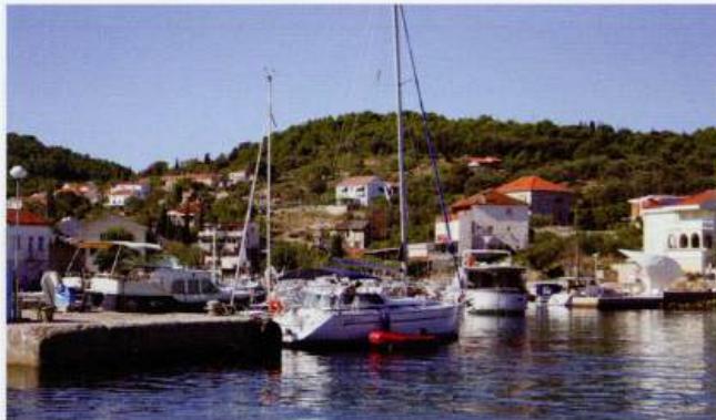
Water and electricity laid onto the visitors' berths. Grocery shop. Restaurant. The former fishing village of Zman (Uvala Zmanscica) on Dugi Otok has berths with water and electricity for visiting yachts Uvala Triluke (Zaglav) Fuel and water from the fuel berth (2m alongside). Oil and a few basic engine parts from the fuel station. Bread from the bakery attached to the restaurant on the main road. Small grocery store next to the restaurant. Tourist information office. Telephone. Bus and ferry service. OTOK RAVA Charts BA 2711, SC 5767, MK 13, lmray M25 The small island of Rava lies just off the E coast of Dugi Otok, between Dugi Otok and Otok IZ. The island has a number of sheltered bays along its W coast, which offer protection from the bora. Otok Rava has a farming community. The chief crops are olives and grapes. There are three small settlements, but the main village (called Rava) lies in the centre of the island. Uvala Marinica