Professional navigation chart centered on Uvala Zavratnica
Uvala Zavratnica
Region: North Adriatic
| Position: 44.7, 14.903333 | Adriatic Sea / Jadransko more
44°42'N 14°54'-2E Charts BA 202, MK 9, Im ray M25 Uvala Zavratnica is a spectacular steep-sided fjord on the mainland coast of the Velebitski Kanai less than M south of Jablanac. The sides of the fjord are partially terraced with some trees, and a path has been constructed most of the way around the inlet. The path leads ultimately to Jablanac. Uva
General
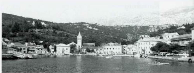
44°42'N 14°54'-2E Charts BA 202, MK 9, Im ray M25 Uvala Zavratnica is a spectacular steep-sided fjord on the mainland coast of the Velebitski Kanai less than M south of Jablanac. The sides of the fjord are partially terraced with some trees, and a path has been constructed most of the way around the inlet. The path leads ultimately to Jablanac. Uvala Zavratnica is a popular beauty spot and a peaceful place to spend the night. The entrance can be difficult to identify, but there is a circular stone 'sheep pen' on the headland to the S, and a big hotel in the next bay N. There are no dangers in the immediate approach, but if crossing from Otok Rab, beware of PliCina Glavina. Pl. Glavina is a rock and shoal, marked by a lit beacon (Fl(2)IOs) and lying approximately IM west of the entrance to Uvala Zavratnica. At the entrance to Uvala Zavratnica there are depths in excess of I 8m, but farther in the depths decrease to Sm near the head of the inlet. Beware of the wreck on the N shore of the 'pool' when manoeuvring. Anchor and take lines ashore because of the limited swinging room. There are some rings for mooring lines in the rock. The bay is sheltered from all directions except SW. There are no facilities ashore. Jablanac
Adriatic Navigation Guide Images for Uvala Zavratnica
Adriatic Navigation Guide images and captions provide additional visual reference for this navigation location.