Uvala Vrbovica
Region: South Adriatic
| Position: 42.963333, 17.105 | Adriatic Sea / Jadransko more
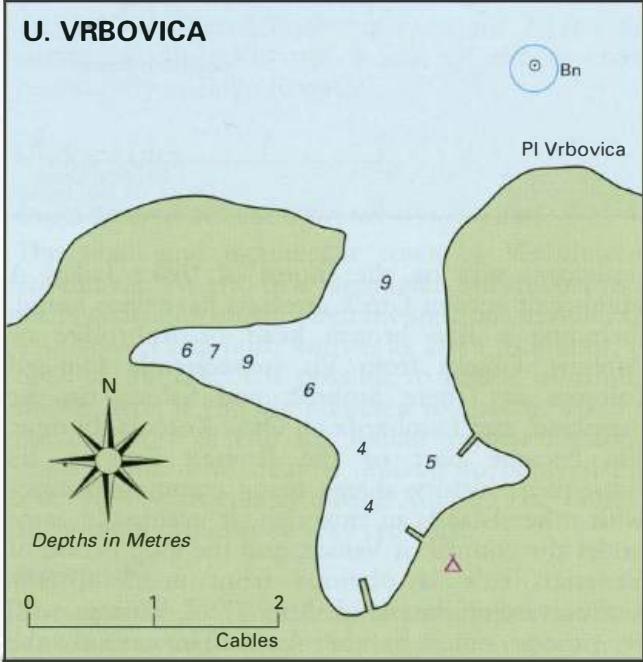
42°57"8N 17°06'.3E Charts BA 1574, 683 (detailed), SC 5767, MK 22, lmray M26 The bay at Vrbovica, approximately lM west of Korcula town, is reasonably well sheltered. There is a campsite here. The entrance to Uvala Vrbovica is easily identified by the red beacon on the shoal to the NE of the entrance. It is possible to pass inside of this beacon, b
General
42°57"8N 17°06'.3E Charts BA 1574, 683 (detailed), SC 5767, MK 22, lmray M26 The bay at Vrbovica, approximately lM west of Korcula town, is reasonably well sheltered. There is a campsite here.
Approach
The entrance to Uvala Vrbovica is easily identified by the red beacon on the shoal to the NE of the entrance. It is possible to pass inside of this beacon, but keep closer to Korcula. The safer approach is to pass N of the beacon, giving it a good berth. Anchor Anchor in either of the two arms of the bay. The bottom is shingle and weed. The anchorage in Uvala Knefa on the north coast of Otok Korcula offers excellent shelter
Shelter
The inlet is exposed to N and E winds, but is well sheltered from other directions.
Facilities
Bus service to Korcula town. Uvala Banja