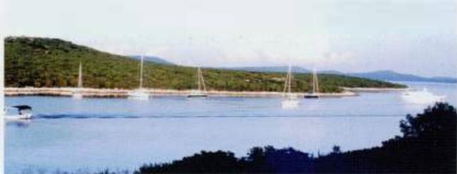
Uvala Vognisca, Uvala Podkujni and Uvala Maracol
Region: North Adriatic
| Position: 44.663333, 14.266667 | Adriatic Sea / Jadransko more
Uvala Vognisca 44°39'.8N 14°16'E Uvala Podkujni 44°39'.5N 14°15'.7E Uvala Marafol 44°38'.8N 14°15'.5E Charts BA 202, MK 8, lmray M24 On the E coast of Otok Unije are three long inlets, Uvala Vognisca, Uvala Podkujni and Uvala Marafol, which provide good shelter from all winds except the sirocco (SE). Uvala Marafol offers the best shelter. It is pos
General
Uvala Vognisca 44°39'.8N 14°16'E Uvala Podkujni 44°39'.5N 14°15'.7E Uvala Marafol 44°38'.8N 14°15'.5E Charts BA 202, MK 8, lmray M24 On the E coast of Otok Unije are three long inlets, Uvala Vognisca, Uvala Podkujni and Uvala Marafol, which provide good shelter from all winds except the sirocco (SE). Uvala Marafol offers the best shelter. It is possible to anchor towards the heads of these inlets in depths ranging from 5-9m. The bottom is sand and the holding good. A large number of visitors moorings have been laid in Uvala Marafol. A boatman comes to collect mooring fees and to take away rubbish. Uvala Marafol can be located by the red and white aerial on the hillside above and a chapel just down from the crest of the hillside, to the W of the inlet. There are a number of buildings on the W side of Uvala Marafol. It is possible to land at the pier and walk across the island to the village. Uvala Podkujni is less popular than Uvala Marafol, and does not have any laid buoys for visitors, but offers good shelter from all but SE winds. Anchor in 8m. The holding on sand is good. Uvala Vrulje
Adriatic Navigation Guide Images for Uvala Vognisca, Uvala Podkujni and Uvala Maracol
Adriatic Navigation Guide images and captions provide additional visual reference for this navigation location.