← Back to navigation map
Professional navigation chart centered on Uvala Vela Luka
Uvala Vela Luka
Region: North Adriatic
| Position: 44.981667, 14.81 | Adriatic Sea / Jadransko more
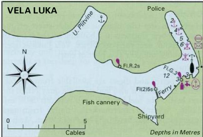
44°58'.9N 14°48'.6E Charts BA 2779, MK 7, lmray M24 Uvala Vela Luka is a deep inlet, which extends lM into the SE corner of Otok Krk. While the inlet offers shelter from the bora it is exposed to the sirocco. The bottom is gravel and the holding unreliable. It would be possible to anchor in 6m near the head of the bay. There is a shingle beach at t
General
44°58'.9N 14°48'.6E Charts BA 2779, MK 7, lmray M24 Uvala Vela Luka is a deep inlet, which extends lM into the SE corner of Otok Krk. While the inlet offers shelter from the bora it is exposed to the sirocco. The bottom is gravel and the holding unreliable. It would be possible to anchor in 6m near the head of the bay. There is a shingle beach at the head of the bay, and a cafe/bar nearby. Ba ska
Adriatic Navigation Guide Images for Uvala Vela Luka
Adriatic Navigation Guide images and captions provide additional visual reference for this navigation location.