Uvala Valdanos
Region: South Adriatic
| Position: 41.953333, 19.166667 | Adriatic Sea / Jadransko more
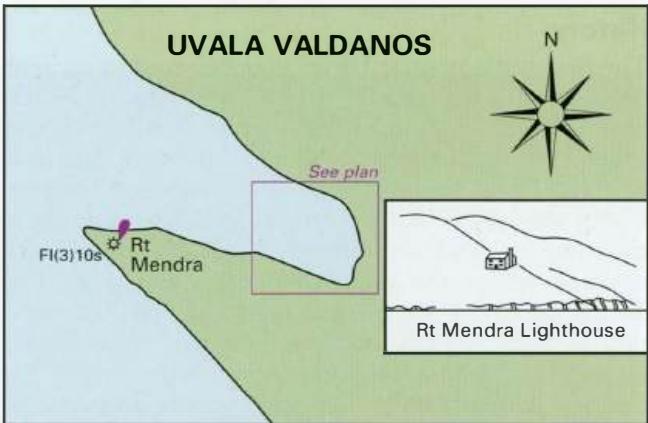
41°57'-2N 19°10'E Charts BA 1582. MK29. lmray M27 Uvala Valdanos is an anchorage 3M northwest of Ulcinj, open northwest. The bay is surrounded by wooded hills (deciduous) with the NE side rising to 389m (over 1000 ft). At the head of the bay is a belt of conifers, which fill the air with their fragrance in the evening. Unfortunately, there is a hot
General
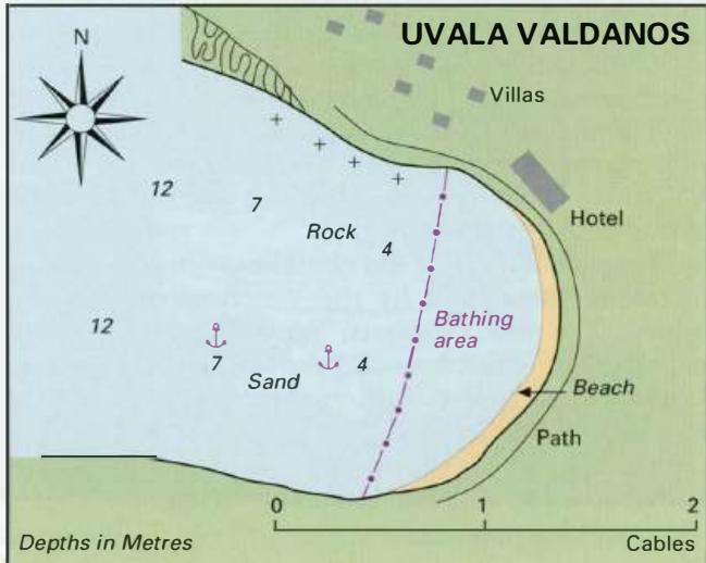
41°57'-2N 19°10'E Charts BA 1582. MK29. lmray M27 Uvala Valdanos is an anchorage 3M northwest of Ulcinj, open northwest. The bay is surrounded by wooded hills (deciduous) with the NE side rising to 389m (over 1000 ft). At the head of the bay is a belt of conifers, which fill the air with their fragrance in the evening. Unfortunately, there is a hotel and holiday complex at the head of the bay, and the loud music in the evening detracts from the beauty of Uvala Valdanos.
Approach
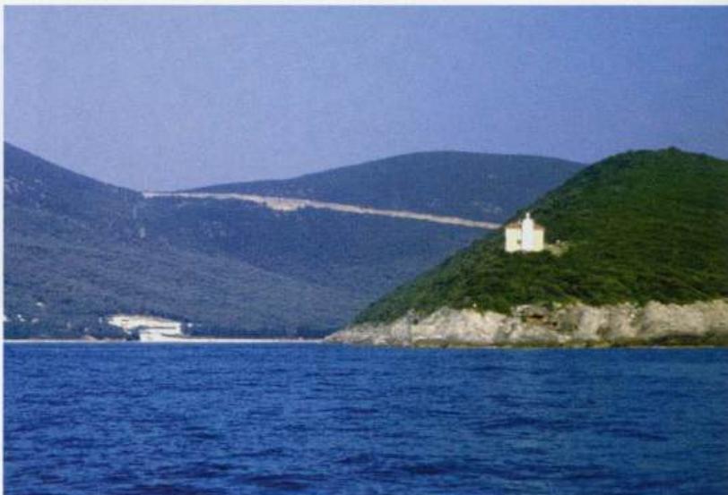
There are no dangers in the approach to Uvala Valdanos. The bay is easily identified by day or night by the lighthouse on Rt Mendra, the S headland at the entrance. When entering the bay keep an eye open for fishing nets with surface floats.
Lights
Rt Mendra Fl(3)10s35m25M Anchor Anchor in 4m to 7m on the S side of the bay, keeping clear of the bathing area with its floating barrier. The bottom is sand and good holding. The bottom on the N side of the bay, nearer the villas, is rocky, and there are a few rocks close to the N shore. The distinctive lighthouse on Rt Mendra helps locate Uvala Valdanos
Shelter
The anchorage is open to NW and W winds, but shelter from other wind directions is good. In SW winds some swell penetrates into the bay.
Facilities
The facilities are limited to those provided by the hotel.
History
Uvala Valdanos was used as an anchorage by pirates from Ulcinj. In 1675 most of their ships in this bay were burnt by the Turks, who were fulfilling the requirements of a treaty they had signed with Venice. Bar