Uvala Tatinja
Region: Central Adriatic
| Position: 43.366667, 16.29 | Adriatic Sea / Jadransko more
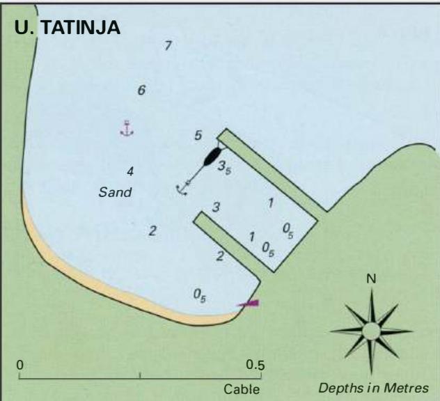
43°22'N 16°17'-4E Charts BA 2712, SC 5767, MK 16, lmray M26 Uvala Tatinja is a large bay almost at the midpoint on the S coast of Salta. The bay is similar to many of the bays along this coast in that it is deep, open to S and subject to swell in SW winds. This bay has large boulders on the bottom which make anchoring impractical. It is not recomme
General
43°22'N 16°17'-4E Charts BA 2712, SC 5767, MK 16, lmray M26 Uvala Tatinja is a large bay almost at the midpoint on the S coast of Salta. The bay is similar to many of the bays along this coast in that it is deep, open to S and subject to swell in SW winds. This bay has large boulders on the bottom which make anchoring impractical. It is not recommended. Uvala Sesula
Adriatic Navigation Guide Images for Uvala Tatinja
Adriatic Navigation Guide images and captions provide additional visual reference for this navigation location.