Uvala Sv. Marak
Region: North Adriatic
| Position: 45.105, 14.67 | Adriatic Sea / Jadransko more
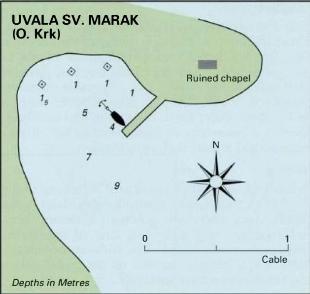
45°06'.3N 14°40'-2E Charts BA 2719, MK 5, 7, lmray M24 Uvala Sv. Marak, in which there is a pier, lies on the S side of a promontory, which has a ruined chapel on its highest point. The chapel is conspicuous. Besides the pier, there are three bollards in the bay. It is possible to secure to the W side of the pier in 4m, or to anchor and take lines
General
45°06'.3N 14°40'-2E Charts BA 2719, MK 5, 7, lmray M24 Uvala Sv. Marak, in which there is a pier, lies on the S side of a promontory, which has a ruined chapel on its highest point. The chapel is conspicuous. Besides the pier, there are three bollards in the bay. It is possible to secure to the W side of the pier in 4m, or to anchor and take lines to the bollards. Unfortunately, this quiet and deserted bay is very rough in strong bora or sirocco winds. Shelter is however good from the W and N. There are no facilities ashore. Vrbnik
Adriatic Navigation Guide Images for Uvala Sv. Marak
Adriatic Navigation Guide images and captions provide additional visual reference for this navigation location.