Uvala Sunj
Region: South Adriatic
| Position: 42.68, 17.958333 | Adriatic Sea / Jadransko more
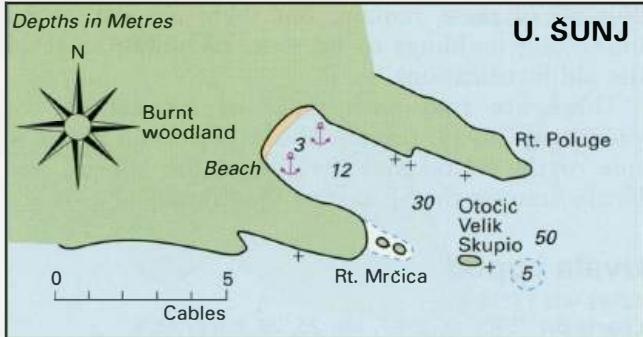
42°40'.8N 17°57"5E Charts BA 1580, 683, SC 5767. MK 25, 26. lmray M26 Uvala Sunj is a popular place for swimming and sunbathing, and there are usually several yachts anchored here. Uvala Sunj is entered between two headlands, Rt Poluge to the E and Rt MrCica to the W. Extending SE from Rt MrCica are a number of rocks, Hridi Skupjeli, and a small is
General
42°40'.8N 17°57"5E Charts BA 1580, 683, SC 5767. MK 25, 26. lmray M26 Uvala Sunj is a popular place for swimming and sunbathing, and there are usually several yachts anchored here.
Approach
Uvala Sunj is entered between two headlands, Rt Poluge to the E and Rt MrCica to the W. Extending SE from Rt MrCica are a number of rocks, Hridi Skupjeli, and a small island, 0. Velik Skupio. A rock lies to the SE of 0. Velik Skupio, and a shoal patch with 5.8m over it lies approximately 2 cables farther E. It is possible to pass close to the W of O.Velik Skupio. If approaching, U. Sunj from the Kolocepski Kanai or from Donje Celo on 0. Kolocep, beware of the shoal with just 2m over it, which lies 2 cables W of the westernmost extremity of 0. Kolocep. A number of rocks lie close to the N shore of Uvala Sunj. Sipanska Luka Anchor Anchor in a suitable depth. The bottom is sand.
Shelter
Uvala Sunj is open to the SE and dangerous in winds from this direction. The bay offers good shelter from W through N to NE. The innermost part of the bay offers shelter from SW winds.
Facilities
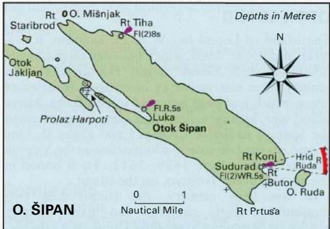
During the summer there is a cafe at the bay. OTOK SIPAN Otok Sipan is the largest and most populated island in the Elaphite group. It has several villages, the largest being Luka (or Sipanska Luka) at the end of a long inlet, which cuts into the NW coast. Suourad is a smaller village on the SE coast with a harbour.
Berth
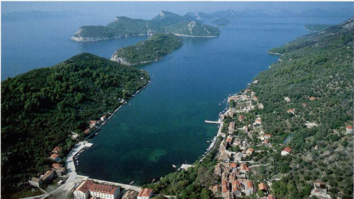
Go bow/stern-to the quay, either off the NE quay, or if of shallow draught, near the hotel. It is also possible to tie up alongside the quay but do not obstruct the ferry. Anchor The two villages are linked by a track. Tourism is now a major source of income, but agriculture and fishing are still important. Wine and olive oil are produced on the island and can be bought directly from the producers. Luka (Sipanska Luka)
Adriatic Navigation Guide Images for Uvala Sunj
Adriatic Navigation Guide images and captions provide additional visual reference for this navigation location.