Uvala Stipanska
Region: Central Adriatic
| Position: 43.376667, 16.446667 | Adriatic Sea / Jadransko more
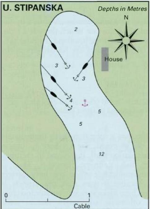
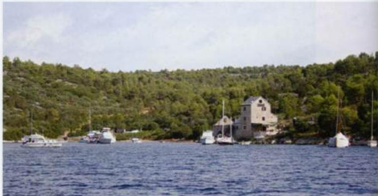
43°22'.6N 16°26'.8E Charts BA 2772, SC 5767, MK 18, lmray M26 Uvala Stipanska is a small inlet just over a mile N of Bobovisce. It can be difficult to see because it is tucked around a corner, but a house on the E side of the bay helps identify it positively when close to. The anchorage is popular, not only with flotilla yachts, The anchorage at Uv
General
43°22'.6N 16°26'.8E Charts BA 2772, SC 5767, MK 18, lmray M26 Uvala Stipanska is a small inlet just over a mile N of Bobovisce. It can be difficult to see because it is tucked around a corner, but a house on the E side of the bay helps identify it positively when close to. The anchorage is popular, not only with flotilla yachts, The anchorage at Uva la Stipanska on the W coast of Otok Brae The onion-shaped church belfry at Sutivan on Otok Brae is distinctive but also with weekenders from Split. There are no dangers in the approach, other than the fish farm mentioned above in the entry for Bobovisce. Anchor in 3-4m. The bottom is sand and weed and the holding is good. You may have to take a line ashore to limit your swinging room because of other boats. The bay is sheltered from all directions except Sutivan