Uvala Stari Stani
Region: South Adriatic
| Position: 43.155, 16.386667 | Adriatic Sea / Jadransko more
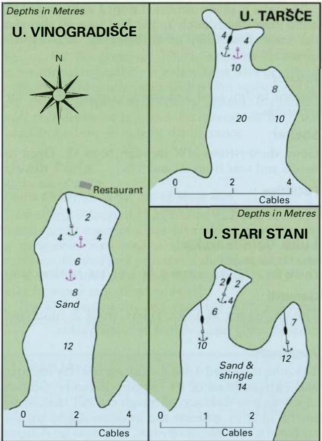
43°09'.3N 16°23'-2E Uvala Stari Stani is a small secluded bay, less popular than Uvala Vinogradisce, where the ideal arrangement is to anchor and take a line ashore. Some parts of the bay are steep-to and it may be possible to arrange a mooring so that you can step ashore. The weather for this needs to be calm. The bottom is sand and shingle with a
General
43°09'.3N 16°23'-2E Uvala Stari Stani is a small secluded bay, less popular than Uvala Vinogradisce, where the ideal arrangement is to anchor and take a line ashore. Some parts of the bay are steep-to and it may be possible to arrange a mooring so that you can step ashore. The weather for this needs to be calm. The bottom is sand and shingle with a few patches of weed in.the W part of the bay, but more weed in the E part of the bay. In the approach beware of OtoCic Stambedar and Hrid PloCice, the off-lying island, rocks and shoals approximately 5 cables S and SE. Uvala Tarsce
Adriatic Navigation Guide Images for Uvala Stari Stani
Adriatic Navigation Guide images and captions provide additional visual reference for this navigation location.