Uvala Sapan
Region: North Adriatic
| Position: 45.203333, 14.546667 | Adriatic Sea / Jadransko more
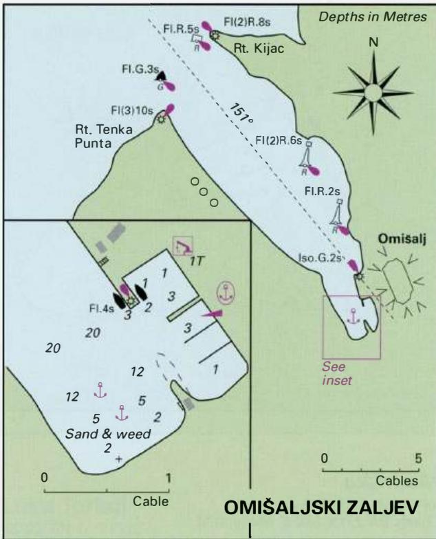
45°12'.2N 14°32'.8E Charts BA 2719, MK 5, lmray M24 Uvala Sapan lies 2.3M north of Njivice. The bay is part of an oil refinery and oil storage area, and is therefore best avoided by yachts. up in the small harbour, close N of the anchorage, Omisaljski Zaljev but beware of the rocky underwater spit, which
General
45°12'.2N 14°32'.8E Charts BA 2719, MK 5, lmray M24 Uvala Sapan lies 2.3M north of Njivice. The bay is part of an oil refinery and oil storage area, and is therefore best avoided by yachts. up in the small harbour, close N of the anchorage, Omisaljski Zaljev but beware of the rocky underwater spit, which
Adriatic Navigation Guide Images for Uvala Sapan
Adriatic Navigation Guide images and captions provide additional visual reference for this navigation location.