Uvala Prklog
Region: North Adriatic
| Position: 45.051667, 14.151667 | Adriatic Sea / Jadransko more
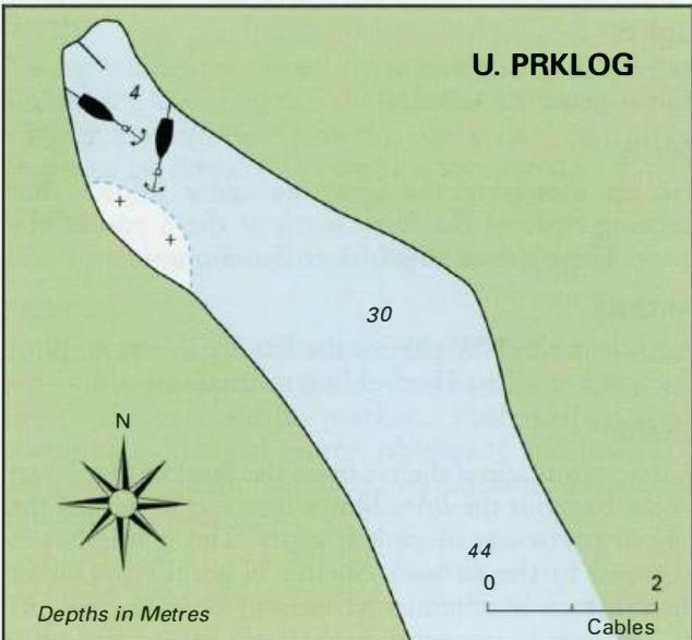
45°03'.1N 14°09'.1E Charts BA 2719, MK 4, lmray M24 Uvala Prklog lies just over 2M south of Rabac and about SM north of the light on Rt Crna Punta. There is a chapel on Rt Sv. Marina, the headland to the S of the entrance. The inlet is long and narrow, and provides good shelter from all but S and SE winds, although the bora blows strongly here. It
General
45°03'.1N 14°09'.1E Charts BA 2719, MK 4, lmray M24 Uvala Prklog lies just over 2M south of Rabac and about SM north of the light on Rt Crna Punta. There is a chapel on Rt Sv. Marina, the headland to the S of the entrance. The inlet is long and narrow, and provides good shelter from all but S and SE winds, although the bora blows strongly here. It is possible to anchor towards the head of the inlet, taking a line ashore to the NE shore in case of a bora. Within the inlet beware of some rocks, which dry, lying near the head of the inlet on the W side (see plan). ZALJEV RASA
Adriatic Navigation Guide Images for Uvala Prklog
Adriatic Navigation Guide images and captions provide additional visual reference for this navigation location.