Uvala Osibova
Region: Central Adriatic
| Position: 43.313333, 16.44 | Adriatic Sea / Jadransko more
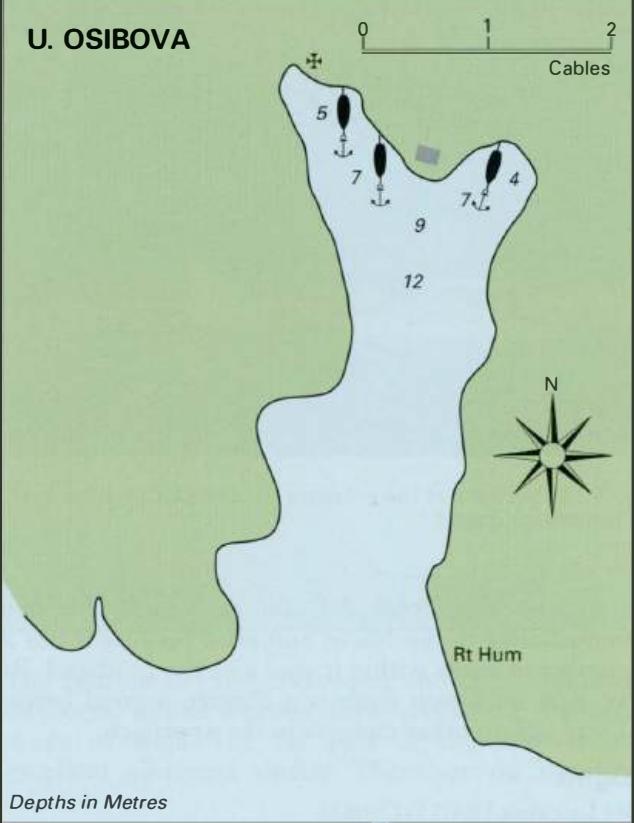
43°18"8N 16°26"4E Charts BA 2712, SC 5767, MK 18, 19, lmray M26 The inlet of Osibova lies 1 .3M southeast of Rt Rafanj. It is a pleasant anchorage surrounded by woods, and is popular with swimmers. A few houses have been built amongst the trees, and there are two chapels at the head of the bay. One is still in use and the other, a Gothic chapel, is
General
43°18"8N 16°26"4E Charts BA 2712, SC 5767, MK 18, 19, lmray M26 The inlet of Osibova lies 1 .3M southeast of Rt Rafanj. It is a pleasant anchorage surrounded by woods, and is popular with swimmers. A few houses have been built amongst the trees, and there are two chapels at the head of the bay. One is still in use and the other, a Gothic chapel, is ruined. There are no dangers in the approach. Anchor at the head of the bay, and take a line ashore. The bottom is sand and weed. Shelter is good from W through N to E. Luka Milna
Adriatic Navigation Guide Images for Uvala Osibova
Adriatic Navigation Guide images and captions provide additional visual reference for this navigation location.