Uvala Manastir
Region: South Adriatic
| Position: 43.095, 16.713333 | Adriatic Sea / Jadransko more
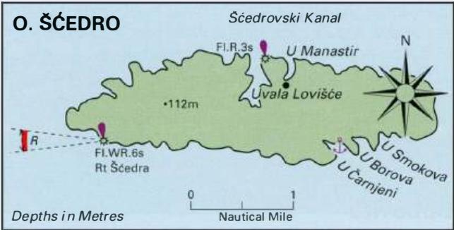
43°05'.7N 16°42'.8E Charts BA 2772, SC 5767, MK 79, 21, lmray M26 Uvala Manastir (also called Mostir) is located to the E of Luka Lovisce and the light structure on the side of Otok Scedro. The name of the inlet comes from the Dominican monastery, which was founded here in the 15th century and abandoned in the 18th century. The ruins stand near the
General
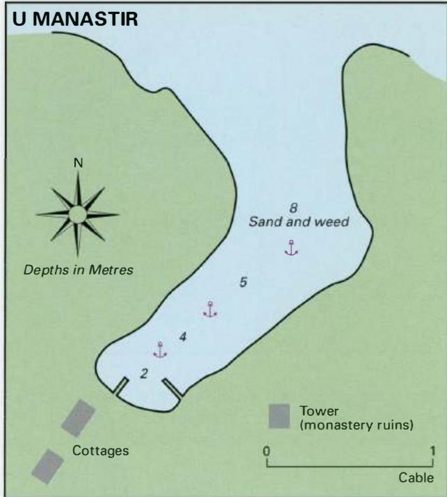
43°05'.7N 16°42'.8E Charts BA 2772, SC 5767, MK 79, 21, lmray M26 Uvala Manastir (also called Mostir) is located to the E of Luka Lovisce and the light structure on the side of Otok Scedro. The name of the inlet comes from the Dominican monastery, which was founded here in the 15th century and abandoned in the 18th century. The ruins stand near the head of the bay, There are a few holiday houses at the head of the bay, an ethnic bistro, but no other facilities. The anchorage is very attractive, is sheltered and good for swimming. There are no dangers in the approach, Anchor in an appropriate depth, avoiding the mooring buoys, The bottom is sand and weed. Shelter is good from W through S to Luka Lovisce
Adriatic Navigation Guide Images for Uvala Manastir
Adriatic Navigation Guide images and captions provide additional visual reference for this navigation location.