Uvala Mala Luka
Region: Central Adriatic
| Position: 43.443333, 16.126667 | Adriatic Sea / Jadransko more
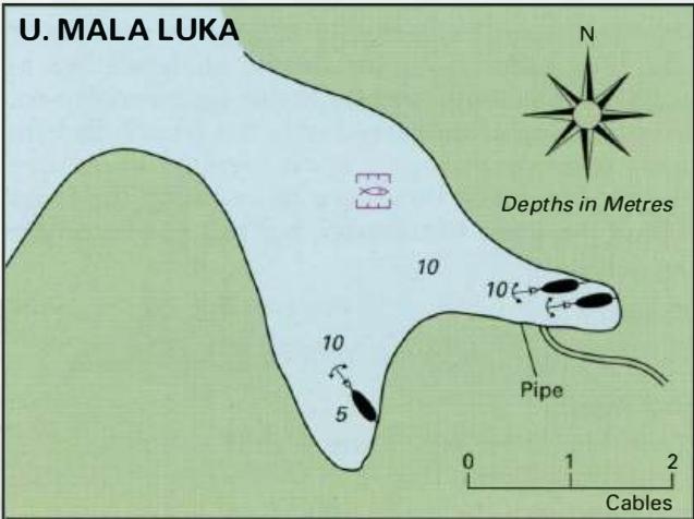
43°26'.6N 16°07'-6E Charts BA 2772, 2774, SC 5767, MK 16, lmray M26 Uvala Mala Luka lies on the west side of Otok Drvenik Veli, approximately lM southwest of Drvenik. The bay is surrounded by wooded slopes. Unfortunately a fish farm has been established here, resulting in an oily slick and fishy smell. The fish farm is well marked with lights and r
General
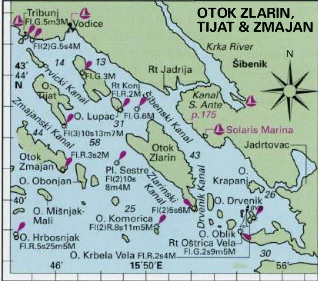
43°26'.6N 16°07'-6E Charts BA 2772, 2774, SC 5767, MK 16, lmray M26 Uvala Mala Luka lies on the west side of Otok Drvenik Veli, approximately lM southwest of Drvenik. The bay is surrounded by wooded slopes. Unfortunately a fish farm has been established here, resulting in an oily slick and fishy smell. The fish farm is well marked with lights and radar reflectors. There is still room to anchor in the S part of the bay. The anchorage is open NW, but is sheltered from all other directions, including the afternoon breeze. OTOK DRVENIK MALI Charts BA 2772, 2774, SC 5767, MK 16, lmray M26 The small island of Drvenik Mali lies just under lM west of Otok Drvenik Veli. It is 2M (W-E) by lM (N-S) at its widest point. Drvenik Mali is claimed to have a population of 200 people! Olives are grown on the island. There is a small harbour on the NE facing coast of Otok Drvenik Mali. It is possible to anchor off the harbour in under lOm, on a bottom of sand. The anchorage is exposed, but makes a pleasant lunchtime stop.
Adriatic Navigation Guide Images for Uvala Mala Luka
Adriatic Navigation Guide images and captions provide additional visual reference for this navigation location.