Uvala Lamjana Vela
Region: Central Adriatic
| Position: 44.04, 15.21 | Adriatic Sea / Jadransko more
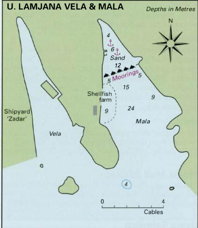
44°02'-4N 15°12"6E Charts BA 271 1, 515, SC 5767, MK 13, lmray M25 Uvala Lamjana Vela is the more westerly of two inlets, which cut NW into the SW coast of Otok Ugljan. The bay has been developed as the Zadar shipyard with a quay, floating dock and cranes. Ships and oil rigs may be anchored in deep water in the Srednji Kanal, awaiting a berth in th
General
44°02'-4N 15°12"6E Charts BA 271 1, 515, SC 5767, MK 13, lmray M25 Uvala Lamjana Vela is the more westerly of two inlets, which cut NW into the SW coast of Otok Ugljan. The bay has been developed as the Zadar shipyard with a quay, floating dock and cranes. Ships and oil rigs may be anchored in deep water in the Srednji Kanal, awaiting a berth in the shipyard. If you do need to enter the bay however beware of the above-water rock lying close to the SW entrance point of the bay. Uvala Prtljug