Uvala Kneza
Region: South Adriatic
| Position: 42.975, 17.05 | Adriatic Sea / Jadransko more
42°58'.5N 17°03'E Charts BA 1574, 683 (detailed), SC 5767, MK 22, lmray M26 The sheltered anchorage at Uvala Knefa lies at the westernmost end of the Peljdki Kanai. Approaching from W it is possible to pass between the main island of Koreula and Otocic Knefa Vela, on which there is a major light. Do not be tempted to pass to the NW of Otocic Knefa
General
42°58'.5N 17°03'E Charts BA 1574, 683 (detailed), SC 5767, MK 22, lmray M26 The sheltered anchorage at Uvala Knefa lies at the westernmost end of the Peljdki Kanai.
Approach
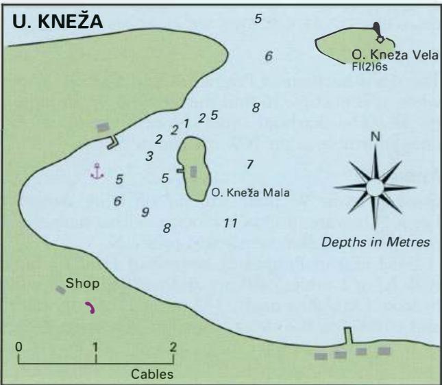
Approaching from W it is possible to pass between the main island of Koreula and Otocic Knefa Vela, on which there is a major light. Do not be tempted to pass to the NW of Otocic Knefa Mala as this is joined to Korcula by a rocky ridge and has a least depth of Im. Approaching from E there are no off-lying dangers, other than the unlit beacon marking a rock off Uvala Vrbovica, over 2M to the E.
Lights
Otocic Knefa Vela Fl(2)6s13m8M Anchor Anchor to the W of OtoCic KneZa Mala in Sm. The bottom is sand and mud and offers good holding, but ensure your anchor has dug in well. In a bora take lines ashore for additional security.
Shelter
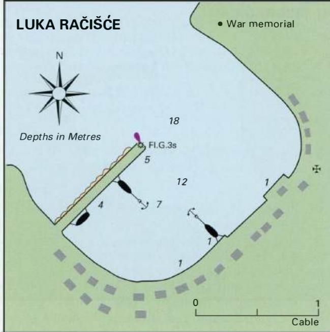
Tucked behind 0. Knefa Mala there is all-round shelter. We spent a couple of days anchored here in strong E winds, gusting at times to Force 8, and had no problems at all. We were not even uncomfortable. Luka Racisce