Uvala Kljemtine
Region: South Adriatic
| Position: 42.94, 17.56 | Adriatic Sea / Jadransko more
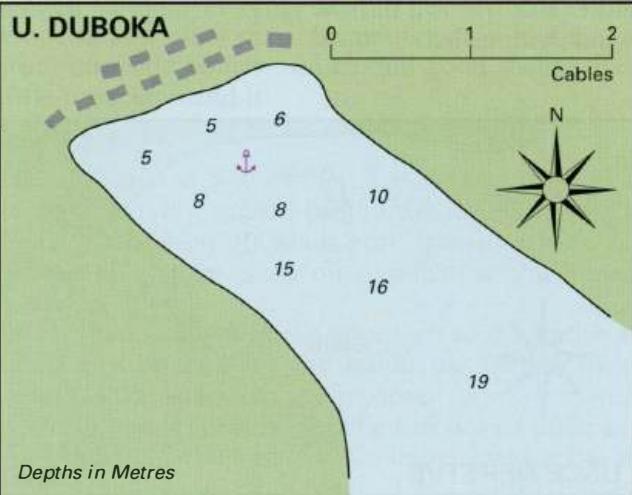
42°56'-4N 17°33'.6E E of U. Duboka is a narrow inlet, which has a long shallow rocky spit extending SE from the W promontory. Anchor in the centre of the inlet in Sm, using a second anchor if necessary to restrict your swinging. The anchorage is sheltered from W through N to E. There are no facilities here. The main Adriatic Highway runs past the h
General
42°56'-4N 17°33'.6E E of U. Duboka is a narrow inlet, which has a long shallow rocky spit extending SE from the W promontory. Anchor in the centre of the inlet in Sm, using a second anchor if necessary to restrict your swinging. The anchorage is sheltered from W through N to E. There are no facilities here. The main Adriatic Highway runs past the head of the cove. Uvala Klek
Adriatic Navigation Guide Images for Uvala Kljemtine
Adriatic Navigation Guide images and captions provide additional visual reference for this navigation location.