Professional navigation chart centered on Uvala Klada
Uvala Klada
Region: North Adriatic
| Position: 44.815, 14.886667 | Adriatic Sea / Jadransko more
44°48'.9N 14°53".2E Charts BA 202, MK 7, lmray M24 Approximately lM north of Luka Starigrad lies Uvala Klada. Uvala Klada is a larger and deeper bay with a shop and a cafe in the village. It is possible to anchor in the part of the bay in depths of 10-12m, taking lines ashore to the bollards provided. The bottom is mud and sand with patches of weed
General
44°48'.9N 14°53".2E Charts BA 202, MK 7, lmray M24 Approximately lM north of Luka Starigrad lies Uvala Klada. Uvala Klada is a larger and deeper bay with a shop and a cafe in the village. It is possible to anchor in the part of the bay in depths of 10-12m, taking lines ashore to the bollards provided. The bottom is mud and sand with patches of weed. The Admiralty Pilot does not recommend this as an anchorage, but in an emergency you may have no alternative. There are no dangers in the approach to Uvala Klada. The light structure on the end of the pier is no longer lit. Luka Lukovo Otocko
Adriatic Navigation Guide Images for Uvala Klada
Adriatic Navigation Guide images and captions provide additional visual reference for this navigation location.
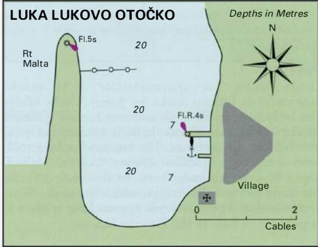
The approach to Luka Lukovo Otočko, with the harbour mole and its light just visible on the left-hand side of the photograph. The village is dwarfed by the Velebit 'mountains behind it