Uvala Kablin
Region: Central Adriatic
| Position: 44.138333, 15.013333 | Adriatic Sea / Jadransko more
44°08'.3N 15°00'.8E Charts BA 515, SC 5767, MK 13, lmray M25 Uvala Kablin lies on the SW coast of Otok Sestrunj, approximately lM northwest of the southernmost tip of the island. There are a number of houses, a ferry waiting room, and a harbour wall at the head of the bay, but these can only be seen when approaching from S. The bay is hidden by Rt
General
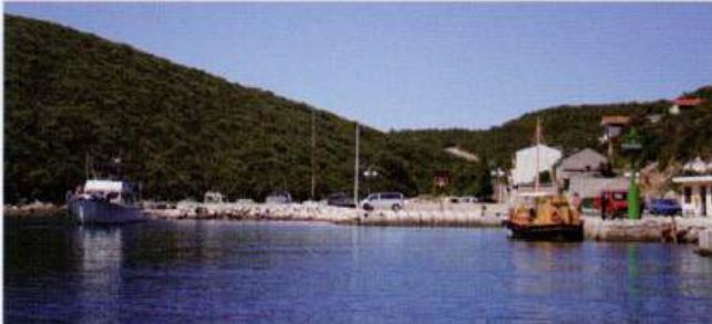
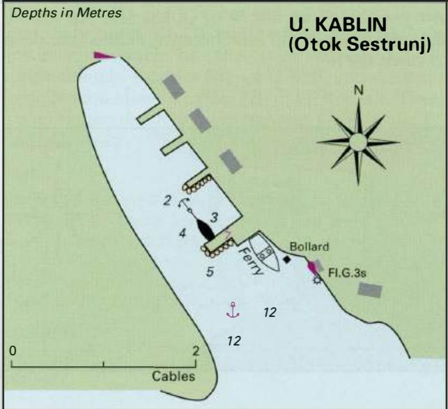
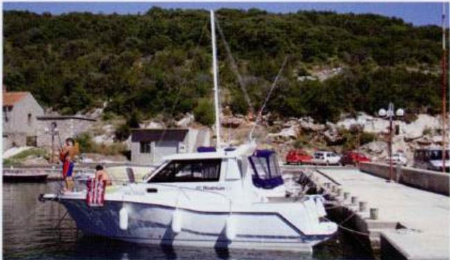
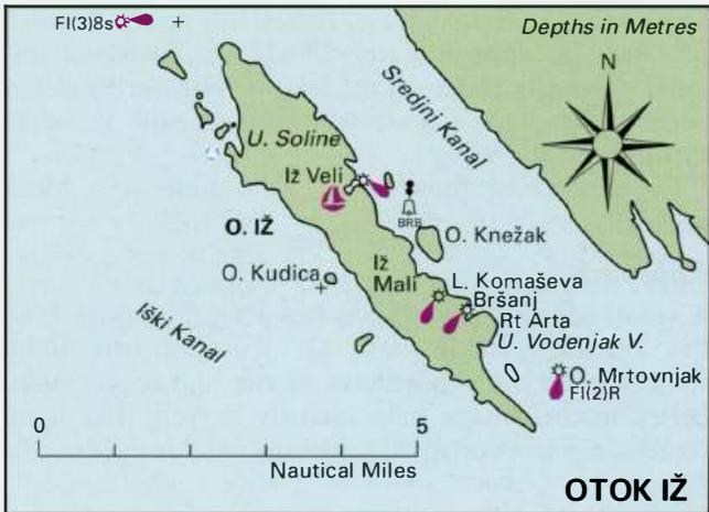
44°08'.3N 15°00'.8E Charts BA 515, SC 5767, MK 13, lmray M25 Uvala Kablin lies on the SW coast of Otok Sestrunj, approximately lM northwest of the southernmost tip of the island. There are a number of houses, a ferry waiting room, and a harbour wall at the head of the bay, but these can only be seen when approaching from S. The bay is hidden by Rt Kablin when approaching from NW. The approach is clear of dangers. The approach to Kablin, Otok Sestrunj. The car ferry berths at the root of the harbour mole. The best shelter here, space permitting, is tucked in behind the harbour wall, beyond the anchored motor boat The best shelter at Kablin is tucked in behind the harbour wall At the head of the bay are several small piers. It is possible to tie up bow/stern to the inside of the first pier. There are depths of 3m. Alternatively anchor W of the ferry berth in 8m, sand and weed. The ferry arrives quite late and you might prefer to be onboard at this time to ensure that you are anchored sufficiently clear of the ferry berth. Uvala Kablin is sheltered from W through N to E, but exposed to winds with any S in them. There are no facilities at the cove although electricity has been laid onto the outer pier. There is a shop up in the village. OTOK IZ Otok IZ lies between Otok Ugljan to the E and Dugi Otok to the W. The island is 6.6M long (NW to SE) and no more than 1-4M wide at its widest point. Around the shores of Otok Iz are a few anchorages and harbours of interest to yachtsmen. One of the harbours, Iz Veli, is now designated a marina. Facilities on the island are limited. Water, for instance, comes from cisterns or is brought in by tanker. It is only easily available for yachts at the marina in lz Veli. There is no fuel station on the island. The nearest fuel station is at Uvala Triluke (Zaglav) on Dugi Otok. The main settlement and harbour on the island is at IZ Veli and this is where the description of the harbours and anchorages commences. The other harbours and anchorages are then described in clockwise order. The approach to lz Veli. The marina is on the left-hand side of the photograph lz Veli 44°03".2N 1 s00TE Charts BA 2711, 515, SC 5767, MK 13, lmray M25 The attractive settlement of IZ Veli lies on the E coast of Otok IZ, approximately 2.6M southeast of the most northerly point on the island. The harbour has been designated a marina. The manna is open throughout the year. Every year at the end of July there is a local festival.
Approach
A small island, 0. Rutnjak, lies about 4 cables E of the entrance to lz Veli. 0. Rutnjak, the light structure on the S headland at the entrance, and a belfry in the village help identify IZ Veli. The light structure is not conspicuous if approaching from SE, but the hotel with flags located on the opposite side of the entrance is. There is a conspicuous concrete rain-catchment area on the hillside above the village. The approach from N and NW is straightforward with no hidden dangers. Approaching from S beware of the unlit beacon about 8 cables SE of the entrance, marking a shoal off OtoCic Knefak, and a rock close inshore approximately 4 cables SSE of the entrance to the harbour. Depths in the approach to Iz Veli are about 7m.
Lights
IZ Veli (S headland) Fl.R.2s6m4M When approaching from E of 0. Rutnjak, the island, which is 17m high, obscures the light on the S side of the entrance to Iz Veli.
Berth
Tie up bow/stern-to the quay on the SE side of the harbour as directed.
Shelter
Good shelter from N through W to SE. Strong E and E winds send swell into the harbour making it uncomfortable.
Facilities
Water, electricity, toilets, showers, and laundry facilities at the marina. There is a charge for water if you do not stay overnight. Small supermarket and a bread kiosk on the S side of the harbour. Chandlers and general hardware store. Fruit and vegetable market. Post Office. Currency exchange office. Medical centre. Several restaurants and cafe/bars. Ferry to Zadar. The marina has a slip and marine railway (40-ton) and can carry out repairs on hull and machinery. The marina address is: Marina lz 23284 Veli lz, Croatia 'B' (023) 277 006 Fax (023) 277 186 Email [email protected] lz Mali The village of IZ Mali has two small harbours, Uvala Knez to the NW and Luka Komaseva to the SE. It is also possible to anchor W of 0. Knefak, but choose the anchorage with care because depths are deep towards the S. The approach to Luka Komaseva showing the water catchment area above the harbour and the harbour wall with its light structure The war memorial at the head of the harbour in Uvala Knez is quite distinctive Uvala Knez