Professional navigation chart centered on Uvala Griparica
Uvala Griparica
Region: Central Adriatic
| Position: 44.276667, 14.723333 | Adriatic Sea / Jadransko more
44°16'.6N 14°43'-4E Charts BA 515, MK 11, lmray M25 Uvala Griparica can be identified by the building at its head. This building can be seen from SE for some distance. Approaching from S beware of the various rocks, shoals and islets which lie W and SW of Otok 1st. None of these dangers is marked by lights. Their position is best seen from the char
General
44°16'.6N 14°43'-4E Charts BA 515, MK 11, lmray M25
Approach
Uvala Griparica can be identified by the building at its head. This building can be seen from SE for some distance. Approaching from S beware of the various rocks, shoals and islets which lie W and SW of Otok 1st. None of these dangers is marked by lights. Their position is best seen from the chart. The S headland of Otok Skarda has a shallow bank with 5.8m over it extending SW. Approaching from N beware of the isolated shoal patch with 3m over it lying about 8 cables W of Rt Kok on Otok 1st. There are no navigational lights here. Strong tidal streams of up to 1.5kns run between Otok 1st and Otok Skarda.
Berth
Pick up one of the visitors moorings, or alternatively anchor in an appropriate depth. The holding in sand and weed is good.
Shelter
Good shelter from all directions except S and SE.
Facilities
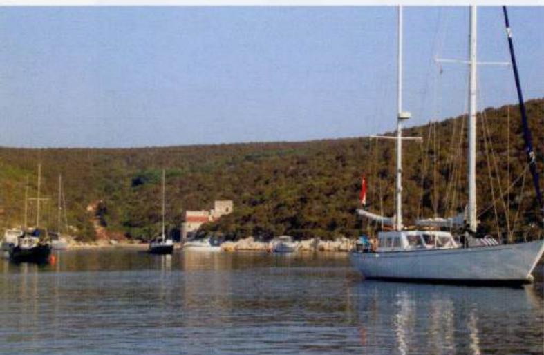
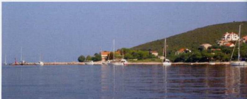
None. Uvala Griparica on Otok Skarda has a number of moorings laid for visitors The approach to the small harbour of Luka Krijal on Otok Premuda, approached from southeast. Visitors moorings have been laid on either side of the harbour and opposite it in the shelter of the off-lying islets OTOK PREMUDA Charts BA 515, MK 9, 11, lmray M25 The narrow island of Premuda lies NW of Otok Skarda, separated from it by a channel approximately 9 cables wide. The headlands on both sides of the channel should not be approached too closely because of off-lying shallows. There are two anchorages and a small harbour on the southwest-facing coast of Otok Premuda and a ferry pier in Uvala Loza on the northeast-facing coast. In a bora the ferry uses the pier at Luka Krijal on the opposite side of the island. The village of Premuda lies on the hillside between Luka Krijal and Uvala Loza. Luka Krijal
Adriatic Navigation Guide Images for Uvala Griparica
Adriatic Navigation Guide images and captions provide additional visual reference for this navigation location.
Uvala Griparica on Otok škarda has a number of moorings laid for visitorsThe approach to the small harbour of Luka Krijal on Otok approached from southeast. Visitors 'moorings have been laid on either side of the harbour and opposite it in the shelter of the off-lying islets