Professional navigation chart centered on Uvala Gracisce
Uvala Gracisce
Region: Central Adriatic
| Position: 43.2, 16.535 | Adriatic Sea / Jadransko more
43°12'N 16°32'.1E Charts BA 2772, SC 5767, MK 79, lmray M26 Uvala GraCisce is located on the S shore within Starogradski Zaljev. The bay, which can be recognised by its sandy beach and a villa with two arches on the ground floor and a garage to one side, offers shelter from S winds including the sirocco. It is however exposed to N and NE winds. Anc
General
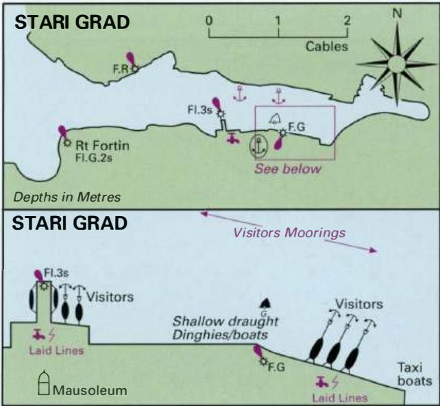
43°12'N 16°32'.1E Charts BA 2772, SC 5767, MK 79, lmray M26 Uvala GraCisce is located on the S shore within Starogradski Zaljev. The bay, which can be recognised by its sandy beach and a villa with two arches on the ground floor and a garage to one side, offers shelter from S winds including the sirocco. It is however exposed to N and NE winds. Anchor in 12m. There are no facilities ashore. The remains of a prehistoric fort can be seen on the headland. Stari Grad
Adriatic Navigation Guide Images for Uvala Gracisce
Adriatic Navigation Guide images and captions provide additional visual reference for this navigation location.