Uvala Gnal
Region: Central Adriatic
| Position: 43.9, 15.455 | Adriatic Sea / Jadransko more
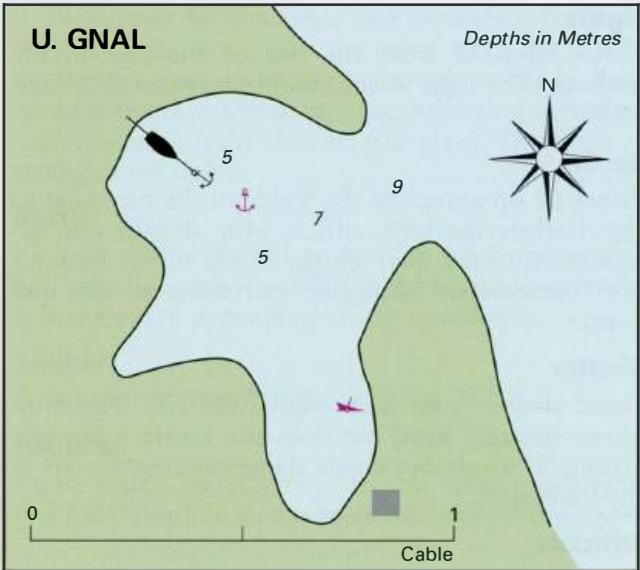
43°54'N 15°27'.3E Charts BA 2711, 2773 (detailed), SC 5767, MK 14, lmray M25 At the far SE end of Otok Pasman, just NW of Rt Gnalic, and 1 . lM southeast of 0. Ostarije near the mainland, there is a small cove surrounded by trees and bushes which is deserted. It has clear water and is a delightful place for swimming. The bay gives good shelter agai
General
43°54'N 15°27'.3E Charts BA 2711, 2773 (detailed), SC 5767, MK 14, lmray M25 At the far SE end of Otok Pasman, just NW of Rt Gnalic, and 1 . lM southeast of 0. Ostarije near the mainland, there is a small cove surrounded by trees and bushes which is deserted. It has clear water and is a delightful place for swimming. The bay gives good shelter against the afternoon breeze, and is sheltered from all wind directions except NE. The cove has 9m depth in the entrance and 5m farther inside. There is a wreck in the S part of the cove. The bottom is sand and weed, and the holding is good. Uvala Landin
Adriatic Navigation Guide Images for Uvala Gnal
Adriatic Navigation Guide images and captions provide additional visual reference for this navigation location.