Uvala Duga
Region: Central Adriatic
| Position: 43.483333, 16.253333 | Adriatic Sea / Jadransko more
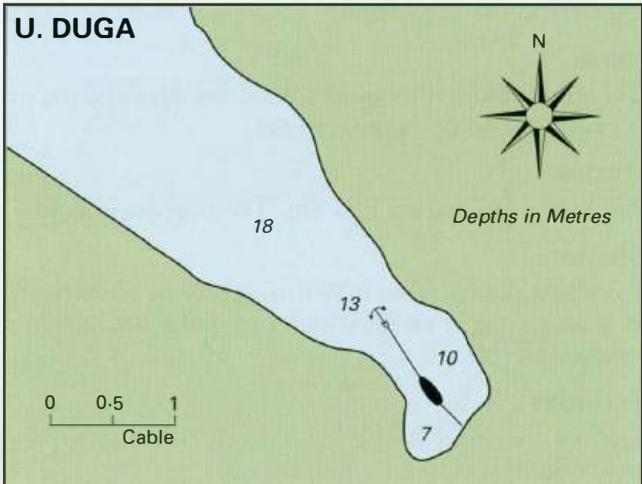
43°29'N 16°15'.2E Charts BA 2772, 2774, SC 5767, MK76, lmray M26 Uvala Duga is situated on the south coast of Otok Ciovo approximately M northeast of Otok Sv. Fumija. The bay is sheltered from the afternoon breeze and makes a pleasant lunchtime anchorage. Anchor in about 6m. The bottom is sand. There is a shallow bank with 4m over it extending 1 ca
General
43°29'N 16°15'.2E Charts BA 2772, 2774, SC 5767, MK76, lmray M26 Uvala Duga is situated on the south coast of Otok Ciovo approximately M northeast of Otok Sv. Fumija. The bay is sheltered from the afternoon breeze and makes a pleasant lunchtime anchorage. Anchor in about 6m. The bottom is sand. There is a shallow bank with 4m over it extending 1 cable E of Rt Rat, the S headland of the bay. Uvala Sv. Fumija
Adriatic Navigation Guide Images for Uvala Duga
Adriatic Navigation Guide images and captions provide additional visual reference for this navigation location.