Uvala Divna
Region: South Adriatic
| Position: 43.018333, 17.206667 | Adriatic Sea / Jadransko more
43°01'.1N 17°12'-4E Charts BA 1574, SC 5767. MK 22. lmray M26 Approximately 1.4M east of LuCica Duba there is a small bay, open N, which is a suitable lunchtime anchorage. The water here is very clean and there is a beach. Uvala Divna is visited by holidaymakers. The bay is easily identified by the small island on the NW side of the entrance, and b
General
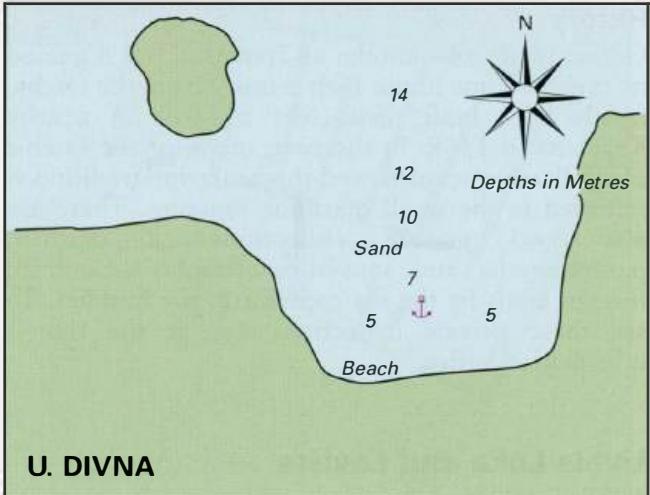
43°01'.1N 17°12'-4E Charts BA 1574, SC 5767. MK 22. lmray M26 Approximately 1.4M east of LuCica Duba there is a small bay, open N, which is a suitable lunchtime anchorage. The water here is very clean and there is a beach. Uvala Divna is visited by holidaymakers. The bay is easily identified by the small island on the NW side of the entrance, and by the beach and buildings at the head of the bay. Enter the bay by passing to the N of the island. Anchor in a suitable depth on a bottom of sand. The anchorage is sheltered from W through S to E. Trpanj
Adriatic Navigation Guide Images for Uvala Divna
Adriatic Navigation Guide images and captions provide additional visual reference for this navigation location.