Uvala Bistrina
Region: South Adriatic
| Position: 42.871667, 17.708333 | Adriatic Sea / Jadransko more
42°52'-3N 17°42'.5E Charts BA 1574, SC 5767. MK 25. lmray M26 Access to Uvala Bistrina, 1 M north of Mali Stan, is restricted by a road bridge with 6m air draught. Anchoring in Uvala Bistrina is prohibited, on account of extensive shell-fish beds. MAINLAND COAST I KANAL MALOG STONA Zaljev Klek Neum Charts BA 1574, 269 (detailed), SC 5767. MK 24. lm
General
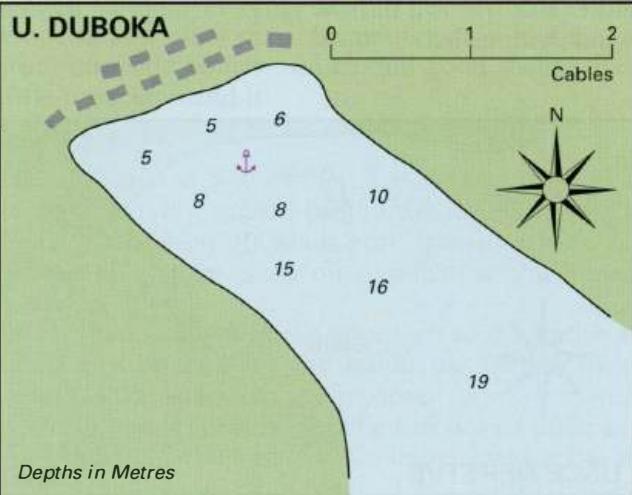
42°52'-3N 17°42'.5E Charts BA 1574, SC 5767. MK 25. lmray M26 Access to Uvala Bistrina, 1 M north of Mali Stan, is restricted by a road bridge with 6m air draught. Anchoring in Uvala Bistrina is prohibited, on account of extensive shell-fish beds. MAINLAND COAST I KANAL MALOG STONA Zaljev Klek Neum Charts BA 1574, 269 (detailed), SC 5767. MK 24. lmray M26 The inlet of Zaljev Klek Neum, which is 4M long and surrounded by high land, lies NE of and parallel to the Kanal Malog Stana. The SE part of the inlet and the peninsula on the W belong to BosniaHerzegovina. This does not however cause visiting yachts any problems. It is being developed as a holiday area, with many large hotel blocks at its SE end. The depths throughout most of Zaljev Klek Neum are in excess of 20m. There are anchorages at U. Duboka, U. Klje5tine and U. Klek on the N side of the inlet, and at U. Lopata just inside the entrance, S of the other three anchorages mentioned above. At Neum (Bosnia-Herzegovina) there are quays near the hoteL Shops are also to be found nearby. Shellfishing beds are located at the far SE end of the inlet in Uvala Jazina. Uvala Duboka
Adriatic Navigation Guide Images for Uvala Bistrina
Adriatic Navigation Guide images and captions provide additional visual reference for this navigation location.