Professional navigation chart centered on Ustrinska Luka
Ustrinska Luka
Region: North Adriatic
| Position: 44.75, 14.388333 | Adriatic Sea / Jadransko more
44°45'N 14°23"3E Charts BA 202, MK 6, lmray M24 Ustrinska Luka (called Uvala Zal on the Croatian charts) is a large sheltered bay on the W coast of Otok Cres, 3M north of Osor. The bay is easily identified from seaward by the village of Ustrine at the top of the hill, with a dirt track zigzagging down to the bay. In the near approach, an isolated c
General
44°45'N 14°23"3E Charts BA 202, MK 6, lmray M24 Ustrinska Luka (called Uvala Zal on the Croatian charts) is a large sheltered bay on the W coast of Otok Cres, 3M north of Osor. The bay is easily identified from seaward by the village of Ustrine at the top of the hill, with a dirt track zigzagging down to the bay. In the near approach, an isolated cottage with a walled garden near sea level becomes visible just inside the N end of the bay. The best and most sheltered anchorage is to be found in the N inlet, between the N headland of the bay and the headland with the cottage. Anchor in 3 to Sm. The bottom is sand and weed and the holding is good. There is a shingle beach at the head of the inlet, and a small ruined pier on its E side. Good allround shelter. Martinscica
Adriatic Navigation Guide Images for Ustrinska Luka
Adriatic Navigation Guide images and captions provide additional visual reference for this navigation location.
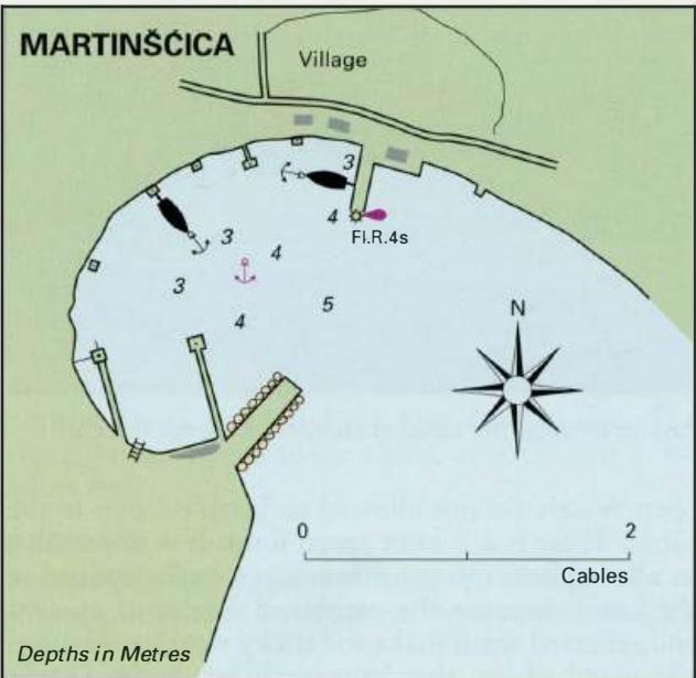
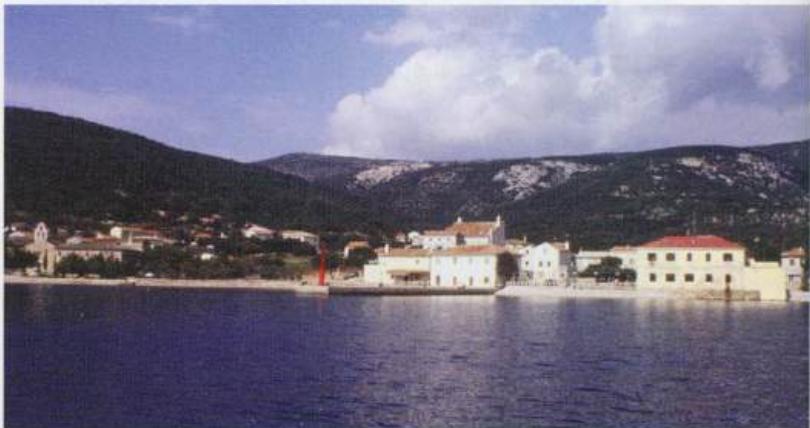
Martinscica on the west coast of Otok Cres is an attractive place to visit. It is possible to tie up alongside the ferry quay or to anchor in the bay