Umag
Region: North Adriatic
| Position: 45.438333, 13.52 | Adriatic Sea / Jadransko more
45°26'.3N 13°31'.2E Charts BA 7477, MK 7, 2, lmray M24 The town of Umag lies on the shores of a west-facing bay, which lies 7.4M north-northwest of Novigad. It is the nearest Croatian port to Slovenia and 1s a port of entry, open throughout the year. The shelter available in the harbour has been improved by the construction of an additional breakwa
General
45°26'.3N 13°31'.2E Charts BA 7477, MK 7, 2, lmray M24 The town of Umag lies on the shores of a west-facing bay, which lies 7.4M north-northwest of Novigad. It is the nearest Croatian port to Slovenia and 1s a port of entry, open throughout the year. The shelter available in the harbour has been improved by the construction of an additional breakwater behind which there is a marina.
Approach
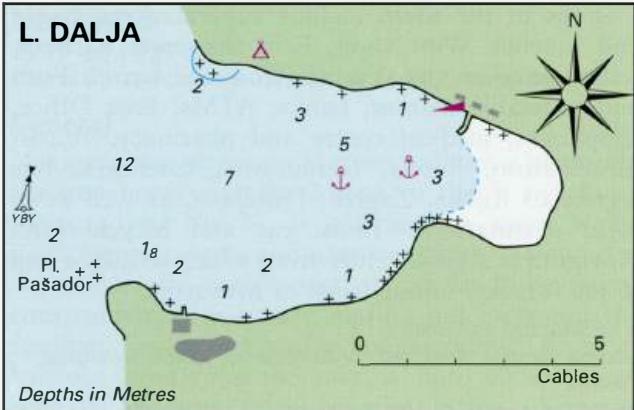
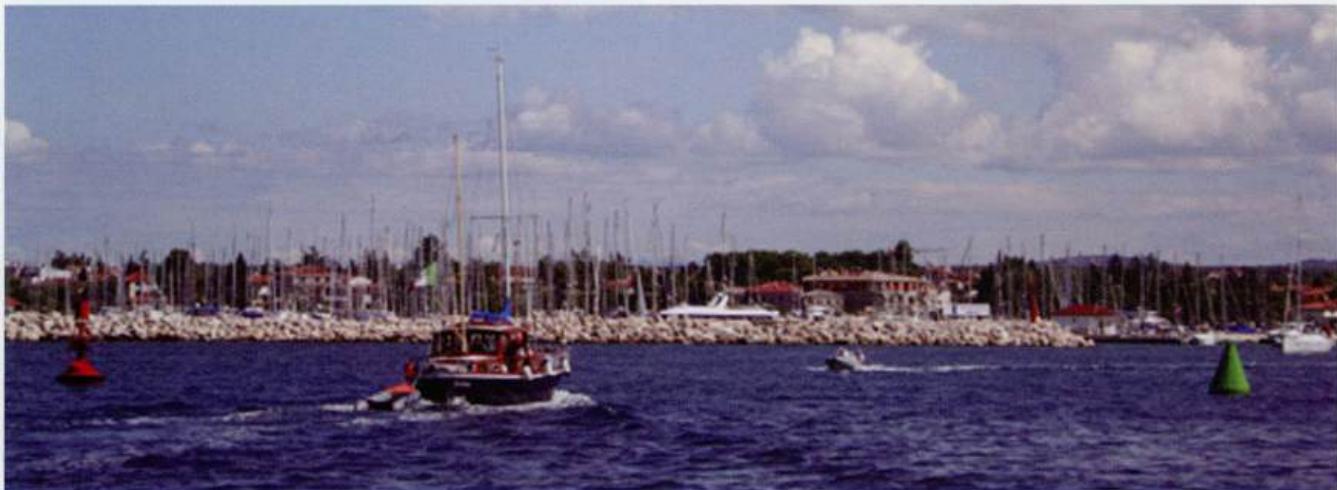
Umag is easily recognised because of a cement works (with a quay), which lies about lM south of the entrance to the harbour. The cement works is visible from some distance offshore. There is also a large hotel building N of the marina, and a tall, pink building in the town. Both are lit up at night. Approaching from S keep at least 4 cables offshore to avoid a shallow and rocky bank which fringes the coast. Beware of PliCina Fijandara, an unmarked rock only 0.8m below water, lying approximately 3 cables N of Umaski Rt (near the cement works) and 9 cables S of the light on the S breakwater at Umag. This rock lies nearly 3 cables offshore. The coast northward between Umag and Rt Savudrija is shallow for up to 8 cables offshore in places, with a number of dangerous reefs, rocks and islets. Beware in particular of the rocks 4 cables NW of the main breakwater light. These rocks, which lie W of Rt Paklena (or Rt Pegolota), are marked by a S cardinal beacon near the harbour entrance and a white concrete beacon bearing a sectored light, which lies to the W of the rocks. The red sector is visible over the shoals off Umaski Rt to the S and over the rocks and islets, which lie off the coast between the beacon and Rt Far to the N. Of these rocks and shoals, only Pl. Sipar is marked by a buoy to seaward The entrance to Umag harbour. The marina is ahead to port whilst the town and customs quays are out of sight behind the breakwater (which is on the right, just out of the frame) The beacon NW of the entrance to Umag marks Pl. Paklena, an area of rocks and shallows, which lie between it and the headland of Rt Paklena. The tall hotel building is conspicuous and can be identified from some distance offshore The red light buoy at the entrance to Umag. The unlit south cardinal beacon marking the southern edge of the shoals off Rt Paklena is visible beyond the buoy. The tall hotel building is conspicuous and can be identified from some distance offshore To enter The entrance to Umag is comparatively shallow, with a minimum depth of 4m in the channel. It should not be attempted in big onshore seas. The approach channel is marked by a red porthand buoy (lit) and a green starboard-hand buoy (unlit). To the N of these buoys there is an unlit S cardinal beacon marking a shoal. To enter Umag pass between the red and green outer buoys, then steer to pass between the end of the marina breakwater and the inner green buoy (which is lit). From this point, proceed either to the marina or in a SE direction towards the town quay and pier. The light on the end of the pier does not come into sight until beyond the inner green buoy. The obscured sector covers shallows within the harbour. The leading lights at Umag have been discontinued. Note that there is an unlit R and W buoy in the marina entrance. Rt Savudrija (called Stara Savudrija in the Admiralty List of Lights) Fl(2)R.5s7m4M 090°-vis-163°, 264°-vis 3040 Pl. Paklena (Pegolota) Fl(2)WR.8s10m8/6M 165°-R-34 7°-W-1 65° Buoy off Umag entrance Fl.R.3s2M
Adriatic Navigation Guide Images for Umag
Adriatic Navigation Guide images and captions provide additional visual reference for this navigation location.