Ugljan
Region: Central Adriatic
| Position: 44.13, 15.111667 | Adriatic Sea / Jadransko more
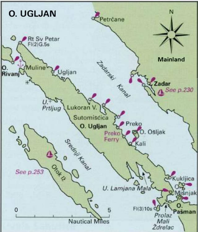
44°07'-8N 15°06'.7E Charts BA 515, SC 5767, MK 13, lmray M25 There is a shallow harbour at Ugljan, which offers limited shelter only. Luka Ugljan is located on the northeast coast of Otok Ugljan 2M southeast of Rt Sv. Petar (the most northerly point of Otok Ugljan) and 5. lM west-northwest of Zadar (on the mainland). The coast in this area is low w
General
44°07'-8N 15°06'.7E Charts BA 515, SC 5767, MK 13, lmray M25 There is a shallow harbour at Ugljan, which offers limited shelter only. Luka Ugljan is located on the northeast coast of Otok Ugljan 2M southeast of Rt Sv. Petar (the most northerly point of Otok Ugljan) and 5. lM west-northwest of Zadar (on the mainland). The coast in this area is low with no hills behind Luka Ugljan.
Approach
Luka Ugljan can be identified by a monastery and stone cross on the headland on the NW side of the bay. A red-painted light structure is located on the end of the breakwater. On entering the bay note that a shallow spit extends SE from the headland with the stone cross. Depths in the approach are shallow, only 4 to Sm.
Lights
Ugljan breakwater Fl(2)R.5s6m4M 220°-R-286°-obscd 352 °-R-090°-obscd-220°
Berth
There are depths of 2.5m along the NW facing side of the breakwater. Farther in, depths decrease to 2m and less. The inner harbour has depths of less than lm. Anchor It is possible to anchor outside of the harbour, but the holding is not reliable and the anchorage is exposed.
Shelter
Alongside the breakwater there is shelter from NW through S to SE, but the harbour is exposed to the bora.
Facilities
No freshwater tap or fuel station. Several shops including a supermarket. Post Office, telephones. Medical centre and hospital. Tourist information. Hotel, restaurants and cafe/bars. Ceprljanda
Adriatic Navigation Guide Images for Ugljan
Adriatic Navigation Guide images and captions provide additional visual reference for this navigation location.