Trstenik
Region: South Adriatic
| Position: 42.915, 17.405 | Adriatic Sea / Jadransko more
42°54'.9N 17°24'.3E Charts BA 1580, SC 5767. MK 24. lmray M26 The harbour of Trstenik is situated in the most N part of Zaton Zuljana, 2.7M northwest of Zuljana. The unspoilt village and spacious harbour nestle at the foot of a hillside covered with vineyards (the locally produced wine is Dingac). The village is quiet, and in many ways preferable t
General
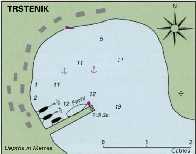
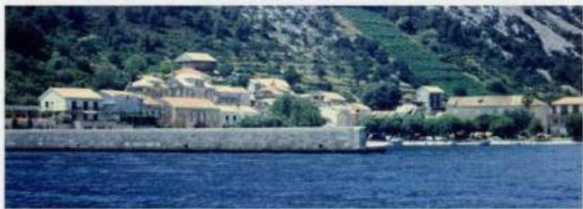
42°54'.9N 17°24'.3E Charts BA 1580, SC 5767. MK 24. lmray M26 The harbour of Trstenik is situated in the most N part of Zaton Zuljana, 2.7M northwest of Zuljana. The unspoilt village and spacious harbour nestle at the foot of a hillside covered with vineyards (the locally produced wine is Dingac). The village is quiet, and in many ways preferable to Zuljana.
Lights
0. Lirica LFl.10s34m9M Trstenik breakwater head Fl.R.3s6m3M Zuljana breakwater head Fl.G.3s6m4M
Berth
Tie up alongside the breakwater or go bow/stern-to the quay. Keep clear of the ferry berth when the ferry is due (the local timetable is posted at the small booking office). Anchor Anchor in the centre of the harbour m llm. The bottom is sand.
Shelter
The bora blows very violently here. In the summer, the harbour is well sheltered, but it is not considered safe in the winter months. S and SW winds send a big swell into the harbour.
Facilities
There is a small general store selling groceries and some items of chandlery. Small fruit and vegetable market. Post Office. Telephone. Tourist information. Cafe/bar. Restaurant. Bus service. Ferry service to Polace (Otok Mljet). Orebic