Professional navigation chart centered on Tijesno (Tisno)
Tijesno (Tisno)
Region: Central Adriatic
| Position: 43.8, 15.646667 | Adriatic Sea / Jadransko more
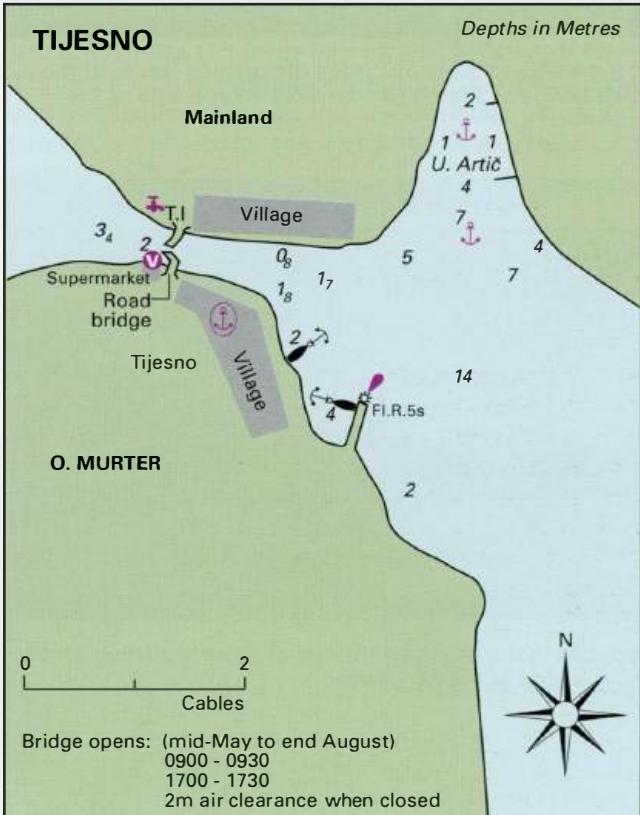
43°48'N 15°38'.8E Charts BA 271 1, SC 5767, MK 74, 15 lmray M25 The village of Tijesno lies SE of the road bridge which connects the island of Murter to the mainland. The shores of both Murter and the mainland are built up here. A strong current flows under the bridge, and at times it can reach 4kns. The road bridge opens, from the middle of May to
General
43°48'N 15°38'.8E Charts BA 271 1, SC 5767, MK 74, 15 lmray M25 The village of Tijesno lies SE of the road bridge which connects the island of Murter to the mainland. The shores of both Murter and the mainland are built up here. A strong current flows under the bridge, and at times it can reach 4kns. The road bridge opens, from the middle of May to the end of August. Opening times are 0900-0930 and 1700-1730. The bridge lights were not operational in 2006.
Lights
Tijesno breakwater head Fl.R.5s7m4M
Berth
Tie up alongside the quay W of the bridge on the Otok Murter side, near the supermarket. The quay E The road bridge at Tijesno, viewed here from the E, opens mornings and evenings during the summer to allow the passage of yachts It is possible to moor alongside the quay to the W of the road bridge at Tijesno (on the Otok Murter side of the channel of the bridge has a ledge, and is also right next to the road. It may be possible to berth bow to the quay further S or bow to the pier with the light on the end. The alternative is to anchor. Anchor Either anchor off the pier (with the light) in depths of 4m to lOm, or anchor in Uvala Artie, a small cove NE of the village. Depths in Uvala Artie range from 2 to 4m in the centre. The bottom is mud and sand and the holding in both anchorages is good. If approaching Tijesno from the NW, there are two anchorages in bays to the W of the bridge where it is possible to anchor overnight. The nearer anchorage has a large campsite at the end and the shores are quayed for the use of campsite guests. The campsite -cabaret stops before midnight, and the speedboats are all safely tied up well before this, so the anchorage is better than you might think. The farther anchorage is quieter.
Shelter
Uvala Artie is sheltered from all directions except SE. Strong SE winds raise a large swell here. The quay is exposed to the bora.
Officials
Harbourmaster's office on the quayside. Police.
Facilities
No water and electricity on the quayside. Water is available from a tap in the tourist information office. No fuel. Supermarket on quayside near bridge, butcher and baker. Bank, ATM (at Hotel Borovnik), Post Office and telephones. Pharmacy and medical centre. Hotel, restaurants, cafe/bars. Bus service to Sibenik and Zadar. Mechanic. Jezera
Adriatic Navigation Guide Images for Tijesno (Tisno)
Adriatic Navigation Guide images and captions provide additional visual reference for this navigation location.
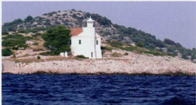
The lighthouse on O. Prisnjak, off the NW coast of