Region: South Adriatic
| Position: 42.003333, 15 | Adriatic Sea / Jadransko more
42°00'.2N 15°00'E Charts BA 200 Termoli is a mixture of an old walled town and a modern holiday resort. It has a 12th-century cathedral, a castle built by Frederick II of Hohenstaufen, quaint squares and narrow alleyways. The modern part of the town offers excellent shopping. The harbour, the only port of the Molise region, offers poor shelter, bei
General
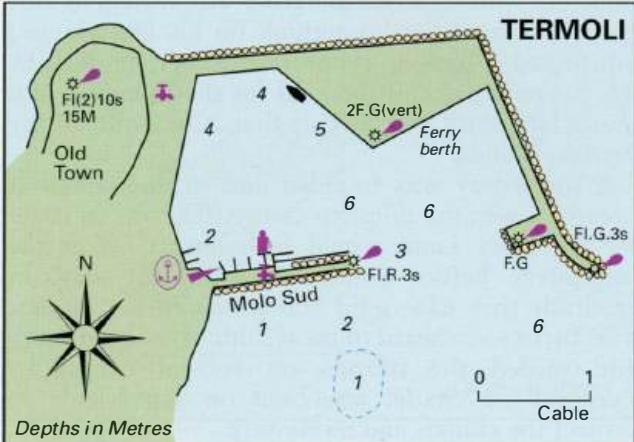
42°00'.2N 15°00'E Charts BA 200 Termoli is a mixture of an old walled town and a modern holiday resort. It has a 12th-century cathedral, a castle built by Frederick II of Hohenstaufen, quaint squares and narrow alleyways. The modern part of the town offers excellent shopping. The harbour, the only port of the Molise region, offers poor shelter, being wide open to the SE. In settled weather, however, Termoli can be a pleasant place to stop. There are plans to build a marina on the S side of the Molo Sud.
Approach
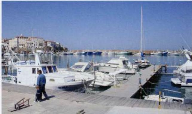
The old walled part of Termoli stands on a rocky peninsula and is easily recognisable. The cathedral The marina at Termoli is small, but offers the best berth for visiting yachts as the town quays are monopolised by the fishing fleet belfry is not particularly high or prominent. The approach from N is straightforward. If approaching from SE beware of rocks close inshore. The harbour and approaches are subject to silting. In particular, the area S and SE of the Molo Sud is very shallow. Underwater ballasting extends from the ends of both breakwaters.
Lights
Termoli LtHo Fl(2)10s41m15M N breakwater seaward end Fl.G.3sllm8M Spur F.G.3M
Adriatic Navigation Guide Images for Termoli
Adriatic Navigation Guide images and captions provide additional visual reference for this navigation location.
The marina at Termoli is small, but offers the best berth for visiting yachts as the town quays are monopolised by the fishing fleet